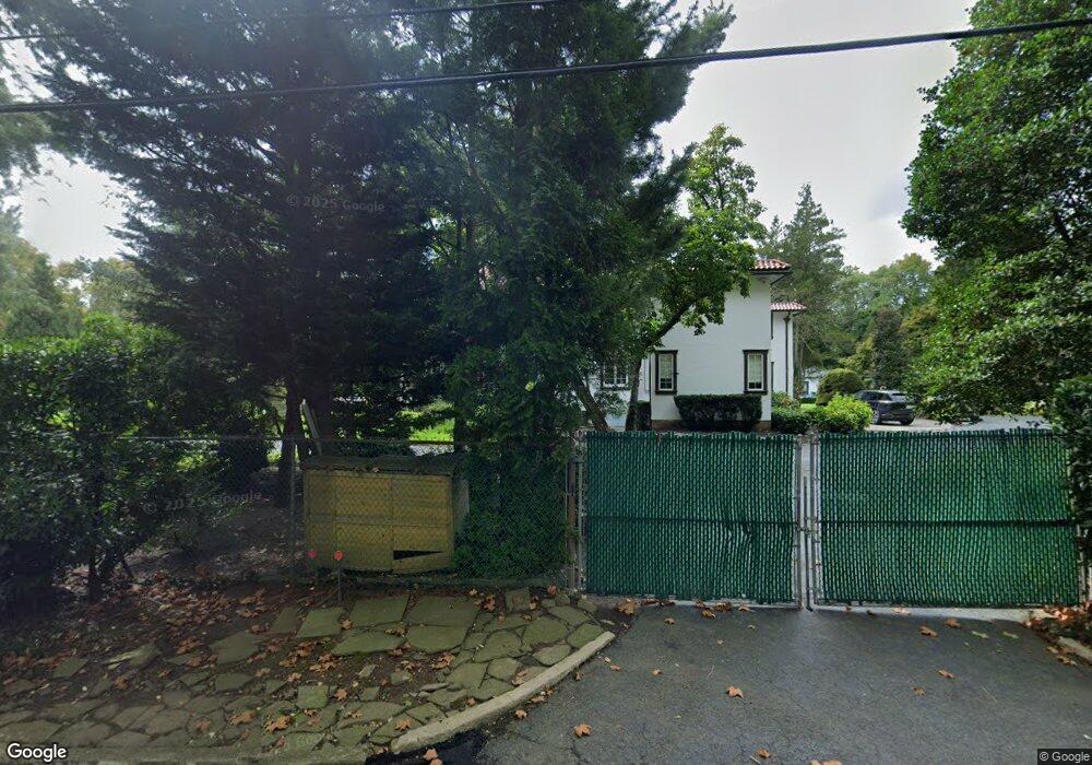
427 Navesink River Rd Red Bank, NJ 07701
New Monmouth NeighborhoodEstimated Value: $2,546,234 - $2,728,000
5
Beds
4
Baths
6,208
Sq Ft
$427/Sq Ft
Est. Value
About This Home
This home is located at 427 Navesink River Rd, Red Bank, NJ 07701 and is currently estimated at $2,648,078, approximately $426 per square foot. 427 Navesink River Rd is a home located in Monmouth County with nearby schools including Fairview Elementary School, Bayshore Middle School, and Middletown High School North.
Ownership History
Date
Name
Owned For
Owner Type
Purchase Details
Closed on
Aug 30, 2018
Sold by
Paparone Donald
Bought by
Paparone Donald and Paparone Jacqueline
Current Estimated Value
Purchase Details
Closed on
Mar 20, 2017
Sold by
Musg Associates Lp
Bought by
Paparone Donald
Home Financials for this Owner
Home Financials are based on the most recent Mortgage that was taken out on this home.
Interest Rate
4.3%
Purchase Details
Closed on
Oct 10, 2005
Sold by
Uram Martin
Bought by
Musg Associates Lp
Create a Home Valuation Report for This Property
The Home Valuation Report is an in-depth analysis detailing your home's value as well as a comparison with similar homes in the area
Home Values in the Area
Average Home Value in this Area
Purchase History
| Date | Buyer | Sale Price | Title Company |
|---|---|---|---|
| Paparone Donald | -- | None Available | |
| Paparone Donald | $1,841,300 | -- | |
| Musg Associates Lp | -- | -- |
Source: Public Records
Mortgage History
| Date | Status | Borrower | Loan Amount |
|---|---|---|---|
| Closed | Paparone Donald | -- |
Source: Public Records
Tax History Compared to Growth
Tax History
| Year | Tax Paid | Tax Assessment Tax Assessment Total Assessment is a certain percentage of the fair market value that is determined by local assessors to be the total taxable value of land and additions on the property. | Land | Improvement |
|---|---|---|---|---|
| 2025 | $35,465 | $2,290,100 | $545,600 | $1,744,500 |
| 2024 | $38,465 | $2,155,900 | $443,000 | $1,712,900 |
| 2023 | $38,465 | $2,213,200 | $443,000 | $1,770,200 |
| 2022 | $40,171 | $2,117,700 | $431,400 | $1,686,300 |
| 2021 | $40,171 | $1,935,700 | $431,400 | $1,504,300 |
| 2020 | $41,336 | $1,933,400 | $461,500 | $1,471,900 |
| 2019 | $40,848 | $1,934,100 | $471,500 | $1,462,600 |
| 2018 | $45,455 | $2,097,600 | $700,000 | $1,397,600 |
| 2017 | $48,245 | $2,271,400 | $700,000 | $1,571,400 |
| 2016 | $47,417 | $2,225,100 | $700,000 | $1,525,100 |
| 2015 | $46,992 | $2,200,000 | $700,000 | $1,500,000 |
| 2014 | $45,332 | $2,070,900 | $700,000 | $1,370,900 |
Source: Public Records
Map
Nearby Homes
- 458 Navesink River Rd
- 39 Market St
- 839 Arthur Dr
- 51 Blossom Cove Rd
- 310 Cooper Rd Unit C
- 139 Statesir Place
- 4 Breana Ct
- 37 Delaware Ave
- 583 Navesink River Rd
- 152 Chapel Hill Rd
- 79 Lake Shore Dr
- 1 Hance Rd
- 43 Roosevelt Cir W
- 130 Bodman Place Unit 15
- 833 Lincoln St
- 11 Wharf Ave Unit 3
- 4 Boat Club Ct Unit 3E
- 89 Grange Ave
- 23 Haddon Park
- 28 Riverside Ave Unit 2G
- 435 Navesink River Rd
- 423 Navesink River Rd
- 439 Navesink River Rd
- 424 Navesink River Rd
- 432 Navesink River Rd
- 444 Navesink River Rd
- 601 Martins Ln
- 603 Martins Ln
- 452 Navesink River Rd
- 602 Martins Ln
- 459 Navesink River Rd
- 15 Blossom Cove Rd
- 23 Blossom Cove Rd
- 605 Martins Ln
- 23 Blossom Cove Rd
- 604 Martins Ln
- 12 Blossom Cove Rd
- 467 Navesink River Rd
- 856 Grove St
- 303 Patterson Ln