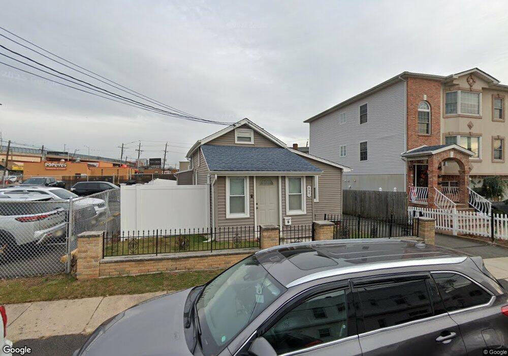
427 New York Place Hillside, NJ 07205
Estimated Value: $316,076 - $493,000
--
Bed
--
Bath
1,002
Sq Ft
$394/Sq Ft
Est. Value
About This Home
This home is located at 427 New York Place, Hillside, NJ 07205 and is currently estimated at $394,769, approximately $393 per square foot. 427 New York Place is a home located in Union County with nearby schools including Abram P. Morris-Saybrook Elementary School, Hurden Looker School, and Ola Edwards Community School.
Ownership History
Date
Name
Owned For
Owner Type
Purchase Details
Closed on
Sep 12, 2000
Sold by
Horning Margaret and Twords Kathleen
Bought by
Sutherland Kirk and Sutherland Marva
Current Estimated Value
Home Financials for this Owner
Home Financials are based on the most recent Mortgage that was taken out on this home.
Original Mortgage
$78,744
Outstanding Balance
$28,638
Interest Rate
8.07%
Mortgage Type
FHA
Estimated Equity
$366,131
Create a Home Valuation Report for This Property
The Home Valuation Report is an in-depth analysis detailing your home's value as well as a comparison with similar homes in the area
Home Values in the Area
Average Home Value in this Area
Purchase History
| Date | Buyer | Sale Price | Title Company |
|---|---|---|---|
| Sutherland Kirk | $79,394 | Lawyers Title Insurance Corp |
Source: Public Records
Mortgage History
| Date | Status | Borrower | Loan Amount |
|---|---|---|---|
| Open | Sutherland Kirk | $78,744 |
Source: Public Records
Tax History Compared to Growth
Tax History
| Year | Tax Paid | Tax Assessment Tax Assessment Total Assessment is a certain percentage of the fair market value that is determined by local assessors to be the total taxable value of land and additions on the property. | Land | Improvement |
|---|---|---|---|---|
| 2025 | $6,734 | $81,600 | $54,100 | $27,500 |
| 2024 | $6,539 | $81,600 | $54,100 | $27,500 |
| 2023 | $6,539 | $81,600 | $54,100 | $27,500 |
| 2022 | $6,478 | $81,600 | $54,100 | $27,500 |
| 2021 | $6,436 | $81,600 | $54,100 | $27,500 |
| 2020 | $6,398 | $81,600 | $54,100 | $27,500 |
| 2019 | $6,274 | $81,600 | $54,100 | $27,500 |
| 2018 | $6,211 | $81,600 | $54,100 | $27,500 |
| 2017 | $6,174 | $81,600 | $54,100 | $27,500 |
| 2016 | $6,167 | $81,600 | $54,100 | $27,500 |
| 2015 | $6,112 | $81,600 | $54,100 | $27,500 |
| 2014 | $6,016 | $77,600 | $54,100 | $23,500 |
Source: Public Records
Map
Nearby Homes
- 386 Yale Ave
- 393 Harvard Ave
- 628 Us Highway 22 and 3
- 257 Herbert Ave
- 339 Hillside Ave
- 339 Hillside Ave Unit 2
- 507 Locust Ave
- 1430 Franklin St
- 410 Rutgers Ave
- 167 Silver Ave
- 1436 Liberty Ave Unit A
- 1442 Highland Ave
- 1435 Leslie St Unit 7
- 155 Silver Ave
- 525 Us Highway 22
- 292 Crann St
- 1451 Franklin St
- 537 Us Highway 22
- 149 Baltimore Ave
- 1282 Baker St
- 425 New York Place
- 421 New York Place
- 421 New York Place Unit 3
- 1318 Liberty Ave
- 123 Liberty Ave Unit 2
- 1314 Liberty Ave
- 122 New York Place
- 1312 Liberty Ave
- 1315 Liberty Ave
- 1310 Liberty Ave
- 1313 Liberty Ave
- 1308 Liberty Ave
- 305 Long Ave
- 1305 Liberty Ave
- 1300 Liberty Ave
- 285 Williams St
- 331 Yale Ave
- 285 Gertrude St
- 330 Long Ave
- 323 Long Ave