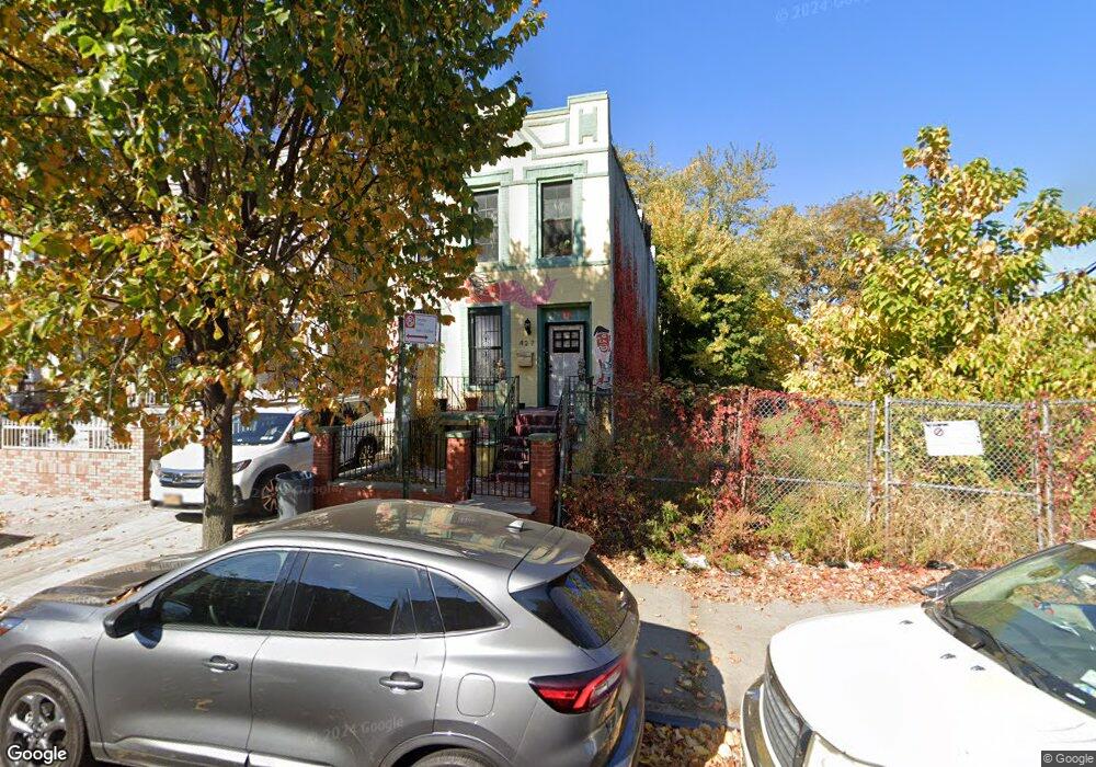
427 Newport St Brooklyn, NY 11207
Brownsville NeighborhoodEstimated Value: $849,052 - $968,000
6
Beds
3
Baths
2,080
Sq Ft
$443/Sq Ft
Est. Value
About This Home
This home is located at 427 Newport St, Brooklyn, NY 11207 and is currently estimated at $921,013, approximately $442 per square foot. 427 Newport St is a home located in Kings County with nearby schools including P.S. 190 - Sheffield, Achievement First - East New York School, and Hyde Leadership Charter School-Brooklyn.
Ownership History
Date
Name
Owned For
Owner Type
Purchase Details
Closed on
Dec 29, 2017
Sold by
Bk Barclay Brownstone Llc
Bought by
Osunsina Sonyika Alaje Boatema
Current Estimated Value
Home Financials for this Owner
Home Financials are based on the most recent Mortgage that was taken out on this home.
Original Mortgage
$706,755
Outstanding Balance
$595,807
Interest Rate
3.9%
Mortgage Type
Purchase Money Mortgage
Estimated Equity
$325,206
Purchase Details
Closed on
Mar 8, 2017
Sold by
Allen Steventon R
Bought by
Bk Barclay Brownstone Llc
Home Financials for this Owner
Home Financials are based on the most recent Mortgage that was taken out on this home.
Original Mortgage
$200,000
Interest Rate
4.17%
Mortgage Type
New Conventional
Purchase Details
Closed on
Apr 5, 2001
Sold by
Ortanne Enterprises Ltd
Bought by
Allen Steventon R
Home Financials for this Owner
Home Financials are based on the most recent Mortgage that was taken out on this home.
Original Mortgage
$236,292
Interest Rate
6.9%
Purchase Details
Closed on
Feb 27, 2001
Sold by
Williams Almetta
Bought by
Williams Sarah
Home Financials for this Owner
Home Financials are based on the most recent Mortgage that was taken out on this home.
Original Mortgage
$236,292
Interest Rate
6.9%
Purchase Details
Closed on
Apr 27, 2000
Sold by
Williams Almetta
Bought by
Williams Almetta and Williams Sarah
Home Financials for this Owner
Home Financials are based on the most recent Mortgage that was taken out on this home.
Original Mortgage
$96,500
Interest Rate
8.48%
Create a Home Valuation Report for This Property
The Home Valuation Report is an in-depth analysis detailing your home's value as well as a comparison with similar homes in the area
Home Values in the Area
Average Home Value in this Area
Purchase History
| Date | Buyer | Sale Price | Title Company |
|---|---|---|---|
| Osunsina Sonyika Alaje Boatema | $755,000 | -- | |
| Osunsina Sonyika Alaje Boatema | $755,000 | -- | |
| Bk Barclay Brownstone Llc | $200,000 | -- | |
| Bk Barclay Brownstone Llc | $200,000 | -- | |
| Allen Steventon R | -- | -- | |
| Ortanne Enterprises Ltd | -- | -- | |
| Allen Steventon R | -- | -- | |
| Williams Sarah | -- | Commonwealth Land Title Ins | |
| Williams Sarah | -- | Commonwealth Land Title Ins | |
| Williams Almetta | -- | Old Republic Natl Title Ins | |
| Williams Almetta | -- | Old Republic Natl Title Ins |
Source: Public Records
Mortgage History
| Date | Status | Borrower | Loan Amount |
|---|---|---|---|
| Open | Osunsina Sonyika Alaje Boatema | $706,755 | |
| Closed | Osunsina Sonyika Alaje Boatema | $706,755 | |
| Previous Owner | Bk Barclay Brownstone Llc | $200,000 | |
| Previous Owner | Allen Steventon R | $236,292 | |
| Previous Owner | Allen Steventon R | $0 | |
| Previous Owner | Williams Almetta | $96,500 |
Source: Public Records
Tax History Compared to Growth
Tax History
| Year | Tax Paid | Tax Assessment Tax Assessment Total Assessment is a certain percentage of the fair market value that is determined by local assessors to be the total taxable value of land and additions on the property. | Land | Improvement |
|---|---|---|---|---|
| 2025 | $1,770 | $49,620 | $19,140 | $30,480 |
| 2024 | $1,770 | $55,440 | $19,140 | $36,300 |
| 2023 | $1,695 | $63,960 | $19,140 | $44,820 |
| 2022 | $1,573 | $56,340 | $19,140 | $37,200 |
| 2021 | $1,568 | $45,420 | $19,140 | $26,280 |
| 2020 | $784 | $36,060 | $19,140 | $16,920 |
| 2019 | $1,536 | $36,060 | $19,140 | $16,920 |
| 2018 | $1,418 | $6,956 | $3,650 | $3,306 |
| 2017 | $1,339 | $6,567 | $3,357 | $3,210 |
| 2016 | $1,241 | $6,208 | $3,816 | $2,392 |
| 2015 | $747 | $6,194 | $3,212 | $2,982 |
| 2014 | $747 | $6,120 | $3,594 | $2,526 |
Source: Public Records
Map
Nearby Homes
- 533 Snediker Ave
- 442 Newport St
- 541 Hinsdale St
- 584 Hinsdale St
- 578 Williams Ave
- 576 Williams Ave
- 582 Williams Ave
- 589 Hinsdale St
- 563 Powell St
- 546 Powell St
- 606 Alabama Ave
- 610 Alabama Ave
- 650 Williams Ave
- 699 Sackman St
- 660 Williams Ave Unit 142
- 1753 Linden Blvd
- 1755 Linden Blvd
- 406 Hinsdale St
- 555 Christopher Ave
- 797 Mother Gaston Blvd
- 423 Newport St
- 429 Newport St
- 421 Newport St
- 417 Newport St
- 558 Snediker Ave
- 415 Newport St
- 554 Snediker Ave
- 431 Newport St
- 552 Snediker Ave
- 435 Newport St
- 435 Newport St Unit 439
- 413 Newport St
- 550 Snediker Ave
- 437 Newport St
- 557 Snediker Ave
- 546 Snediker Ave
- 435-439 Newport St
- 428 Newport St
- 428 Newport St Unit 28
- 430 Newport St