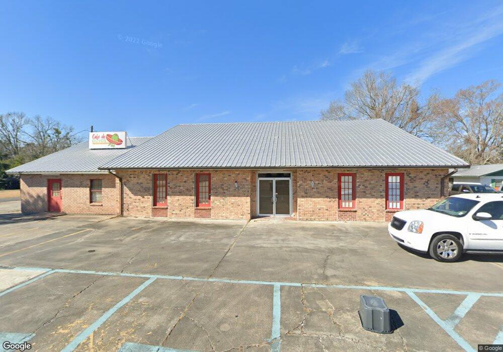
427 S Burnside Ave Gonzales, LA 70737
Estimated Value: $158,000
--
Bed
--
Bath
7,189
Sq Ft
$22/Sq Ft
Est. Value
About This Home
This home is located at 427 S Burnside Ave, Gonzales, LA 70737 and is currently priced at $158,000, approximately $21 per square foot. 427 S Burnside Ave is a home located in Ascension Parish with nearby schools including Gonzales Primary School, Gonzales Middle School, and East Ascension High School.
Ownership History
Date
Name
Owned For
Owner Type
Purchase Details
Closed on
Sep 30, 2021
Sold by
Right Or Wong Properties Llc
Bought by
Boriel Investment Group Llc
Current Estimated Value
Home Financials for this Owner
Home Financials are based on the most recent Mortgage that was taken out on this home.
Original Mortgage
$100,000
Interest Rate
2.8%
Create a Home Valuation Report for This Property
The Home Valuation Report is an in-depth analysis detailing your home's value as well as a comparison with similar homes in the area
Home Values in the Area
Average Home Value in this Area
Purchase History
| Date | Buyer | Sale Price | Title Company |
|---|---|---|---|
| Boriel Investment Group Llc | $400,000 | Commonwealth Land Title |
Source: Public Records
Mortgage History
| Date | Status | Borrower | Loan Amount |
|---|---|---|---|
| Closed | Boriel Investment Group Llc | $100,000 | |
| Open | Boriel Investment Group Llc | $300,000 |
Source: Public Records
Tax History Compared to Growth
Tax History
| Year | Tax Paid | Tax Assessment Tax Assessment Total Assessment is a certain percentage of the fair market value that is determined by local assessors to be the total taxable value of land and additions on the property. | Land | Improvement |
|---|---|---|---|---|
| 2024 | $3,328 | $30,500 | $7,200 | $23,300 |
| 2023 | $5,511 | $50,400 | $7,200 | $43,200 |
| 2022 | $5,511 | $50,400 | $7,200 | $43,200 |
| 2021 | $3,717 | $34,000 | $13,000 | $21,000 |
| 2020 | $3,736 | $34,000 | $13,000 | $21,000 |
| 2019 | $3,755 | $34,000 | $13,000 | $21,000 |
| 2018 | $3,715 | $34,000 | $13,000 | $21,000 |
| 2017 | $3,715 | $34,000 | $13,000 | $21,000 |
| 2015 | $3,730 | $34,000 | $13,000 | $21,000 |
| 2014 | $3,729 | $34,000 | $13,000 | $21,000 |
Source: Public Records
Map
Nearby Homes
- 630 S Pleasant Ave
- 309 W Joan St
- 235 S Sammy Ave
- 419 W Bluebird St
- 5013 Colmar Rd
- 619 W Cornerview St
- 410 E Weber St
- 319 N Marchand Ave
- 21.85 acres Bull Wevil Dr
- 0 Don Lou Rd Unit 2025005050
- 0 Don Lou Rd Unit 2025005042
- 107 N Frances Ave
- 11106 Cessna St
- 11080 Cessna St
- 2.76 Acres S Darla Ave
- 1317 S Shirley Ave
- 834 W Cornerview St
- 502 E Caldwell St
- 415 N Frances Ave
- 431 E Josephine St
- 126 W Lulu St
- 128 W Edna St
- 119 W Lulu St
- 116 W Edna St
- 126 W Edna St
- 131 S Veronica Ave
- 137 W Edna St
- 506 S Pleasant Ave
- 434 S Pleasant Ave
- 512 S Pleasant Ave
- 428 S Pleasant Ave
- 520 S Pleasant Ave
- 422 S Pleasant Ave
- 528 S Pleasant Ave
- 430 S Burnside Ave
- 414 S Pleasant Ave
- 608 S Pleasant Ave
- 505 S Pleasant Ave
- 435 S Pleasant Ave
- 612-A S Burnside Ave