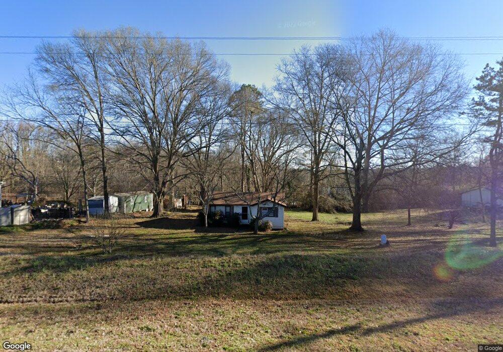
4270 Highway 145 Carnesville, GA 30521
Estimated Value: $51,362 - $221,000
2
Beds
1
Bath
752
Sq Ft
$181/Sq Ft
Est. Value
About This Home
This home is located at 4270 Highway 145, Carnesville, GA 30521 and is currently estimated at $136,181, approximately $181 per square foot. 4270 Highway 145 is a home with nearby schools including Franklin County High School.
Ownership History
Date
Name
Owned For
Owner Type
Purchase Details
Closed on
Jan 24, 2022
Sold by
Elrod Larry D
Bought by
Evans Jeffery W
Current Estimated Value
Home Financials for this Owner
Home Financials are based on the most recent Mortgage that was taken out on this home.
Original Mortgage
$15,000
Interest Rate
3.45%
Mortgage Type
Cash
Purchase Details
Closed on
Feb 3, 2020
Sold by
Elrod Annie B
Bought by
Elrod Larry D
Purchase Details
Closed on
Jan 23, 2015
Sold by
U S Bank National Associat
Bought by
Elrod Larry D and Elrod Annie B
Purchase Details
Closed on
Jul 1, 2014
Sold by
Kirk William and Kirk Joann
Bought by
Us Bank National Association As
Purchase Details
Closed on
Nov 14, 2003
Sold by
Kirk William and Kirk Joann
Bought by
Kirk William and Kirk Joann
Purchase Details
Closed on
May 30, 1996
Bought by
Kirk William and Kirk Joann
Create a Home Valuation Report for This Property
The Home Valuation Report is an in-depth analysis detailing your home's value as well as a comparison with similar homes in the area
Home Values in the Area
Average Home Value in this Area
Purchase History
| Date | Buyer | Sale Price | Title Company |
|---|---|---|---|
| Evans Jeffery W | $16,000 | -- | |
| Elrod Larry D | -- | -- | |
| Elrod Larry D | $14,929 | -- | |
| Us Bank National Association As | $30,000 | -- | |
| Kirk William | -- | -- | |
| Kirk William | -- | -- |
Source: Public Records
Mortgage History
| Date | Status | Borrower | Loan Amount |
|---|---|---|---|
| Closed | Evans Jeffery W | $15,000 |
Source: Public Records
Tax History Compared to Growth
Tax History
| Year | Tax Paid | Tax Assessment Tax Assessment Total Assessment is a certain percentage of the fair market value that is determined by local assessors to be the total taxable value of land and additions on the property. | Land | Improvement |
|---|---|---|---|---|
| 2024 | $193 | $8,114 | $1,778 | $6,336 |
| 2023 | $165 | $7,376 | $1,616 | $5,760 |
| 2022 | $229 | $8,889 | $1,251 | $7,638 |
| 2021 | $209 | $7,612 | $1,251 | $6,361 |
| 2020 | $212 | $7,612 | $1,251 | $6,361 |
| 2019 | $204 | $7,612 | $1,251 | $6,361 |
| 2018 | $0 | $7,081 | $1,590 | $5,491 |
| 2017 | $198 | $7,081 | $1,590 | $5,491 |
| 2016 | $174 | $6,342 | $1,590 | $4,752 |
| 2015 | -- | $6,341 | $1,590 | $4,752 |
| 2014 | -- | $14,406 | $2,271 | $12,136 |
| 2013 | -- | $14,406 | $2,270 | $12,135 |
Source: Public Records
Map
Nearby Homes
- 499 Aderhold Rd
- 0 Murphy Rd Unit 10585891
- 456 Aderhold Rd
- 2985 Jackson Bridge Rd
- 2695 Brays Lake Rd
- 365 Carroll Church Rd
- 110 Telford Rd
- 597 Meadow Brook Ln
- 0 New Franklin Church Rd
- 6.98 ACRES New Franklin Church Rd
- 6602 New Franklin Church Rd
- 1350 Noah Crow Rd
- 1291 Brays Lake Rd
- 7690 Royston Rd
- 2521 Starrs Bridge Rd
- 2556 Turkey Creek Rd
- 0 Turkey Creek Rd Unit 10589237
- 210 Nora Moss Ln
- 0 Manley St Unit 10611784
- 735 Bowersville Rd
- 4284 Highway 145
- 4206 Georgia 145
- 4206 Highway 145
- 4211 Highway 145
- 4176 Highway 145
- 4176 Georgia 145
- 4211 Georgia 145
- 4181 Highway 145
- 4181 Highway 145
- 4344 Highway 145
- 4301 Highway 145
- 4360 Highway 145
- 4080 Highway 145
- 4148 Highway 145
- 0 Georgia 145
- 4040 Highway 145
- 4399 Highway 145
- 1731 Atkinson Bridge Rd
- 1553 Atkinson Bridge Rd
- 4580 Highway 145