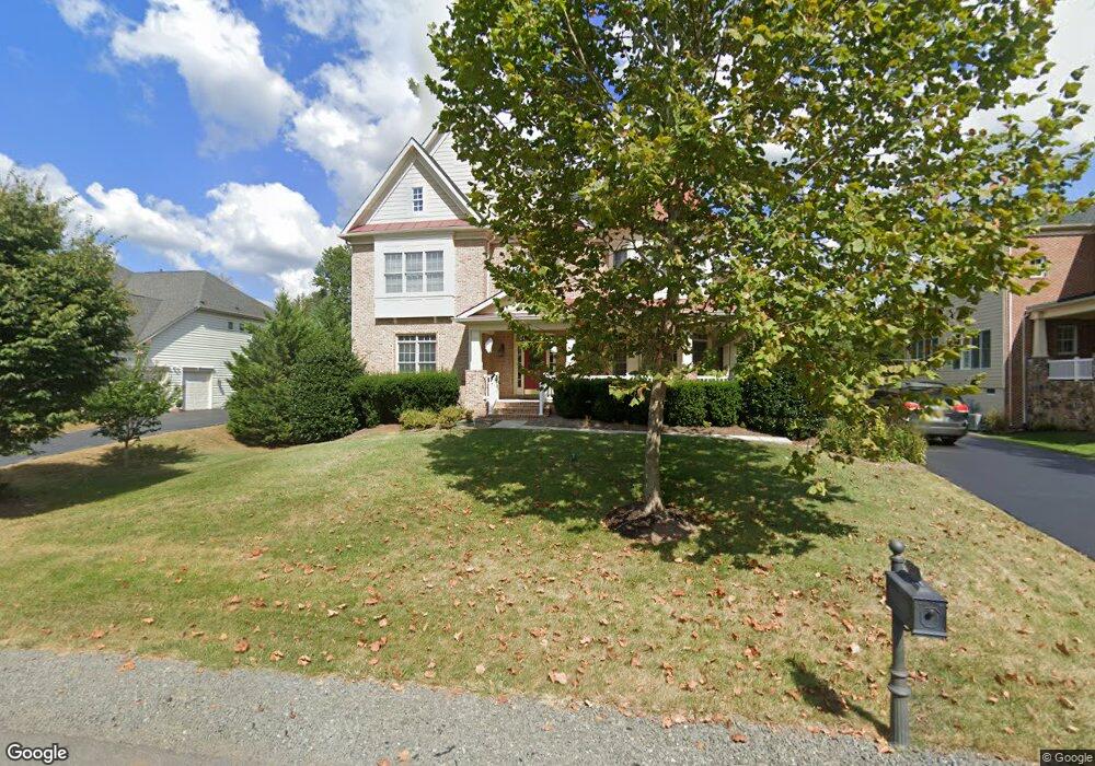
42708 Red Shale Ct Ashburn, VA 20148
Estimated Value: $1,442,000 - $1,810,000
4
Beds
6
Baths
4,691
Sq Ft
$363/Sq Ft
Est. Value
About This Home
This home is located at 42708 Red Shale Ct, Ashburn, VA 20148 and is currently estimated at $1,704,506, approximately $363 per square foot. 42708 Red Shale Ct is a home located in Loudoun County with nearby schools including Mill Run Elementary School, Eagle Ridge Middle School, and Briar Woods High School.
Ownership History
Date
Name
Owned For
Owner Type
Purchase Details
Closed on
Nov 30, 2006
Sold by
Brookfield Waxpoll Llc
Bought by
Weber Edward C
Current Estimated Value
Home Financials for this Owner
Home Financials are based on the most recent Mortgage that was taken out on this home.
Original Mortgage
$735,000
Outstanding Balance
$440,658
Interest Rate
6.36%
Mortgage Type
New Conventional
Estimated Equity
$1,263,848
Create a Home Valuation Report for This Property
The Home Valuation Report is an in-depth analysis detailing your home's value as well as a comparison with similar homes in the area
Home Values in the Area
Average Home Value in this Area
Purchase History
| Date | Buyer | Sale Price | Title Company |
|---|---|---|---|
| Weber Edward C | $980,054 | -- |
Source: Public Records
Mortgage History
| Date | Status | Borrower | Loan Amount |
|---|---|---|---|
| Open | Weber Edward C | $735,000 |
Source: Public Records
Tax History Compared to Growth
Tax History
| Year | Tax Paid | Tax Assessment Tax Assessment Total Assessment is a certain percentage of the fair market value that is determined by local assessors to be the total taxable value of land and additions on the property. | Land | Improvement |
|---|---|---|---|---|
| 2025 | $13,159 | $1,634,620 | $440,000 | $1,194,620 |
| 2024 | $13,239 | $1,530,510 | $425,000 | $1,105,510 |
| 2023 | $12,662 | $1,447,070 | $425,000 | $1,022,070 |
| 2022 | $11,707 | $1,315,380 | $315,000 | $1,000,380 |
| 2021 | $10,977 | $1,120,080 | $290,000 | $830,080 |
| 2020 | $11,001 | $1,062,900 | $255,000 | $807,900 |
| 2019 | $10,510 | $1,005,770 | $235,000 | $770,770 |
| 2018 | $10,243 | $944,040 | $225,000 | $719,040 |
| 2017 | $10,352 | $920,220 | $225,000 | $695,220 |
| 2016 | $10,627 | $928,120 | $0 | $0 |
| 2015 | $10,637 | $712,200 | $0 | $712,200 |
| 2014 | $9,521 | $614,310 | $0 | $614,310 |
Source: Public Records
Map
Nearby Homes
- 42645 Cochrans Lock Dr
- 42623 Trappe Rock Ct
- 42662 Gulicks Landing Ct
- 21997 Stonestile Place
- 42911 Park Brooke Ct
- 22197 Withers Grove Ct
- 22273 Rampsbeck Terrace
- 22070 Avonworth Square
- 42904 Bittner Square
- 22047 Avonworth Square
- 42961 Thornblade Cir
- 40396 Milford Dr
- 43138 Stillwater Terrace Unit 305
- 21563 Awbrey Place
- 21946 Windover Dr
- 21934 Windover Dr
- 21507 Tithables Cir
- 21518 Wild Timber Ct
- 22520 Highcroft Terrace
- 22059 Water Run Ct
- 42712 Red Shale Ct
- 42704 Red Shale Ct
- 42716 Red Shale Ct
- 42700 Red Shale Ct
- 42705 Red Shale Ct
- 42651 Trappe Rock Ct
- 42709 Red Shale Ct
- 42647 Trappe Rock Ct
- 42655 Trappe Rock Ct
- 42717 Red Shale Ct
- 42701 Red Shale Ct
- 42663 Trappe Rock Ct
- 42643 Trappe Rock Ct
- 42664 Cochrans Lock Dr
- 42696 Red Shale Ct
- 42639 Trappe Rock Ct
- 42656 Cochrans Lock Dr
- 42697 Red Shale Ct
- 42668 Cochrans Lock Dr
- 42635 Trappe Rock Ct