
Seller's Agent in 2025
Anna Ames
Weichert Realtors
(610) 762-9331
6 in this area
302 Total Sales
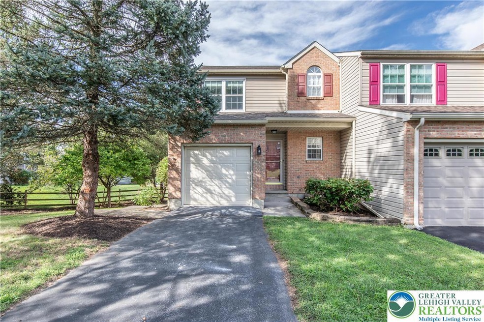
Spacious end of row townhome in Upper Milford is ready for its new owner to make it their own. Located in the highly sought after East Penn school district at the end of a Cul de sac this home has lots to offer. The first floor features a large living room open to the dining room and foyer along with the cozy kitchen and half bath. A covered deck great for relaxing or entertaining is located off the living room. The second floor has two bedrooms and a full bathroom and a primary bedroom with an en suite full bath. The finished basement has the laundry room, a huge family room and another half bath and leads to the back patio and private yard. All this in a great location close to downtown Emmaus, schools, parks, shopping and more!
| Date | Type | Sale Price | Title Company |
|---|---|---|---|
| Deed | $361,100 | Traditional Abstract | |
| Warranty Deed | $205,080 | -- |
| Date | Status | Loan Amount | Loan Type |
|---|---|---|---|
| Open | $118,600 | New Conventional | |
| Previous Owner | $100,000 | New Conventional |
| Date | Event | Price | List to Sale | Price per Sq Ft |
|---|---|---|---|---|
| 09/26/2025 09/26/25 | Sold | $361,100 | +3.2% | $194 / Sq Ft |
| 09/03/2025 09/03/25 | Off Market | $350,000 | -- | -- |
| 09/01/2025 09/01/25 | Pending | -- | -- | -- |
| 08/27/2025 08/27/25 | For Sale | $350,000 | -- | $188 / Sq Ft |
| Year | Tax Paid | Tax Assessment Tax Assessment Total Assessment is a certain percentage of the fair market value that is determined by local assessors to be the total taxable value of land and additions on the property. | Land | Improvement |
|---|---|---|---|---|
| 2025 | $3,937 | $154,200 | $21,000 | $133,200 |
| 2024 | $3,762 | $154,200 | $21,000 | $133,200 |
| 2023 | $3,686 | $154,200 | $21,000 | $133,200 |
| 2022 | $3,598 | $154,200 | $133,200 | $21,000 |
| 2021 | $3,521 | $154,200 | $21,000 | $133,200 |
| 2020 | $3,487 | $154,200 | $21,000 | $133,200 |
| 2019 | $3,465 | $154,200 | $21,000 | $133,200 |
| 2018 | $3,376 | $154,200 | $21,000 | $133,200 |
| 2017 | $3,317 | $154,200 | $21,000 | $133,200 |
| 2016 | -- | $154,200 | $21,000 | $133,200 |
| 2015 | -- | $154,200 | $21,000 | $133,200 |
| 2014 | -- | $154,200 | $21,000 | $133,200 |
Seller's Agent in 2025
Anna Ames
Weichert Realtors
(610) 762-9331
6 in this area
302 Total Sales
W
Seller Co-Listing Agent in 2025
Wade Ames
Weichert Realtors
(610) 762-8495
6 in this area
260 Total Sales
Buyer's Agent in 2025
Denise Rich
RE/MAX
3 in this area
97 Total Sales
Buyer Co-Listing Agent in 2025
The Denise & Jul Rich Team
RE/MAX
(610) 691-6100
3 in this area
95 Total Sales
Source: Greater Lehigh Valley REALTORS®
MLS Number: 763481
APN: 549309783266-1
Disclaimer: Certain information contained herein is derived from information provided by parties other than Homes.com. All information provided is deemed reliable, but is not guaranteed to be accurate and should be independently verified.
![]() IDX information is provided exclusively for personal, non-commercial use, and may not be used for any purpose other than to identify prospective properties consumers may be interested in purchasing.
IDX information is provided exclusively for personal, non-commercial use, and may not be used for any purpose other than to identify prospective properties consumers may be interested in purchasing.
Information is deemed reliable but not guaranteed.