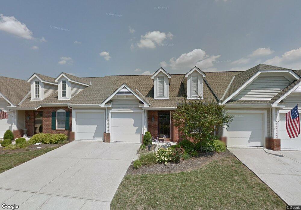
4272 W Fork Rd Unit 4272 Cincinnati, OH 45247
West Monfort Heights NeighborhoodEstimated Value: $244,000 - $298,413
2
Beds
3
Baths
2,227
Sq Ft
$123/Sq Ft
Est. Value
About This Home
This home is located at 4272 W Fork Rd Unit 4272, Cincinnati, OH 45247 and is currently estimated at $273,103, approximately $122 per square foot. 4272 W Fork Rd Unit 4272 is a home located in Hamilton County with nearby schools including Monfort Heights Elementary School, White Oak Middle School, and Colerain High School.
Ownership History
Date
Name
Owned For
Owner Type
Purchase Details
Closed on
Aug 12, 2011
Sold by
Hanson Pam and Hanson Mike
Bought by
Goldschmidt Wilma J
Current Estimated Value
Home Financials for this Owner
Home Financials are based on the most recent Mortgage that was taken out on this home.
Original Mortgage
$204,300
Outstanding Balance
$139,223
Interest Rate
4.54%
Mortgage Type
New Conventional
Estimated Equity
$133,880
Purchase Details
Closed on
Feb 14, 2005
Sold by
Cottage Pointe Development Co Ltd
Bought by
Morgenthal Pam
Home Financials for this Owner
Home Financials are based on the most recent Mortgage that was taken out on this home.
Original Mortgage
$184,840
Interest Rate
6.12%
Mortgage Type
Fannie Mae Freddie Mac
Create a Home Valuation Report for This Property
The Home Valuation Report is an in-depth analysis detailing your home's value as well as a comparison with similar homes in the area
Home Values in the Area
Average Home Value in this Area
Purchase History
| Date | Buyer | Sale Price | Title Company |
|---|---|---|---|
| Goldschmidt Wilma J | $227,000 | Attorney | |
| Morgenthal Pam | $231,100 | None Available |
Source: Public Records
Mortgage History
| Date | Status | Borrower | Loan Amount |
|---|---|---|---|
| Open | Goldschmidt Wilma J | $204,300 | |
| Previous Owner | Morgenthal Pam | $184,840 |
Source: Public Records
Tax History
| Year | Tax Paid | Tax Assessment Tax Assessment Total Assessment is a certain percentage of the fair market value that is determined by local assessors to be the total taxable value of land and additions on the property. | Land | Improvement |
|---|---|---|---|---|
| 2025 | $3,974 | $73,385 | $11,900 | $61,485 |
| 2024 | $3,885 | $73,385 | $11,900 | $61,485 |
| 2023 | $3,904 | $73,385 | $11,900 | $61,485 |
| 2022 | $5,152 | $79,142 | $11,900 | $67,242 |
| 2021 | $4,721 | $79,142 | $11,900 | $67,242 |
| 2020 | $4,768 | $79,142 | $11,900 | $67,242 |
| 2019 | $5,262 | $79,142 | $11,900 | $67,242 |
| 2018 | $4,685 | $79,142 | $11,900 | $67,242 |
| 2017 | $4,427 | $79,142 | $11,900 | $67,242 |
| 2016 | $4,512 | $79,450 | $10,752 | $68,698 |
| 2015 | $4,553 | $79,450 | $10,752 | $68,698 |
| 2014 | $4,561 | $79,450 | $10,752 | $68,698 |
| 2013 | $4,005 | $74,585 | $11,200 | $63,385 |
Source: Public Records
Map
Nearby Homes
- 4192 Timberpoint Dr
- 4491 W Fork Rd
- 3899 Ridgedale Dr
- 4252 Runningfawn Dr
- 4366 Runningfawn Dr
- 4600 Farcrest Ct
- 5320 Meadow Walk Ln
- 5165 N Bend Crossing
- 5440 Asbury Lake Dr
- 4643 Whispering Oak Trail
- 5763 Cheviot Rd
- 5761 Cheviot Rd
- 5765 Cheviot Rd Unit 52D
- 5617 Cheviot Rd
- 5769 Cheviot Rd
- 4575 Boomer Rd
- 5165 Rowan Dr
- 3649 Shortridge Cir
- 5339 Race Rd
- 5225 Ivy Rose Ln
- 4274 W Fork Rd Unit 4274
- 4270 W Fork Rd Unit 4270
- 4292 W Fork Rd
- 4294 W Fork Rd
- 4290 W Fork Rd
- 4254 W Fork Rd Unit 4254
- 4250 W Fork Rd Unit 4250
- 4282 W Fork Rd Unit 4282
- 4280 W Fork Rd
- 4252 W Fork Rd
- 4284 W Fork Rd Unit 4284
- 4262 W Fork Rd Unit 4262
- 4264 W Fork Rd Unit 4264
- 4260 W Fork Rd Unit 4260
- 4310 W Fork Rd
- 4300 W Fork Rd
- 4354 W Fork Rd
- 4328 W Fork Rd
- 5459 Northpoint Dr
- 4376 W Fork Rd
Your Personal Tour Guide
Ask me questions while you tour the home.