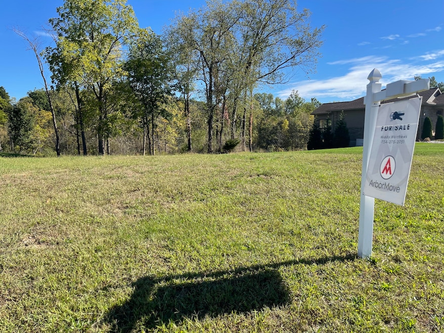
4278 Evergreen Rd Adrian, MI 49221
Estimated payment $389/month
Total Views
6,145
1
Acre
$65,000
Price per Acre
43,560
Sq Ft Lot
About This Lot
4282 Evergreen Road is included with this lot. Parcel ID number XA0-890-0160-00
Property Details
Property Type
- Land
Est. Annual Taxes
- $555
Lot Details
- 1 Acre Lot
Utilities
- High Speed Internet
- Internet Available
- Phone Available
- Cable TV Available
Community Details
- Wolf Ridge II Condos Subdivision
Map
Create a Home Valuation Report for This Property
The Home Valuation Report is an in-depth analysis detailing your home's value as well as a comparison with similar homes in the area
Home Values in the Area
Average Home Value in this Area
Tax History
| Year | Tax Paid | Tax Assessment Tax Assessment Total Assessment is a certain percentage of the fair market value that is determined by local assessors to be the total taxable value of land and additions on the property. | Land | Improvement |
|---|---|---|---|---|
| 2025 | $940 | $12,700 | $0 | $0 |
| 2024 | $555 | $12,600 | $0 | $0 |
| 2023 | $650 | $12,400 | $0 | $0 |
| 2022 | $371 | $12,500 | $0 | $0 |
| 2021 | $364 | $12,500 | $0 | $0 |
| 2020 | $362 | $12,500 | $0 | $0 |
| 2019 | $16,522 | $12,500 | $0 | $0 |
| 2018 | $349 | $12,500 | $0 | $0 |
| 2017 | $339 | $12,500 | $0 | $0 |
| 2016 | $337 | $10,000 | $0 | $0 |
| 2014 | -- | $11,900 | $0 | $0 |
Source: Public Records
Property History
| Date | Event | Price | List to Sale | Price per Sq Ft |
|---|---|---|---|---|
| 06/21/2025 06/21/25 | For Sale | $65,000 | -- | -- |
Source: MichRIC
Source: MichRIC
MLS Number: 25030093
APN: XA0-890-0150-00
Disclaimer: Certain information contained herein is derived from information provided by parties other than Homes.com. All information provided is deemed reliable, but is not guaranteed to be accurate and should be independently verified.
![]() Information is deemed reliable but not guaranteed.
Information is deemed reliable but not guaranteed.
Copyright 2025 MichRIC, LLC. All rights reserved.
Nearby Homes
- 4173 Evergreen Rd
- 4250 Evergreen Rd
- 4274 Evergreen Rd Unit 14
- 1312 Fairlane Dr
- 4157 Evergreen Rd
- 1325 Country Club Rd
- 1100 Blk Country Club Rd
- 260 Renfrew Ave
- 1269 Scott Ridge Dr
- 104 Canterbury St
- Lot B Windcrest Ct
- Lot A Windcrest Ct
- 1144 W Maumee St
- 1058 W Maumee St
- 682 Budlong St
- 3014 Marvin Dr
- 1136 Michigan Ave
- 558 N Mckenzie St
- 4823 Thompson Heights Dr
- 4892 Thompson Heights Dr
- 1966 Burning Bush Ct
- 1215 Corporate Dr Unit 204
- 1215 Corporate Dr Unit 218
- 1215 Corporate Dr Unit 215
- 1215 Corporate Dr Unit 114
- 1215 Corporate Dr Unit 102
- 1215 Corporate Dr Unit 104
- 712 Company St Unit . 1
- 421 Northwestern Dr Unit 421
- 428 Merrick St Unit 428 Merrick
- 136 S Main St Unit 2
- 139 Union St
- 605 Rio Grande Dr
- 102 N Center St Unit 1
- 1956 W Cadmus Rd
- 1940 W Cadmus Rd Unit 101
- 1940 W Cadmus Rd Unit 104
- 1940 W Cadmus Rd Unit 103
- 1940 W Cadmus Rd Unit 102
- 713 E Michigan St Unit 713 East Michigan
