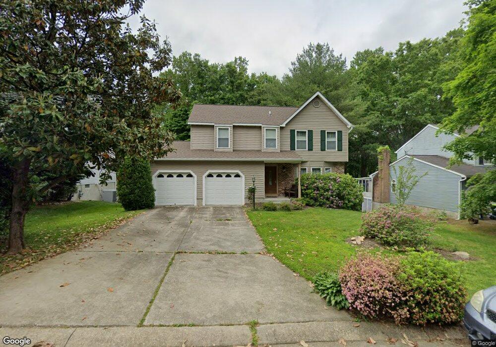
428 Abbey Cir Abingdon, MD 21009
Estimated Value: $428,000 - $533,000
--
Bed
3
Baths
1,884
Sq Ft
$250/Sq Ft
Est. Value
About This Home
This home is located at 428 Abbey Cir, Abingdon, MD 21009 and is currently estimated at $470,205, approximately $249 per square foot. 428 Abbey Cir is a home located in Harford County with nearby schools including Homestead-Wakefield Elementary School, Patterson Mill Middle School, and Patterson Mill High School.
Ownership History
Date
Name
Owned For
Owner Type
Purchase Details
Closed on
Nov 13, 1995
Sold by
Associates Relocation Management
Bought by
Brown Thomas Gordon and Brown Dianne Lynn
Current Estimated Value
Purchase Details
Closed on
Dec 9, 1985
Sold by
Ryland Group Inc The
Bought by
Holweck Ralph D
Home Financials for this Owner
Home Financials are based on the most recent Mortgage that was taken out on this home.
Original Mortgage
$89,000
Interest Rate
11.5%
Create a Home Valuation Report for This Property
The Home Valuation Report is an in-depth analysis detailing your home's value as well as a comparison with similar homes in the area
Home Values in the Area
Average Home Value in this Area
Purchase History
| Date | Buyer | Sale Price | Title Company |
|---|---|---|---|
| Brown Thomas Gordon | $155,000 | -- | |
| Associates Relocation Management | $158,000 | -- | |
| Holweck Ralph D | $111,500 | -- |
Source: Public Records
Mortgage History
| Date | Status | Borrower | Loan Amount |
|---|---|---|---|
| Previous Owner | Holweck Ralph D | $89,000 | |
| Closed | Brown Thomas Gordon | -- |
Source: Public Records
Tax History Compared to Growth
Tax History
| Year | Tax Paid | Tax Assessment Tax Assessment Total Assessment is a certain percentage of the fair market value that is determined by local assessors to be the total taxable value of land and additions on the property. | Land | Improvement |
|---|---|---|---|---|
| 2025 | $3,437 | $343,167 | $0 | $0 |
| 2024 | $3,437 | $321,433 | $0 | $0 |
| 2023 | $3,206 | $299,700 | $100,100 | $199,600 |
| 2022 | $3,206 | $294,167 | $0 | $0 |
| 2021 | $6,412 | $288,633 | $0 | $0 |
| 2020 | $3,267 | $283,100 | $100,100 | $183,000 |
| 2019 | $3,250 | $281,633 | $0 | $0 |
| 2018 | $3,204 | $280,167 | $0 | $0 |
| 2017 | $3,187 | $278,700 | $0 | $0 |
| 2016 | -- | $275,067 | $0 | $0 |
| 2015 | $3,175 | $271,433 | $0 | $0 |
| 2014 | $3,175 | $267,800 | $0 | $0 |
Source: Public Records
Map
Nearby Homes
- 603 E Wheel Rd Unit (11.65 ACRES)
- 603 E Wheel Rd
- 607 E Wheel Rd
- 511 Cedar Hill Ct
- 2214 Erin Way
- 2406 Monarch Way
- 2605 Colpepper Rd
- 2638 Smallwood Dr
- 2414 Laurel Bush Rd
- 2608 Laurel Valley Garth
- 809 Cedar Ln
- 745 Dowers Rd
- 431 Fox Catcher Rd
- 211 E Wheel Rd
- 2411 Grand Oaks Ct
- 306 Fox Hound Ct
- 129 Long Meadow Ct
- 903 Shelburne Rd
- 111 Cinnamon Tree Dr
- 2521 Merrick Ct