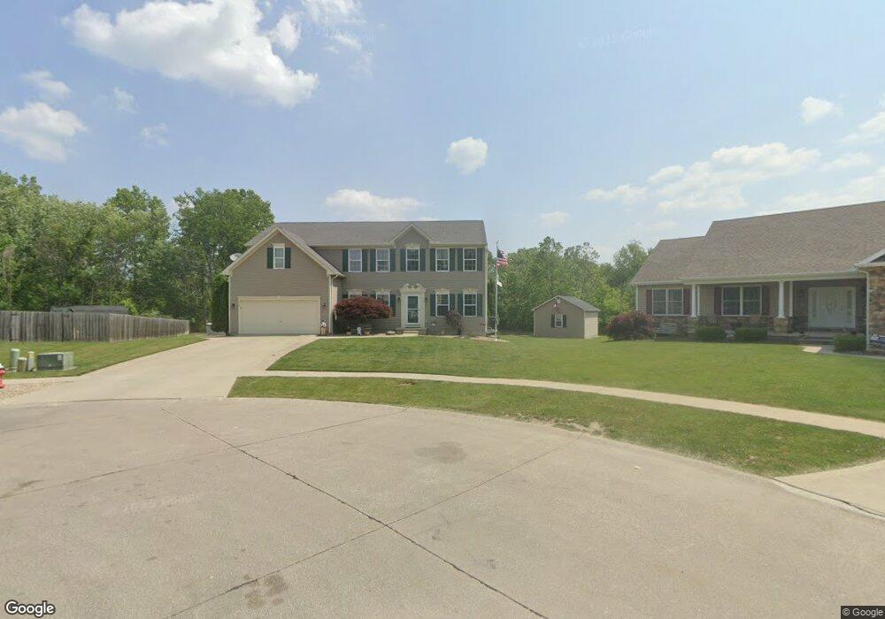
428 Braeburn Ct Amherst, OH 44001
Estimated Value: $442,000 - $523,000
5
Beds
4
Baths
3,117
Sq Ft
$151/Sq Ft
Est. Value
About This Home
This home is located at 428 Braeburn Ct, Amherst, OH 44001 and is currently estimated at $469,770, approximately $150 per square foot. 428 Braeburn Ct is a home located in Lorain County with nearby schools including Powers Elementary School, Walter G. Nord Middle School, and Amherst Junior High School.
Ownership History
Date
Name
Owned For
Owner Type
Purchase Details
Closed on
Oct 11, 2010
Sold by
Nvr Inc
Bought by
Camp Craig M and Camp Cathlene M
Current Estimated Value
Home Financials for this Owner
Home Financials are based on the most recent Mortgage that was taken out on this home.
Original Mortgage
$199,850
Outstanding Balance
$131,342
Interest Rate
4.27%
Mortgage Type
VA
Estimated Equity
$338,428
Purchase Details
Closed on
Sep 3, 2010
Sold by
Braeburn Amherst Llc
Bought by
Nvr Inc and Ryan Homes
Home Financials for this Owner
Home Financials are based on the most recent Mortgage that was taken out on this home.
Original Mortgage
$199,850
Outstanding Balance
$131,342
Interest Rate
4.27%
Mortgage Type
VA
Estimated Equity
$338,428
Create a Home Valuation Report for This Property
The Home Valuation Report is an in-depth analysis detailing your home's value as well as a comparison with similar homes in the area
Home Values in the Area
Average Home Value in this Area
Purchase History
| Date | Buyer | Sale Price | Title Company |
|---|---|---|---|
| Camp Craig M | $228,400 | Nvr Title Agency Llc | |
| Nvr Inc | $35,000 | Nvr Title Agency Llc |
Source: Public Records
Mortgage History
| Date | Status | Borrower | Loan Amount |
|---|---|---|---|
| Open | Camp Craig M | $199,850 |
Source: Public Records
Tax History Compared to Growth
Tax History
| Year | Tax Paid | Tax Assessment Tax Assessment Total Assessment is a certain percentage of the fair market value that is determined by local assessors to be the total taxable value of land and additions on the property. | Land | Improvement |
|---|---|---|---|---|
| 2024 | $5,817 | $144,011 | $28,105 | $115,906 |
| 2023 | $4,769 | $99,505 | $19,842 | $79,664 |
| 2022 | $4,572 | $99,505 | $19,842 | $79,664 |
| 2021 | $4,583 | $99,505 | $19,842 | $79,664 |
| 2020 | $5,032 | $96,980 | $19,340 | $77,640 |
| 2019 | $4,932 | $96,980 | $19,340 | $77,640 |
| 2018 | $4,942 | $96,980 | $19,340 | $77,640 |
| 2017 | $4,927 | $90,480 | $17,100 | $73,380 |
| 2016 | $4,967 | $90,480 | $17,100 | $73,380 |
| 2015 | $4,939 | $90,480 | $17,100 | $73,380 |
| 2014 | $5,179 | $94,440 | $17,850 | $76,590 |
| 2013 | $5,196 | $94,440 | $17,850 | $76,590 |
Source: Public Records
Map
Nearby Homes
- 110 Habant Dr
- 1250 N Main St
- 1011 N Main St
- 0 Cooper Foster Park Rd Unit 5129838
- 3489 Coopers Trail
- 357 Pebble Creek Ct
- 0 Rosecliff Dr
- 4510 Weathervane Dr
- 117 Fall Lake Ln
- 369 Pebble Creek Ct
- 4680 Boulder Ln
- 922 Sharondale Dr
- Lehigh Plan at Sandy Springs Trail
- Alberti Ranch Plan at Sandy Springs Trail
- Bramante Ranch Plan at Sandy Springs Trail
- Columbia Plan at Sandy Springs Trail
- 707 Greenlawn Dr
- 6076 Audriana Way
- 4872 Leavitt Rd
- 3794 Freedom Place
- 424 Braeburn Ct
- 429 Braeburn Ct
- 420 Braeburn Ct
- 425 Braeburn Ct
- 421 Braeburn Ct
- 416 Braeburn Ct
- 417 Braeburn Ct
- 1 Braeburn Ct
- 413 Braeburn Ct
- 412 Braeburn Ct
- 1204 Meadowbrook Ct
- 182 Habant Dr
- 1200 Meadowbrook Ct
- 170 Habant Dr
- 194 Habant Dr
- 409 Braeburn Ct
- 158 Habant Dr
- 200 Habant Dr
- 408 Braeburn Ct
- 1198 Meadowbrook Dr