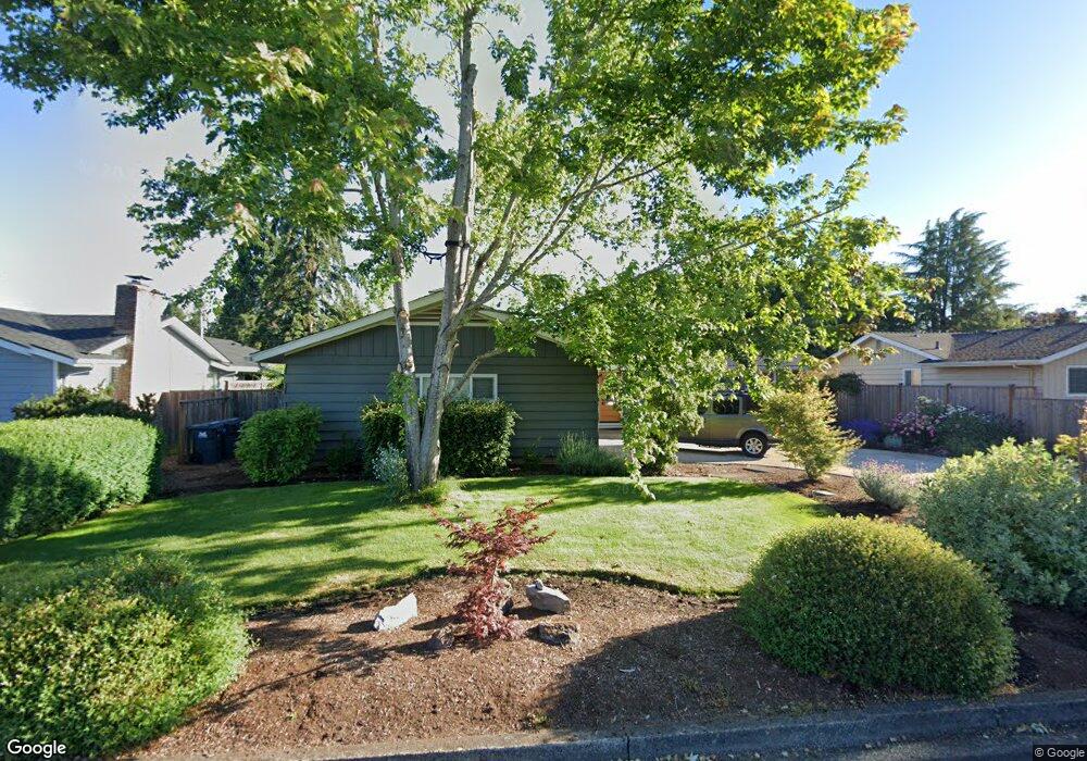
428 Cambridge St Springfield, OR 97477
North Springfield NeighborhoodEstimated Value: $468,373 - $493,000
3
Beds
2
Baths
1,456
Sq Ft
$331/Sq Ft
Est. Value
About This Home
This home is located at 428 Cambridge St, Springfield, OR 97477 and is currently estimated at $482,593, approximately $331 per square foot. 428 Cambridge St is a home located in Lane County with nearby schools including Guy Lee Elementary School, Hamlin Middle School, and Springfield High School.
Ownership History
Date
Name
Owned For
Owner Type
Purchase Details
Closed on
May 3, 2017
Sold by
Curry Ronnel and Curry Mark S
Bought by
Curry Ronnel
Current Estimated Value
Purchase Details
Closed on
Jul 2, 2001
Sold by
Haith Lori and Haith Lorraine M
Bought by
Curry Ronnel and Curry Mark S
Home Financials for this Owner
Home Financials are based on the most recent Mortgage that was taken out on this home.
Original Mortgage
$116,000
Outstanding Balance
$43,987
Interest Rate
7.24%
Estimated Equity
$438,606
Purchase Details
Closed on
Jun 13, 2000
Sold by
Haith David M
Bought by
Haith Lorraine M
Purchase Details
Closed on
Dec 28, 1999
Sold by
Stephen Babjar Ronald
Bought by
Haith David and Haith Lori
Home Financials for this Owner
Home Financials are based on the most recent Mortgage that was taken out on this home.
Original Mortgage
$116,800
Interest Rate
7.68%
Create a Home Valuation Report for This Property
The Home Valuation Report is an in-depth analysis detailing your home's value as well as a comparison with similar homes in the area
Home Values in the Area
Average Home Value in this Area
Purchase History
| Date | Buyer | Sale Price | Title Company |
|---|---|---|---|
| Curry Ronnel | -- | None Available | |
| Curry Ronnel | $145,000 | Cascade Title Co | |
| Haith Lorraine M | -- | -- | |
| Haith David | $146,000 | Western Pioneer Title Co |
Source: Public Records
Mortgage History
| Date | Status | Borrower | Loan Amount |
|---|---|---|---|
| Open | Curry Ronnel | $116,000 | |
| Previous Owner | Haith David | $116,800 | |
| Closed | Haith David | $14,600 |
Source: Public Records
Tax History Compared to Growth
Tax History
| Year | Tax Paid | Tax Assessment Tax Assessment Total Assessment is a certain percentage of the fair market value that is determined by local assessors to be the total taxable value of land and additions on the property. | Land | Improvement |
|---|---|---|---|---|
| 2025 | $3,720 | $253,933 | -- | -- |
| 2024 | $3,619 | $246,537 | -- | -- |
| 2023 | $3,619 | $217,807 | $0 | $0 |
| 2022 | $3,130 | $211,464 | $0 | $0 |
| 2021 | $3,063 | $205,305 | $0 | $0 |
| 2020 | $2,974 | $199,326 | $0 | $0 |
| 2019 | $2,870 | $193,521 | $0 | $0 |
| 2018 | $2,761 | $182,413 | $0 | $0 |
| 2017 | $2,678 | $182,413 | $0 | $0 |
| 2016 | $2,618 | $177,100 | $0 | $0 |
| 2015 | $2,555 | $171,942 | $0 | $0 |
| 2014 | $2,447 | $166,934 | $0 | $0 |
Source: Public Records
Map
Nearby Homes
- 601 Blackstone St
- 236 Greenvale Dr
- 2240 5th St
- 450 U St
- 114 Hayden Bridge Way
- 143 V St
- 40 Allen Ave
- 2268 9th St
- 651 T St
- 1938 7th St
- 2567 Game Farm Rd
- 2252 Rose Blossom Dr
- 2150 Laura (#57) St Unit 57
- 2150 Laura St Unit 119
- 2150 Laura St Unit 111
- 2150 Laura St Unit 39
- 2150 Laura St Unit 57
- 2150 Laura St Unit 83
- 2150 Laura St Unit 44
- 2556 Dumas Dr
- 446 Cambridge St
- 410 Cambridge St
- 464 Cambridge St
- 390 Cambridge St
- 433 Cambridge St
- 415 Cambridge St
- 455 Cambridge St
- 397 Cambridge St
- 2560 5th St
- 471 Cambridge St
- 368 Cambridge St
- 339 Blackstone St
- 375 Cambridge St
- 2600 5th St
- 333 Blackstone St
- 345 Blackstone St
- 2626 5th St
- 357 Cambridge St
- 344 Cambridge St
- 353 Blackstone St