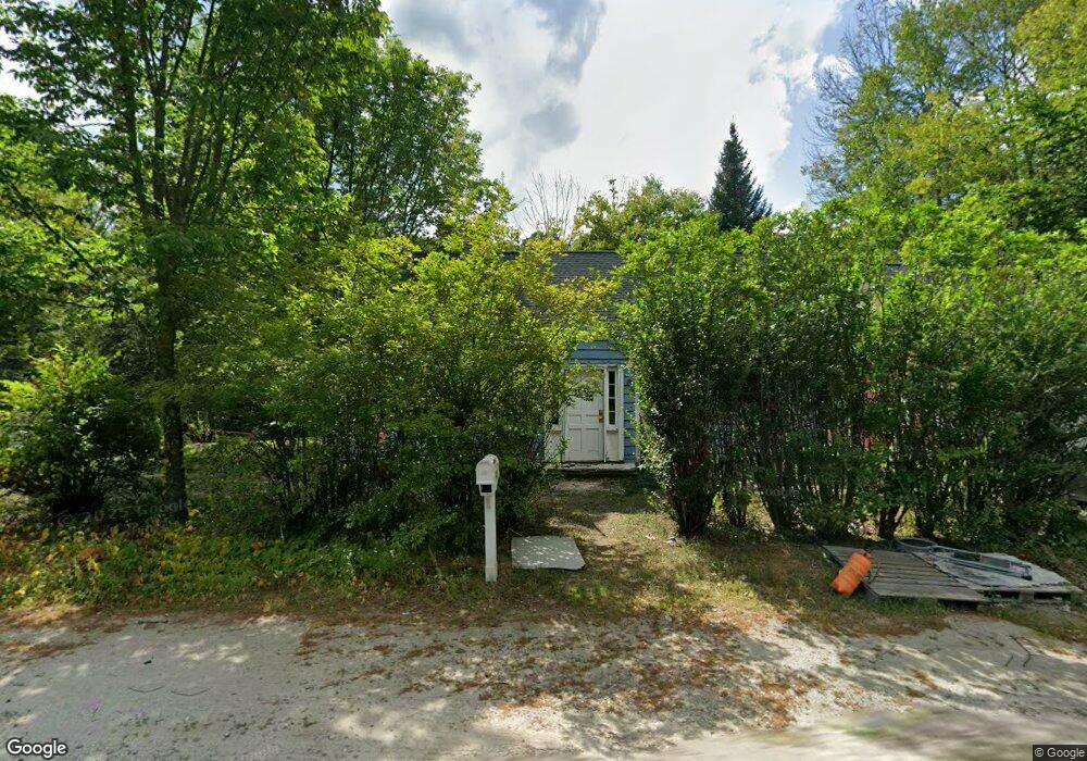
428 Forest Rd Wilton, NH 03086
Estimated Value: $127,000 - $481,000
3
Beds
2
Baths
1,827
Sq Ft
$199/Sq Ft
Est. Value
About This Home
This home is located at 428 Forest Rd, Wilton, NH 03086 and is currently estimated at $363,095, approximately $198 per square foot. 428 Forest Rd is a home located in Hillsborough County with nearby schools including Florence Rideout Elementary School, Wilton-Lyndeborough Cooperative Middle School, and Wilton-Lyndeborough Cooperative High School.
Ownership History
Date
Name
Owned For
Owner Type
Purchase Details
Closed on
Dec 3, 2021
Sold by
Millward Andrew J
Bought by
Briere Kathleen R
Current Estimated Value
Home Financials for this Owner
Home Financials are based on the most recent Mortgage that was taken out on this home.
Original Mortgage
$95,000
Outstanding Balance
$86,628
Interest Rate
3.09%
Mortgage Type
Purchase Money Mortgage
Estimated Equity
$276,467
Create a Home Valuation Report for This Property
The Home Valuation Report is an in-depth analysis detailing your home's value as well as a comparison with similar homes in the area
Home Values in the Area
Average Home Value in this Area
Purchase History
| Date | Buyer | Sale Price | Title Company |
|---|---|---|---|
| Briere Kathleen R | $92,000 | None Available |
Source: Public Records
Mortgage History
| Date | Status | Borrower | Loan Amount |
|---|---|---|---|
| Open | Briere Kathleen R | $95,000 |
Source: Public Records
Tax History
| Year | Tax Paid | Tax Assessment Tax Assessment Total Assessment is a certain percentage of the fair market value that is determined by local assessors to be the total taxable value of land and additions on the property. | Land | Improvement |
|---|---|---|---|---|
| 2025 | $4,778 | $177,100 | $102,200 | $74,900 |
| 2024 | $6,563 | $263,900 | $102,200 | $161,700 |
| 2023 | $5,859 | $263,900 | $102,200 | $161,700 |
| 2022 | $5,452 | $263,900 | $102,200 | $161,700 |
| 2021 | $5,072 | $263,900 | $102,200 | $161,700 |
| 2020 | $5,719 | $194,600 | $74,900 | $119,700 |
| 2019 | $5,642 | $194,300 | $74,900 | $119,400 |
| 2018 | $5,588 | $194,300 | $74,900 | $119,400 |
| 2017 | $5,279 | $194,300 | $74,900 | $119,400 |
| 2016 | $5,118 | $194,300 | $74,900 | $119,400 |
| 2015 | $5,039 | $191,300 | $80,100 | $111,200 |
| 2014 | $4,936 | $191,300 | $80,100 | $111,200 |
| 2013 | $4,978 | $191,300 | $80,100 | $111,200 |
Source: Public Records
Map
Nearby Homes
- 58-6-2 Duggin Rd
- Lot 053 Holt Rd
- A 66 Burton Hwy
- 371 Burton Hwy
- 374 Burton Hwy
- 144 Putnam Hill Rd
- 25 Burns Hill Rd
- F88-9 McGettigan Rd
- F/88-5 McGettigan Rd
- F/88-4 McGettigan Rd
- 10 Whiting Hill Rd
- 302 Forest Rd
- F88-10 McGettigan Rd
- Lots 4 & 7 Gibbons & Robbins Rd
- 123 Falcon Ridge Rd
- 589 Gibbons Hwy
- 33 Falcon Ridge Rd Unit 33
- 82 Wilton Rd Unit A
- 82 Wilton Rd Unit B
- 82 Wilton Rd Unit A & B
- 416 Forest Rd
- 438 Forest Rd
- 1025 Isaac Frye Hwy
- 1009 Isaac Frye Hwy
- 19 Waters Rd
- 1053 Isaac Frye Hwy
- 19 Stoney Brook Dr
- 995 Isaac Frye Hwy
- 1016 Isaac Frye Hwy
- 1020 Isaac Frye Hwy
- 1004 Isaac Frye Hwy
- 7 Waters Rd
- 10 Stoney Brook Dr
- 1 Waters Rd
- 1060 Isaac Frye Hwy
- 462 Forest Rd
- 373 Forest Rd
- 979 Isaac Frye Hwy
- 980 Isaac Frye Hwy
- 978 Isaac Frye Hwy
Your Personal Tour Guide
Ask me questions while you tour the home.