Estimated Value: $185,000 - $207,000
3
Beds
1
Bath
975
Sq Ft
$200/Sq Ft
Est. Value
About This Home
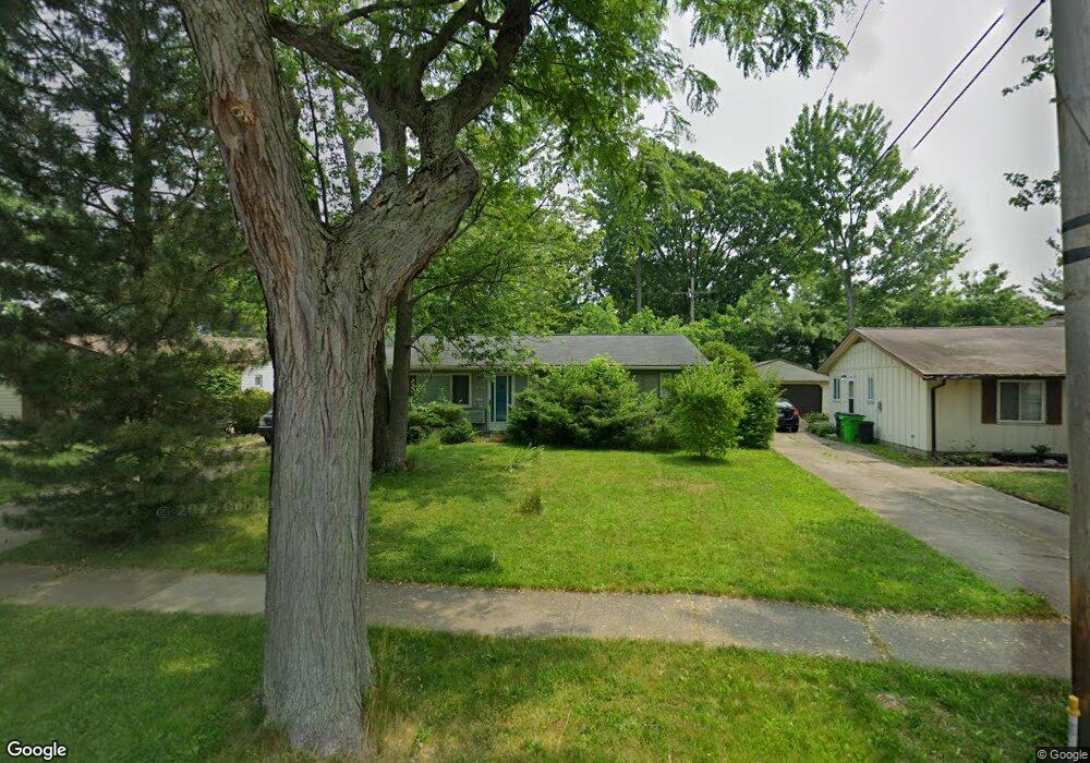
This home is located at 428 Laurel Dr, Berea, OH 44017 and is currently estimated at $195,472, approximately $200 per square foot. 428 Laurel Dr is a home located in Cuyahoga County with nearby schools including Grindstone Elementary School, Berea-Midpark Middle School, and Berea-Midpark High School.
Ownership History
Date
Name
Owned For
Owner Type
Purchase Details
Closed on
Aug 27, 1996
Sold by
Fertal Anthony A
Bought by
Kerlee Karen E
Current Estimated Value
Home Financials for this Owner
Home Financials are based on the most recent Mortgage that was taken out on this home.
Original Mortgage
$93,100
Outstanding Balance
$4,179
Interest Rate
8.47%
Mortgage Type
New Conventional
Estimated Equity
$191,293
Purchase Details
Closed on
May 29, 1992
Sold by
Esterer Andrew B
Bought by
Fertal Anthoy A
Purchase Details
Closed on
Apr 20, 1988
Sold by
Vajas Leonard M and Vajas Emily A
Bought by
Esterer Andrew B
Purchase Details
Closed on
Mar 28, 1983
Sold by
Vajas Leonard
Bought by
Vajas Leonard M and Vajas Emily A
Purchase Details
Closed on
Mar 5, 1981
Sold by
Kaminski William J and D T
Bought by
Vajas Leonard
Purchase Details
Closed on
Jan 1, 1975
Bought by
Kaminski William J and D T
Create a Home Valuation Report for This Property
The Home Valuation Report is an in-depth analysis detailing your home's value as well as a comparison with similar homes in the area
Home Values in the Area
Average Home Value in this Area
Purchase History
| Date | Buyer | Sale Price | Title Company |
|---|---|---|---|
| Kerlee Karen E | $98,000 | -- | |
| Fertal Anthoy A | $78,000 | -- | |
| Esterer Andrew B | $58,500 | -- | |
| Vajas Leonard M | -- | -- | |
| Vajas Leonard | $51,900 | -- | |
| Kaminski William J | -- | -- |
Source: Public Records
Mortgage History
| Date | Status | Borrower | Loan Amount |
|---|---|---|---|
| Open | Kerlee Karen E | $93,100 |
Source: Public Records
Tax History
| Year | Tax Paid | Tax Assessment Tax Assessment Total Assessment is a certain percentage of the fair market value that is determined by local assessors to be the total taxable value of land and additions on the property. | Land | Improvement |
|---|---|---|---|---|
| 2025 | $3,345 | $57,750 | $14,140 | $43,610 |
| 2024 | $3,342 | $57,750 | $14,140 | $43,610 |
| 2023 | $3,065 | $44,380 | $11,410 | $32,970 |
| 2022 | $3,046 | $44,380 | $11,410 | $32,970 |
| 2021 | $3,020 | $44,380 | $11,410 | $32,970 |
| 2020 | $2,883 | $37,590 | $9,660 | $27,930 |
| 2019 | $2,806 | $107,400 | $27,600 | $79,800 |
| 2018 | $2,714 | $37,590 | $9,660 | $27,930 |
| 2017 | $2,826 | $35,320 | $8,260 | $27,060 |
| 2016 | $2,805 | $35,320 | $8,260 | $27,060 |
| 2015 | $2,790 | $35,320 | $8,260 | $27,060 |
| 2014 | $2,790 | $37,170 | $8,680 | $28,490 |
Source: Public Records
Map
Nearby Homes
- 379 Laurel Dr
- 428 Park Place
- 446 Redwood Dr
- 160 Stonepointe Dr
- 487 Karen Dr
- 132 Stonefield Dr
- 147 Stone Ridge Way
- 659 Wesley Dr
- 725 Shakespeare Dr
- 100 River Rock Way
- 6574 Burton Dr
- 93 W 5th Ave
- 146 Marian Ln
- 160 Marian Ln Unit 6A
- 0 River Rd Unit 5169658
- 56 3rd Ave
- 143 Baker St
- 211 W Bridge St
- 7461 River Rd
- 300 West St
Your Personal Tour Guide
Ask me questions while you tour the home.