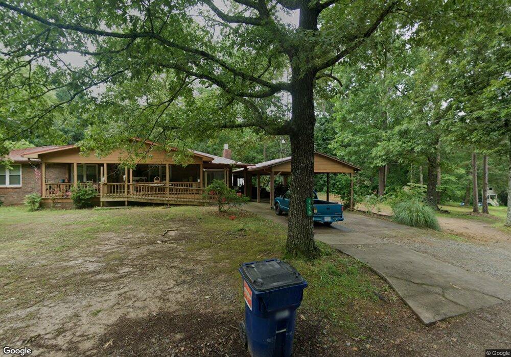
428 Lewis Rd Canton, GA 30115
Union Hill NeighborhoodEstimated Value: $228,877 - $242,000
3
Beds
1
Bath
1,104
Sq Ft
$213/Sq Ft
Est. Value
About This Home
This home is located at 428 Lewis Rd, Canton, GA 30115 and is currently estimated at $235,439, approximately $213 per square foot. 428 Lewis Rd is a home located in Cherokee County with nearby schools including Hasty Elementary School Fine Arts Academy, Teasley Middle School, and Cherokee High School.
Ownership History
Date
Name
Owned For
Owner Type
Purchase Details
Closed on
Feb 21, 2020
Sold by
Faber Ivy
Bought by
Fowler Laurie
Current Estimated Value
Home Financials for this Owner
Home Financials are based on the most recent Mortgage that was taken out on this home.
Original Mortgage
$81,000
Outstanding Balance
$55,392
Interest Rate
3.6%
Mortgage Type
New Conventional
Estimated Equity
$180,047
Purchase Details
Closed on
Aug 27, 1997
Sold by
Mclaughlin Larry
Bought by
Faber Leroy P and Faber Ivy A
Home Financials for this Owner
Home Financials are based on the most recent Mortgage that was taken out on this home.
Original Mortgage
$50,400
Interest Rate
7.52%
Mortgage Type
New Conventional
Create a Home Valuation Report for This Property
The Home Valuation Report is an in-depth analysis detailing your home's value as well as a comparison with similar homes in the area
Home Values in the Area
Average Home Value in this Area
Purchase History
| Date | Buyer | Sale Price | Title Company |
|---|---|---|---|
| Fowler Laurie | $90,000 | -- | |
| Faber Leroy P | $63,000 | -- |
Source: Public Records
Mortgage History
| Date | Status | Borrower | Loan Amount |
|---|---|---|---|
| Open | Fowler Laurie | $81,000 | |
| Previous Owner | Faber Leroy P | $50,400 |
Source: Public Records
Tax History
| Year | Tax Paid | Tax Assessment Tax Assessment Total Assessment is a certain percentage of the fair market value that is determined by local assessors to be the total taxable value of land and additions on the property. | Land | Improvement |
|---|---|---|---|---|
| 2025 | $1,563 | $59,520 | $16,480 | $43,040 |
| 2024 | $1,419 | $54,600 | $13,320 | $41,280 |
| 2023 | $1,274 | $49,040 | $10,720 | $38,320 |
| 2022 | $1,027 | $39,080 | $10,320 | $28,760 |
| 2021 | $902 | $31,760 | $8,600 | $23,160 |
| 2020 | $765 | $26,920 | $6,440 | $20,480 |
| 2019 | $654 | $23,000 | $6,440 | $16,560 |
| 2018 | $636 | $22,240 | $6,440 | $15,800 |
| 2017 | $592 | $56,300 | $6,440 | $16,080 |
| 2016 | $592 | $50,800 | $5,400 | $14,920 |
| 2015 | $548 | $46,600 | $5,080 | $13,560 |
| 2014 | $506 | $42,900 | $4,200 | $12,960 |
Source: Public Records
Map
Nearby Homes
- 302 and 304 Garland Way
- 727 Lower Scott Mill Rd
- 206 Brick Mill Dr
- 199 Mountain Vista Blvd
- 161 Mountain Vista Blvd
- 251 E Killian St
- 241 E Killian St
- 313 Spring Hill Dr
- 407 Cherubs Smile
- 120 E Killian St
- 118 Celebration Song
- 286 Hilton Way
- 1720 Hickory Flat Hwy
- 791 Marietta Rd
- 312 Hillcrest Ln
- 254 Hillcrest Ridge Unit 2
- 204 Hillcrest Ridge
- 701 Longview Dr
- 226 Redbud Rd
- 446 Laurelwood Ln
- 426 Lewis Rd
- 414 Lewis Rd
- 431 Lewis Rd
- 146 Lower Scott Mill Rd
- 413 Lewis Rd
- 188 Lower Scott Mill Rd
- 435 Lewis Rd
- 342 Lower Scott Mill Rd
- 376 Lower Scott Mill Rd
- 173 Lower Scott Mill Rd
- 000 Arbor Trace
- 00 Arbor Trace
- 0 Arbor Trace
- 0 Arbor Trace Unit 7382649
- 191 Lower Scott Mill Rd
- 126 Lower Scott Mill Rd
- 418 Lower Scott Mill Rd
- 188 Michael St
- 190 Michael St Unit TRACT 2
- 190 Michael St
Your Personal Tour Guide
Ask me questions while you tour the home.