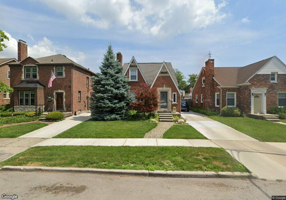
428 Madison St Grosse Pointe Farms, MI 48236
Estimated Value: $369,470 - $432,000
--
Bed
2
Baths
1,497
Sq Ft
$266/Sq Ft
Est. Value
About This Home
This home is located at 428 Madison St, Grosse Pointe Farms, MI 48236 and is currently estimated at $398,868, approximately $266 per square foot. 428 Madison St is a home located in Wayne County with nearby schools including Kerby Elementary School, Brownell Middle School, and Grosse Pointe South High School.
Ownership History
Date
Name
Owned For
Owner Type
Purchase Details
Closed on
Jun 1, 2001
Sold by
Henein Michael N
Bought by
Henein Kathleen A
Current Estimated Value
Purchase Details
Closed on
Jul 17, 1997
Sold by
J K and Troman Michael S
Bought by
John T and Piazza Julie L
Purchase Details
Closed on
May 17, 1996
Sold by
Michael S
Bought by
Alan D Mead and Nordquist Mead Susan D
Purchase Details
Closed on
Dec 12, 1994
Sold by
Bachmann Stephen R
Bought by
Alan D Mead and Nordquist Susan D
Home Financials for this Owner
Home Financials are based on the most recent Mortgage that was taken out on this home.
Original Mortgage
$114,450
Interest Rate
5.75%
Mortgage Type
New Conventional
Create a Home Valuation Report for This Property
The Home Valuation Report is an in-depth analysis detailing your home's value as well as a comparison with similar homes in the area
Home Values in the Area
Average Home Value in this Area
Purchase History
| Date | Buyer | Sale Price | Title Company |
|---|---|---|---|
| Henein Kathleen A | -- | -- | |
| John T | $169,000 | -- | |
| Alan D Mead | $141,000 | -- | |
| Alan D Mead | $121,000 | -- |
Source: Public Records
Mortgage History
| Date | Status | Borrower | Loan Amount |
|---|---|---|---|
| Previous Owner | Alan D Mead | $114,450 |
Source: Public Records
Tax History Compared to Growth
Tax History
| Year | Tax Paid | Tax Assessment Tax Assessment Total Assessment is a certain percentage of the fair market value that is determined by local assessors to be the total taxable value of land and additions on the property. | Land | Improvement |
|---|---|---|---|---|
| 2025 | $2,760 | $173,400 | $0 | $0 |
| 2024 | $2,760 | $163,900 | $0 | $0 |
| 2023 | $2,529 | $151,700 | $0 | $0 |
| 2022 | $2,529 | $139,300 | $0 | $0 |
| 2021 | $4,640 | $127,400 | $0 | $0 |
| 2019 | $4,563 | $117,400 | $0 | $0 |
| 2018 | $2,335 | $110,500 | $0 | $0 |
| 2017 | $4,052 | $107,500 | $0 | $0 |
| 2016 | $4,247 | $105,500 | $0 | $0 |
| 2015 | $8,413 | $92,900 | $0 | $0 |
| 2013 | $8,150 | $81,500 | $0 | $0 |
| 2012 | $2,168 | $81,500 | $22,100 | $59,400 |
Source: Public Records
Map
Nearby Homes
- 441 Manor St
- 415 Lothrop Rd
- 471 Touraine Rd
- 380 Merriweather Rd
- 432 Calvin Ave
- 351 Moselle Place
- 343 Mount Vernon Ave
- 975 Fisher Rd
- 265 Williams Ave
- 4496 Radnor St
- 314 Mount Vernon Ave
- 317 Mount Vernon Ave
- 18119 Cornwall St
- 4607 Radnor St
- 302 Mount Vernon Ave
- 5047 Anatole St
- 352 Mckinley Ave
- 4598 Lodewyck St
- 341 Mcmillan Rd
- 5056 Lafontaine St