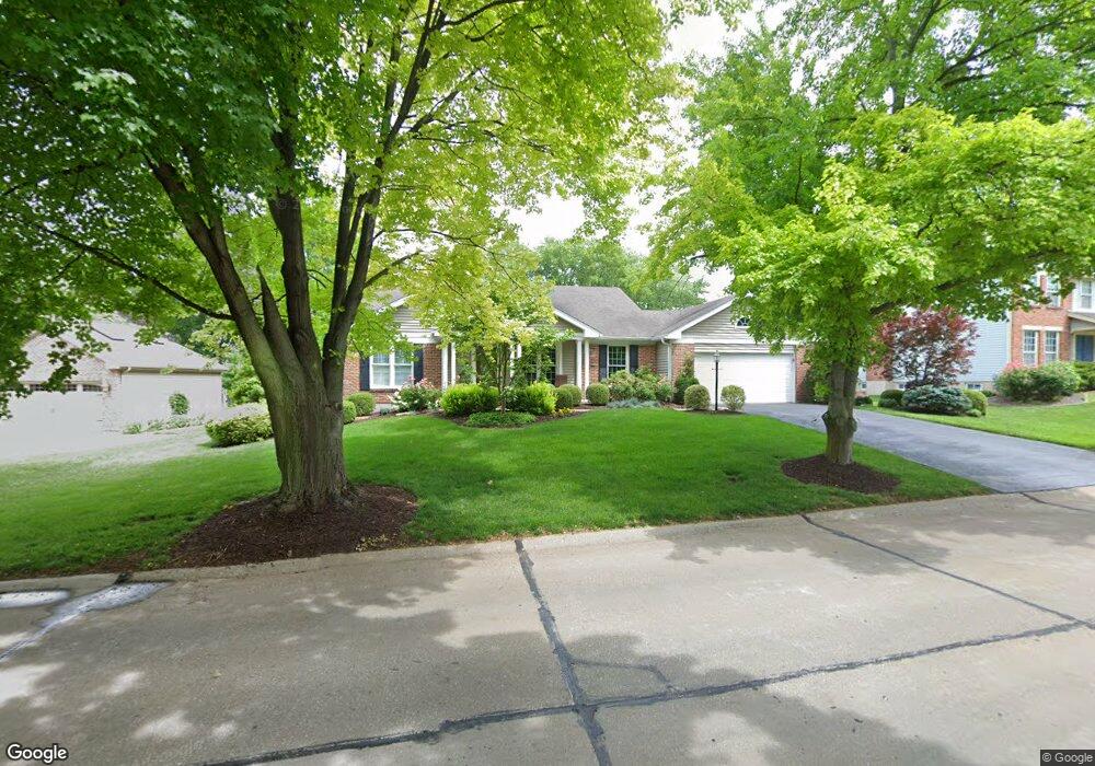
428 Mason Ridge Dr Saint Charles, MO 63304
Estimated Value: $394,238 - $452,000
3
Beds
2
Baths
1,776
Sq Ft
$240/Sq Ft
Est. Value
About This Home
This home is located at 428 Mason Ridge Dr, Saint Charles, MO 63304 and is currently estimated at $426,060, approximately $239 per square foot. 428 Mason Ridge Dr is a home located in St. Charles County with nearby schools including Warren Elementary School, Saeger Middle School, and Francis Howell Central High School.
Ownership History
Date
Name
Owned For
Owner Type
Purchase Details
Closed on
Sep 30, 2013
Sold by
Myer William D and The William D Myer Revocable T
Bought by
Myer William D
Current Estimated Value
Home Financials for this Owner
Home Financials are based on the most recent Mortgage that was taken out on this home.
Original Mortgage
$215,481
Interest Rate
4.62%
Mortgage Type
FHA
Purchase Details
Closed on
Jan 25, 2005
Sold by
Myer William D
Bought by
Myer William D and William D Myer Revocable Trust
Create a Home Valuation Report for This Property
The Home Valuation Report is an in-depth analysis detailing your home's value as well as a comparison with similar homes in the area
Home Values in the Area
Average Home Value in this Area
Purchase History
| Date | Buyer | Sale Price | Title Company |
|---|---|---|---|
| Myer William D | -- | Clear Title Group | |
| Myer William D | -- | -- |
Source: Public Records
Mortgage History
| Date | Status | Borrower | Loan Amount |
|---|---|---|---|
| Closed | Myer William D | $215,481 |
Source: Public Records
Tax History Compared to Growth
Tax History
| Year | Tax Paid | Tax Assessment Tax Assessment Total Assessment is a certain percentage of the fair market value that is determined by local assessors to be the total taxable value of land and additions on the property. | Land | Improvement |
|---|---|---|---|---|
| 2025 | $3,567 | $64,424 | -- | -- |
| 2023 | $3,566 | $59,700 | $0 | $0 |
| 2022 | $3,201 | $49,746 | $0 | $0 |
| 2021 | $3,204 | $49,746 | $0 | $0 |
| 2020 | $2,796 | $41,984 | $0 | $0 |
| 2019 | $2,784 | $41,984 | $0 | $0 |
| 2018 | $2,940 | $42,425 | $0 | $0 |
| 2017 | $2,916 | $42,425 | $0 | $0 |
| 2016 | $2,611 | $36,552 | $0 | $0 |
| 2015 | $2,578 | $36,552 | $0 | $0 |
| 2014 | $2,429 | $33,404 | $0 | $0 |
Source: Public Records
Map
Nearby Homes
- 6024 Mo-N Unit Lot 2
- 6025 Mo-N Unit Lot 1
- 201 Valley Lakes Ct
- 308 Cypress Point Ct
- 1399 Valli Ln
- 301 Switchgrass Landing Ln
- Rosemont Plan at Prairie Bluff - Heritage Collection
- Sierra Plan at Prairie Bluff - Heritage Collection
- Sierra – Universal Design Plan at Prairie Bluff - Heritage Collection
- Pierce Plan at Prairie Bluff - Heritage Collection
- Lancaster Plan at Prairie Bluff - Heritage Collection
- Chesapeake Plan at Prairie Bluff - Heritage Collection
- Windsor Plan at Prairie Bluff - Heritage Collection
- Bridgeport Plan at Prairie Bluff - Heritage Collection
- Davenport Plan at Prairie Bluff - Heritage Collection
- Portsmouth Plan at Prairie Bluff - Heritage Collection
- Braxton Plan at Prairie Bluff - Heritage Collection
- 317 Switchgrass Landing Ln
- 0 Universal Design Prairie Bluff Unit MAR24041208
- 1512 Brittany Cove
- 432 Mason Ridge Dr
- 424 Mason Ridge Dr
- 5149 Silver Lake Ct
- 436 Mason Ridge Dr
- 420 Mason Ridge Dr
- 5145 Silver Lake Ct
- 120 Golden Ridge Ct
- 5153 Silver Lake Ct
- 433 Mason Ridge Dr
- 425 Mason Ridge Dr
- 416 Mason Ridge Dr
- 440 Mason Ridge Dr
- 437 Mason Ridge Dr
- 5141 Silver Lake Ct
- 2 Elk Ridge Ct
- 110 Golden Ridge Ct
- 5148 Silver Lake Ct
- 5140 Silver Lake Ct
- 5140 Silver Lake Ct
- 5157 Silver Lake Ct