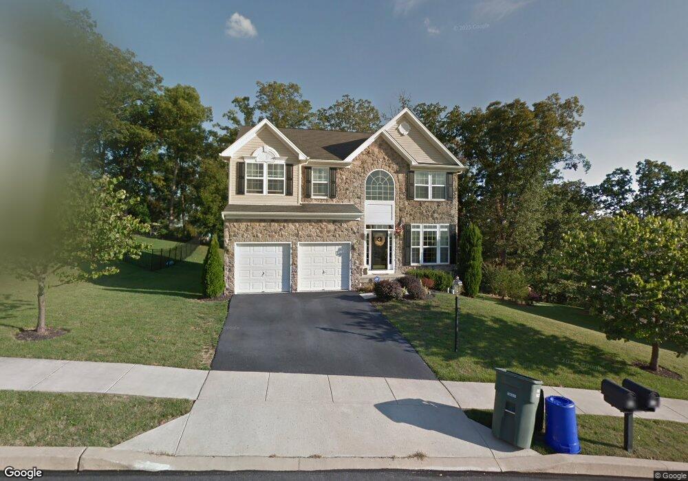
428 Pulaski Place Dallastown, PA 17313
Estimated Value: $435,740 - $490,000
4
Beds
4
Baths
3,360
Sq Ft
$136/Sq Ft
Est. Value
About This Home
This home is located at 428 Pulaski Place, Dallastown, PA 17313 and is currently estimated at $458,435, approximately $136 per square foot. 428 Pulaski Place is a home located in York County with nearby schools including York Township Elementary School, Dallastown Area Middle School, and Dallastown Area Senior High School.
Ownership History
Date
Name
Owned For
Owner Type
Purchase Details
Closed on
May 31, 2006
Sold by
Southern Heights Tract Inc
Bought by
Barnes Anthony and Caver Michael
Current Estimated Value
Home Financials for this Owner
Home Financials are based on the most recent Mortgage that was taken out on this home.
Original Mortgage
$310,999
Interest Rate
8.12%
Mortgage Type
Purchase Money Mortgage
Create a Home Valuation Report for This Property
The Home Valuation Report is an in-depth analysis detailing your home's value as well as a comparison with similar homes in the area
Home Values in the Area
Average Home Value in this Area
Purchase History
| Date | Buyer | Sale Price | Title Company |
|---|---|---|---|
| Barnes Anthony | $345,555 | Residential Title & Escrow C |
Source: Public Records
Mortgage History
| Date | Status | Borrower | Loan Amount |
|---|---|---|---|
| Previous Owner | Barnes Anthony | $310,999 |
Source: Public Records
Tax History Compared to Growth
Tax History
| Year | Tax Paid | Tax Assessment Tax Assessment Total Assessment is a certain percentage of the fair market value that is determined by local assessors to be the total taxable value of land and additions on the property. | Land | Improvement |
|---|---|---|---|---|
| 2025 | $7,819 | $227,780 | $31,410 | $196,370 |
| 2024 | $7,705 | $227,780 | $31,410 | $196,370 |
| 2023 | $7,705 | $227,780 | $31,410 | $196,370 |
| 2022 | $7,453 | $227,780 | $31,410 | $196,370 |
| 2021 | $7,100 | $227,780 | $31,410 | $196,370 |
| 2020 | $7,100 | $227,780 | $31,410 | $196,370 |
| 2019 | $7,077 | $227,780 | $31,410 | $196,370 |
| 2018 | $7,029 | $227,780 | $31,410 | $196,370 |
| 2017 | $6,749 | $227,780 | $31,410 | $196,370 |
| 2016 | $0 | $227,780 | $31,410 | $196,370 |
| 2015 | -- | $227,780 | $31,410 | $196,370 |
| 2014 | -- | $227,780 | $31,410 | $196,370 |
Source: Public Records
Map
Nearby Homes
- 136 Teila Dr
- 106 Teila Dr
- 424 Dartha Dr
- 435 Frederick Dr
- 0 Gary Dr
- 0 S Franklin St
- 355 W Main St
- 428 W Main St
- 2981 Sunset Dr
- 122 S Pleasant Ave
- 64 S Pleasant Ave
- 2933 Exeter Dr S
- 732 Blossom Hill Ln
- 2960 Starfire Dr
- 2925 Starfire Dr
- 774 Blossom Hill Ln
- 680 Hampstead Ct
- 56 E Frederick St
- 74 S Main St
- 125 Verna Dr
- 432 Pulaski Place
- 424 Pulaski Place
- 124 Teila Dr
- 435 Pulaski Place
- 436 Pulaski Place
- 425 Pulaski Place
- 420 Pulaski Place
- 415 Pulaski Place Unit 22
- 415 Pulaski Place
- 118 Teila Dr
- 416 Pulaski Place
- 445 Pulaski Place
- 440 Pulaski Place
- 485 Pulaski Place
- 412 Pulaski Place
- 455 Pulaski Place
- 412 & 408 Pulaski Place
- 112 Teila Dr
- 228 Troy Rd
- 412 & 408 Pulaski Place