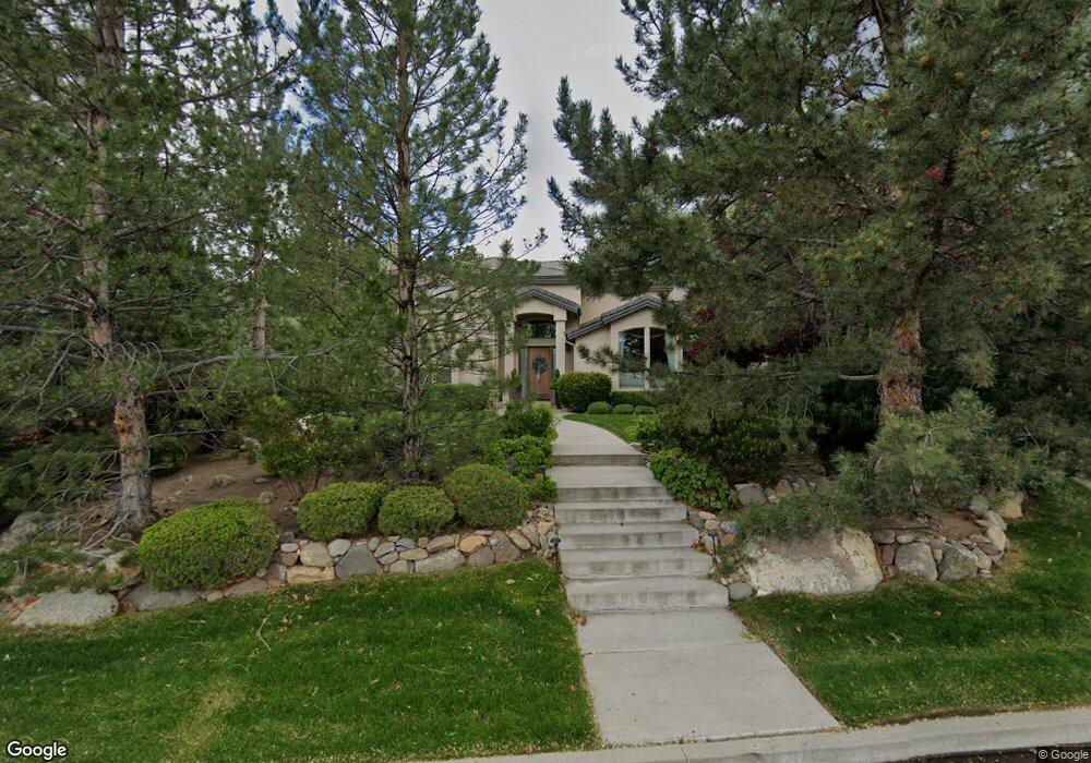
4280 Meadowgate Trail Reno, NV 89519
South Outer Reno NeighborhoodEstimated Value: $1,646,662 - $2,013,000
5
Beds
4
Baths
4,166
Sq Ft
$450/Sq Ft
Est. Value
About This Home
This home is located at 4280 Meadowgate Trail, Reno, NV 89519 and is currently estimated at $1,873,166, approximately $449 per square foot. 4280 Meadowgate Trail is a home located in Washoe County with nearby schools including Roy Gomm Elementary School, Darrell C Swope Middle School, and Reno High School.
Ownership History
Date
Name
Owned For
Owner Type
Purchase Details
Closed on
Feb 9, 1994
Sold by
Lands Of Sierra Inc
Bought by
Sidorski Robert J and Sidorski Danuta
Current Estimated Value
Home Financials for this Owner
Home Financials are based on the most recent Mortgage that was taken out on this home.
Original Mortgage
$40,000
Interest Rate
7.1%
Create a Home Valuation Report for This Property
The Home Valuation Report is an in-depth analysis detailing your home's value as well as a comparison with similar homes in the area
Home Values in the Area
Average Home Value in this Area
Purchase History
| Date | Buyer | Sale Price | Title Company |
|---|---|---|---|
| Sidorski Robert J | $79,000 | First Commercial Title Inc |
Source: Public Records
Mortgage History
| Date | Status | Borrower | Loan Amount |
|---|---|---|---|
| Closed | Sidorski Robert J | $40,000 |
Source: Public Records
Tax History Compared to Growth
Tax History
| Year | Tax Paid | Tax Assessment Tax Assessment Total Assessment is a certain percentage of the fair market value that is determined by local assessors to be the total taxable value of land and additions on the property. | Land | Improvement |
|---|---|---|---|---|
| 2025 | $9,962 | $345,540 | $112,000 | $233,540 |
| 2024 | $9,674 | $348,698 | $112,000 | $236,698 |
| 2023 | $7,245 | $329,925 | $105,000 | $224,925 |
| 2022 | $9,394 | $280,481 | $92,750 | $187,731 |
| 2021 | $9,121 | $266,490 | $78,750 | $187,740 |
| 2020 | $8,852 | $267,511 | $78,750 | $188,761 |
| 2019 | $8,595 | $256,955 | $70,000 | $186,955 |
| 2018 | $8,344 | $252,992 | $70,000 | $182,992 |
| 2017 | $8,102 | $254,168 | $70,000 | $184,168 |
| 2016 | $7,897 | $246,627 | $64,750 | $181,877 |
| 2015 | $5,916 | $222,511 | $39,235 | $183,276 |
| 2014 | $7,654 | $208,757 | $30,450 | $178,307 |
| 2013 | -- | $205,126 | $30,450 | $174,676 |
Source: Public Records
Map
Nearby Homes
- 4305 Mountaingate Dr
- 5195 Canyon Dr
- 4485 Mountaingate Dr
- 4400 Mountaingate Dr
- 7440 W 4th St Unit 7
- 7440 W 4th St Unit 46
- 7440 W 4th St Unit 35
- 4595 Woodchuck Cir
- 4265 Hackamore Dr
- 30 Francovich Ct
- 4930 Woodchuck Cir Unit 4
- 4890 Woodchuck Cir Unit 3
- 4840 Keshmiri Place
- 4820 Woodchuck Cir Unit 2
- 4315 Water Hole Rd
- 4895 Woodchuck Cir Unit 16
- 4760 Woodchuck Cir Unit 1
- 4825 Woodchuck Cir Unit 17
- 4229 Christy Way
- 5045 Hunters Peak Rd Unit 13
- 4290 Meadowgate Trail
- 4270 Meadowgate Trail
- 4260 Meadowgate Trail
- 4285 Meadowgate Trail
- 4304 Meadowgate Trail
- 4450 Juniper Trail Unit 2
- 4400 Juniper Trail Unit 149
- 4400 Juniper Trail
- 4265 Meadowgate Trail
- 711 Aspen Trail
- 4390 Juniper Trail
- 4440 Juniper Trail
- 4410 Juniper Trail
- 4305 Meadowgate Trail
- 4255 Meadowgate Trail
- 4380 Juniper Trail
- 6288 Canyon Dr
- 6272 Canyon Dr
- 6285 Canyon Dr
- 6224 Canyon Dr