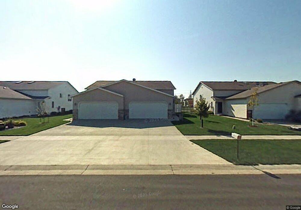
4282 39 1/2 Ave S Fargo, ND 58104
Woodhaven NeighborhoodEstimated Value: $267,000 - $282,000
3
Beds
2
Baths
1,968
Sq Ft
$140/Sq Ft
Est. Value
About This Home
This home is located at 4282 39 1/2 Ave S, Fargo, ND 58104 and is currently estimated at $276,102, approximately $140 per square foot. 4282 39 1/2 Ave S is a home located in Cass County with nearby schools including Kennedy Elementary School, Discovery Middle School, and Fargo Davies High School.
Ownership History
Date
Name
Owned For
Owner Type
Purchase Details
Closed on
Jun 18, 2018
Sold by
Larson Matthew L and Larson Kathryn A
Bought by
Abbott Srah J
Current Estimated Value
Home Financials for this Owner
Home Financials are based on the most recent Mortgage that was taken out on this home.
Original Mortgage
$186,240
Outstanding Balance
$161,066
Interest Rate
4.5%
Mortgage Type
New Conventional
Estimated Equity
$115,036
Purchase Details
Closed on
May 8, 2007
Sold by
Schlieman James and Schlieman Callie
Bought by
Barnholdt Hazel M and Stadter Carol
Create a Home Valuation Report for This Property
The Home Valuation Report is an in-depth analysis detailing your home's value as well as a comparison with similar homes in the area
Home Values in the Area
Average Home Value in this Area
Purchase History
| Date | Buyer | Sale Price | Title Company |
|---|---|---|---|
| Abbott Srah J | $192,000 | Title Co | |
| Barnholdt Hazel M | -- | -- |
Source: Public Records
Mortgage History
| Date | Status | Borrower | Loan Amount |
|---|---|---|---|
| Open | Abbott Srah J | $186,240 |
Source: Public Records
Tax History Compared to Growth
Tax History
| Year | Tax Paid | Tax Assessment Tax Assessment Total Assessment is a certain percentage of the fair market value that is determined by local assessors to be the total taxable value of land and additions on the property. | Land | Improvement |
|---|---|---|---|---|
| 2024 | $2,796 | $120,100 | $18,700 | $101,400 |
| 2023 | $3,081 | $113,200 | $15,100 | $98,100 |
| 2022 | $2,857 | $102,900 | $15,100 | $87,800 |
| 2021 | $2,568 | $93,550 | $15,100 | $78,450 |
| 2020 | $2,553 | $93,550 | $15,100 | $78,450 |
| 2019 | $2,556 | $93,550 | $8,400 | $85,150 |
| 2018 | $2,518 | $93,550 | $8,400 | $85,150 |
| 2017 | $2,366 | $88,650 | $8,400 | $80,250 |
| 2016 | $1,905 | $77,100 | $8,400 | $68,700 |
| 2015 | $2,022 | $77,100 | $6,300 | $70,800 |
| 2014 | $1,955 | $72,600 | $6,300 | $66,300 |
| 2013 | $1,888 | $69,150 | $6,300 | $62,850 |
Source: Public Records
Map
Nearby Homes
- 4282 39 1 2 Ave S
- 4280 39 1 2 Ave S
- 4280 39 1/2 Ave S
- 4284 39 1/2 Ave S
- 4284 39 1 2 Ave S
- 4286 39 1 2 Ave S
- 4278 39 1/2 Ave S
- 4286 39 1/2 Ave S
- 4278 39 1 2 Ave S
- 4276 39 1 2 Ave S
- 4276 39 1/2 Ave S
- 4288 39 1/2 Ave S
- 4288 39 1 2 Ave S
- 4290 39 1 2 Ave S
- 4274 39 1/2 Ave S
- 4290 39 1/2 Ave S
- 4274 39 1 2 Ave S
- 4272 39 1 2 Ave S
- 4272 39 1/2 Ave S
- 4279 39 1/2 Ave S