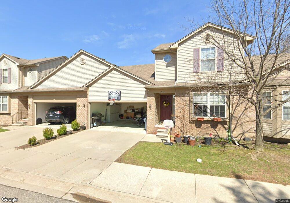
4283 Derray Ct Warren, MI 48092
Northwest Warren NeighborhoodEstimated Value: $214,000 - $232,635
Studio
3
Baths
1,375
Sq Ft
$164/Sq Ft
Est. Value
About This Home
This home is located at 4283 Derray Ct, Warren, MI 48092 and is currently estimated at $225,659, approximately $164 per square foot. 4283 Derray Ct is a home located in Macomb County with nearby schools including Green Acres Elementary School, Beer Middle School, and Warren Mott High School.
Ownership History
Date
Name
Owned For
Owner Type
Purchase Details
Closed on
Jan 10, 2019
Sold by
Hoang Dung and Lethi Thoa
Bought by
Kizy Vanessa and Kizy Lydia
Current Estimated Value
Purchase Details
Closed on
Dec 28, 2018
Sold by
Northpointe Villas Llc
Bought by
Hoang Dung and Lethi Thoa
Purchase Details
Closed on
Dec 8, 2016
Sold by
Chesterfield Homes Llc
Bought by
Northpointe Villas Llc
Purchase Details
Closed on
Dec 13, 2013
Sold by
Michael R Powell Trust
Bought by
Chesterfield Ventures
Create a Home Valuation Report for This Property
The Home Valuation Report is an in-depth analysis detailing your home's value as well as a comparison with similar homes in the area
Home Values in the Area
Average Home Value in this Area
Purchase History
| Date | Buyer | Sale Price | Title Company |
|---|---|---|---|
| Kizy Vanessa | $170,000 | None Available | |
| Hoang Dung | $147,500 | Philip F Greco Title Company | |
| Northpointe Villas Llc | -- | Philip F Greco Title Co | |
| Chesterfield Ventures | -- | Philip F Greco Title Company | |
| Michael R Powelltrust | $142,800 | None Available |
Source: Public Records
Tax History
| Year | Tax Paid | Tax Assessment Tax Assessment Total Assessment is a certain percentage of the fair market value that is determined by local assessors to be the total taxable value of land and additions on the property. | Land | Improvement |
|---|---|---|---|---|
| 2025 | $4,823 | $102,520 | $0 | $0 |
| 2024 | $47 | $98,350 | $0 | $0 |
| 2023 | $4,473 | $97,240 | $0 | $0 |
| 2022 | $4,322 | $89,300 | $0 | $0 |
| 2021 | $4,397 | $85,080 | $0 | $0 |
| 2020 | $4,240 | $78,330 | $0 | $0 |
| 2019 | $3,198 | $74,150 | $0 | $0 |
| 2018 | $3,950 | $57,530 | $0 | $0 |
| 2017 | $3,860 | $56,770 | $4,650 | $52,120 |
| 2016 | $2,591 | $56,770 | $0 | $0 |
| 2015 | -- | $52,270 | $0 | $0 |
| 2013 | $5,049 | $38,720 | $0 | $0 |
Source: Public Records
Map
Nearby Homes
- 4125 Derray Ct Unit 7
- 31418 Reid Dr
- 3902 Marlene Dr
- 3651 Chicago Rd
- 4519 Reader Dr
- 4611 E 13 Mile Rd
- 30987 Boewe Dr
- 32291 Ryan Rd
- 4896 Chicago Rd
- 4812 Berwyn Dr
- 5010 Kelly Dr
- 31030 Cousino Dr
- 30644 Gruenburg Dr
- 32416 Exeter Dr
- 30424 Kelsey Dr
- 4780 S Tuxedo Dr
- 32246 Oakview Dr
- 3858 Hughes Dr
- 4580 Hampton Ct N
- 30205 Boewe Dr
- 4295 Derray Ct Unit 18
- 4271 Derray Ct
- 4259 Derray Ct Unit 15
- 4247 Derray Ct
- 4235 Derray Ct
- 4235 Derray Ct Unit 12
- 31669 Norrid Cir
- 31661 Norrid Cir
- 31651 Norrid Cir Unit Bldg-Unit
- 31651 Norrid Cir
- 31677 Norrid Cir
- 31639 Norrid Cir
- 4185 Derray Ct
- 4173 Derray Ct
- 4161 Derray Ct
- 4137 Derray Ct
- 4173 Derray Ct Unit 12
- 4161 Derray Ct Unit 5
- 31529 Reid Dr
- 31517 Reid Dr
Your Personal Tour Guide
Ask me questions while you tour the home.