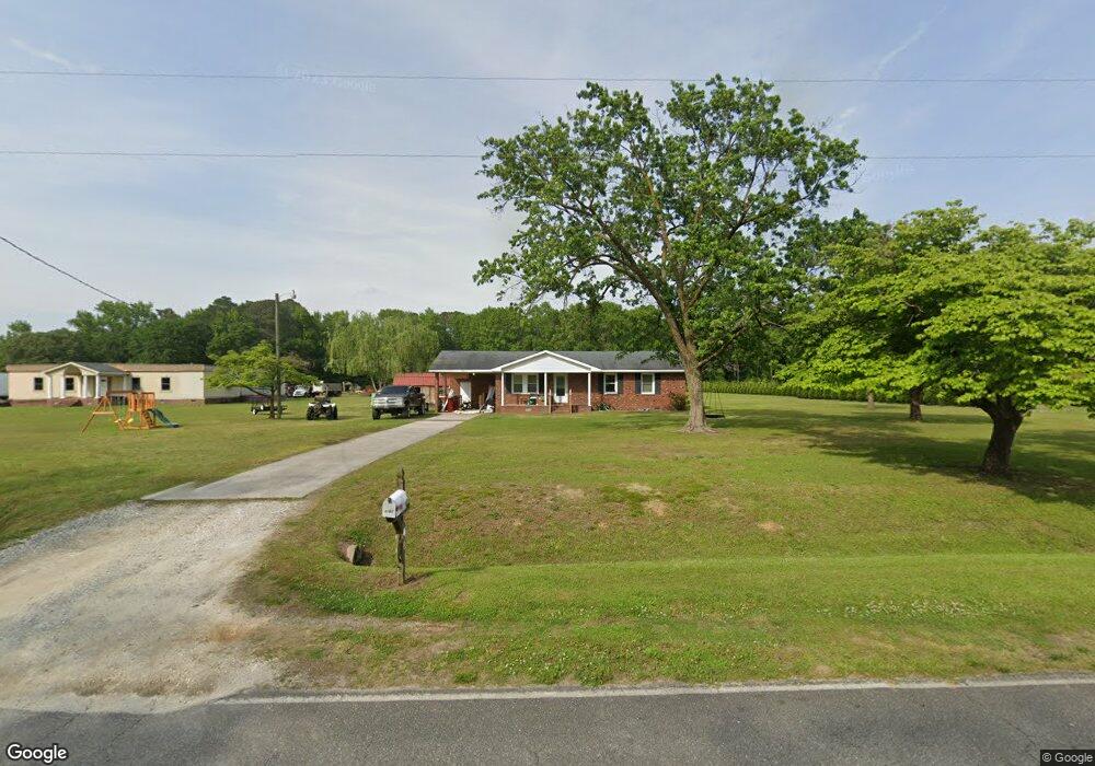
4287 Colie Rd La Grange, NC 28551
Estimated Value: $106,000 - $197,000
3
Beds
2
Baths
1,100
Sq Ft
$137/Sq Ft
Est. Value
About This Home
This home is located at 4287 Colie Rd, La Grange, NC 28551 and is currently estimated at $150,400, approximately $136 per square foot. 4287 Colie Rd is a home located in Lenoir County with nearby schools including La Grange Elementary School, E.B. Frink Middle School, and North Lenoir High School.
Ownership History
Date
Name
Owned For
Owner Type
Purchase Details
Closed on
Jul 20, 2023
Sold by
Taylor Michele Jones and Taylor Timothy Russell
Bought by
Jones David E
Current Estimated Value
Home Financials for this Owner
Home Financials are based on the most recent Mortgage that was taken out on this home.
Original Mortgage
$100,000
Outstanding Balance
$94,453
Interest Rate
6.71%
Mortgage Type
New Conventional
Estimated Equity
$55,947
Purchase Details
Closed on
Sep 27, 2016
Sold by
Houston Emily Colie and Layden Emily Colie
Bought by
Taylor Michele Jones
Create a Home Valuation Report for This Property
The Home Valuation Report is an in-depth analysis detailing your home's value as well as a comparison with similar homes in the area
Home Values in the Area
Average Home Value in this Area
Purchase History
| Date | Buyer | Sale Price | Title Company |
|---|---|---|---|
| Jones David E | $100,000 | None Listed On Document | |
| Taylor Michele Jones | $81,000 | None Available |
Source: Public Records
Mortgage History
| Date | Status | Borrower | Loan Amount |
|---|---|---|---|
| Open | Jones David E | $100,000 |
Source: Public Records
Tax History Compared to Growth
Tax History
| Year | Tax Paid | Tax Assessment Tax Assessment Total Assessment is a certain percentage of the fair market value that is determined by local assessors to be the total taxable value of land and additions on the property. | Land | Improvement |
|---|---|---|---|---|
| 2025 | $1,065 | $146,972 | $17,728 | $129,244 |
| 2024 | $722 | $80,038 | $14,950 | $65,088 |
| 2023 | $722 | $80,038 | $14,950 | $65,088 |
| 2022 | $722 | $80,038 | $14,950 | $65,088 |
| 2021 | $720 | $80,038 | $14,950 | $65,088 |
| 2020 | $720 | $80,038 | $14,950 | $65,088 |
| 2019 | $722 | $80,038 | $14,950 | $65,088 |
| 2018 | $800 | $80,038 | $14,950 | $65,088 |
| 2017 | $798 | $80,038 | $14,950 | $65,088 |
| 2014 | $856 | $87,740 | $14,950 | $72,790 |
| 2013 | -- | $87,740 | $14,950 | $72,790 |
| 2011 | -- | $87,740 | $14,950 | $72,790 |
Source: Public Records
Map
Nearby Homes
- 4310 Colie Rd
- 3803 Huntcliff Dr
- 3766 Huntcliff Dr
- 3725 Huntcliff Dr
- 3740 Huntcliff Dr
- 3730 Huntcliff Dr
- 3821 Lindsey Ln
- 3696 Drew Farmer Rd
- 3684 Drew Farmer Rd
- 3711 Drew Farmer Rd
- 3796 Pecan Grove Cir
- 2526 Moulton Dr
- 2445 Tammy Dr
- 3494 Danfield Dr
- 3395 Danfield Dr
- 3379 Danfield Dr
- 3178 Alton Phillips Rd
- 2321 Fred Everett Rd
- 3216 Dexter Cir
- 5130 Aldridge Store Rd
- 4271 Colie Rd
- 4264 Colie Rd
- 4254 Colie Rd
- 4290 Colie Rd
- 00 Colie Rd
- 4225 Colie Rd
- 3685 Bryan Hardy Rd
- 4150 Colie Rd
- 3673 Bryan Hardy Rd
- 4415 Colie Rd
- 3694 Bryan Hardy Rd
- 3622 Bryan Hardy Rd
- 4101 Colie Rd
- 4280 Ben Dail Rd
- 4266 Ben Dail Rd
- 4480 Colie Rd
- 4302 Colie Rd
- 4502 Colie Rd
- 4271 Ben Dail Rd
- 4237 Ben Dail Rd