Estimated Value: $221,000 - $230,000
3
Beds
2
Baths
1,502
Sq Ft
$150/Sq Ft
Est. Value
About This Home
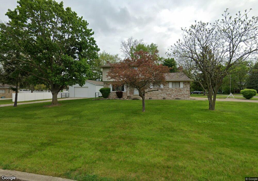
This home is located at 4288 Hall Mark Ct Unit Bldg-Unit, Flint, MI 48532 and is currently estimated at $225,462, approximately $150 per square foot. 4288 Hall Mark Ct Unit Bldg-Unit is a home located in Genesee County with nearby schools including Carman-Ainsworth High School, Genesee STEM Academy, and Linden Charter Academy.
Ownership History
Date
Name
Owned For
Owner Type
Purchase Details
Closed on
Jun 22, 2020
Sold by
Huffman Donald R
Bought by
Garty Stacy and Dixson Keith
Current Estimated Value
Home Financials for this Owner
Home Financials are based on the most recent Mortgage that was taken out on this home.
Original Mortgage
$157,102
Outstanding Balance
$138,685
Interest Rate
3.1%
Mortgage Type
FHA
Estimated Equity
$86,777
Purchase Details
Closed on
May 10, 2018
Sold by
Cole Donald M
Bought by
Huffman Donald and Edwards Jenae
Purchase Details
Closed on
Mar 2, 2011
Sold by
Wells Fargo Bank Na
Bought by
Cole Donald M and Huffman Donald R
Purchase Details
Closed on
Jan 6, 2010
Sold by
Pugh Monique
Bought by
Wells Fargo Bank Na
Purchase Details
Closed on
Jun 30, 2003
Sold by
Huffman Daniel and Huffman Karen
Bought by
Pugh Monique
Create a Home Valuation Report for This Property
The Home Valuation Report is an in-depth analysis detailing your home's value as well as a comparison with similar homes in the area
Home Values in the Area
Average Home Value in this Area
Purchase History
| Date | Buyer | Sale Price | Title Company |
|---|---|---|---|
| Garty Stacy | $160,000 | Liberty Title | |
| Huffman Donald | -- | None Available | |
| Cole Donald M | $30,000 | Attorneys Title Agency Llc | |
| Wells Fargo Bank Na | $150,596 | None Available | |
| Pugh Monique | $149,750 | First American Title |
Source: Public Records
Mortgage History
| Date | Status | Borrower | Loan Amount |
|---|---|---|---|
| Open | Garty Stacy | $157,102 |
Source: Public Records
Tax History Compared to Growth
Tax History
| Year | Tax Paid | Tax Assessment Tax Assessment Total Assessment is a certain percentage of the fair market value that is determined by local assessors to be the total taxable value of land and additions on the property. | Land | Improvement |
|---|---|---|---|---|
| 2025 | $3,457 | $92,500 | $0 | $0 |
| 2024 | $1,827 | $89,900 | $0 | $0 |
| 2023 | $1,744 | $83,900 | $0 | $0 |
| 2022 | $1,470 | $76,800 | $0 | $0 |
| 2021 | $3,054 | $71,600 | $0 | $0 |
| 2020 | $1,390 | $62,100 | $0 | $0 |
| 2019 | $1,154 | $58,300 | $0 | $0 |
| 2018 | $2,638 | $59,300 | $0 | $0 |
| 2017 | $2,756 | $59,300 | $0 | $0 |
| 2016 | $2,299 | $45,000 | $0 | $0 |
| 2015 | $1,647 | $42,900 | $0 | $0 |
| 2014 | $977 | $41,200 | $0 | $0 |
| 2012 | -- | $41,500 | $41,500 | $0 |
Source: Public Records
Map
Nearby Homes
- 1090 Cabot Dr
- 1159 N Linden Rd
- 5021 Forest Side Dr
- 5104 Shady Oak Trail
- 1058 Cora Dr
- 2174 Mill Rd
- 1246 Dyemeadow Ln
- 4022 Beecher Rd
- 1068 S Graham Rd
- 1193 Normandy Terrace Dr
- Graham Rd N Graham Rd
- 2008 Beekman Ct
- 3528 Beecher Rd
- 2 Charter Dr
- 1391 Dye Krest Cir
- 1136 Gilbert St
- 2051 Lavelle Rd
- 1260 Gilbert St
- 0 Charter Dr Unit 50153638
- 5297 Oaktree Dr