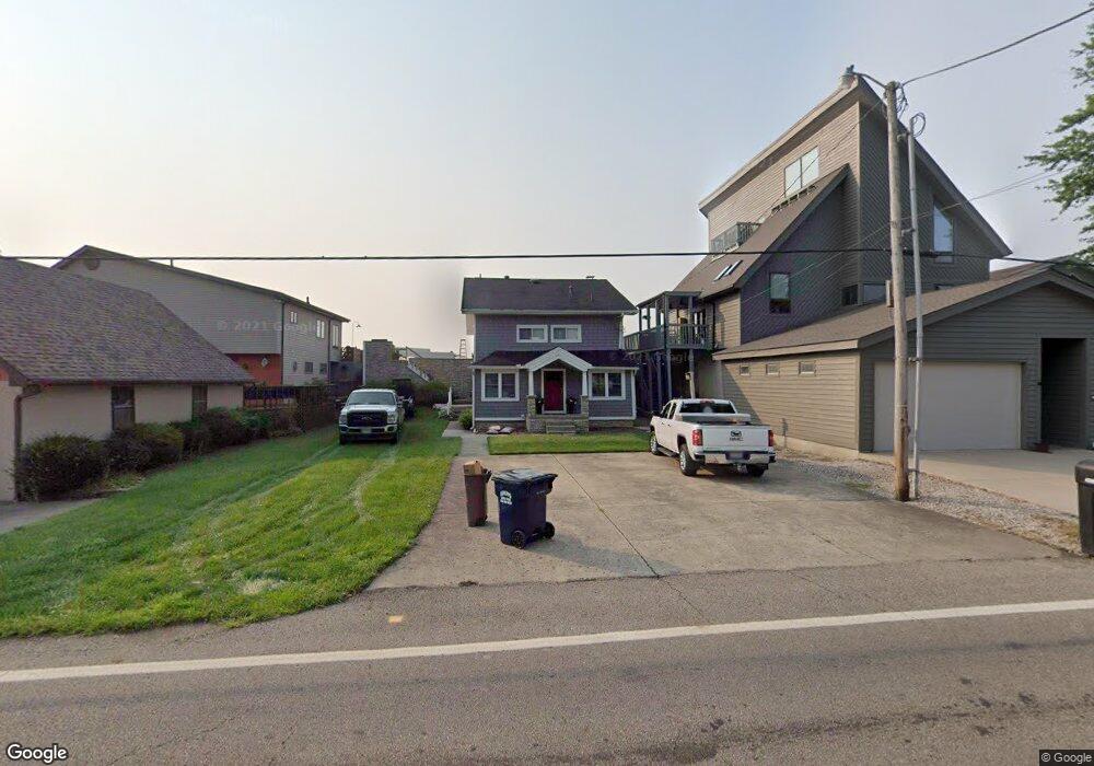
4289 N Bank Rd NE Millersport, OH 43046
Estimated Value: $586,428 - $839,000
2
Beds
2
Baths
2,131
Sq Ft
$334/Sq Ft
Est. Value
About This Home
This home is located at 4289 N Bank Rd NE, Millersport, OH 43046 and is currently estimated at $712,607, approximately $334 per square foot. 4289 N Bank Rd NE is a home located in Fairfield County with nearby schools including Millersport Elementary School and Millersport Jr/Sr High School.
Ownership History
Date
Name
Owned For
Owner Type
Purchase Details
Closed on
Jun 18, 2010
Sold by
Davis Thomas W and Thomas W Davis Trust
Bought by
Durant Scott A and Durant Lisa G
Current Estimated Value
Home Financials for this Owner
Home Financials are based on the most recent Mortgage that was taken out on this home.
Original Mortgage
$149,250
Outstanding Balance
$100,028
Interest Rate
4.97%
Mortgage Type
New Conventional
Estimated Equity
$612,579
Purchase Details
Closed on
Jun 20, 2003
Sold by
Davis Tom W
Bought by
Davis Tom W
Purchase Details
Closed on
Jun 26, 1998
Sold by
Witt Sharon K
Bought by
Davis Tom W
Create a Home Valuation Report for This Property
The Home Valuation Report is an in-depth analysis detailing your home's value as well as a comparison with similar homes in the area
Home Values in the Area
Average Home Value in this Area
Purchase History
| Date | Buyer | Sale Price | Title Company |
|---|---|---|---|
| Durant Scott A | $315,000 | Attorney | |
| Davis Tom W | -- | -- | |
| Davis Tom W | $155,000 | -- |
Source: Public Records
Mortgage History
| Date | Status | Borrower | Loan Amount |
|---|---|---|---|
| Open | Durant Scott A | $149,250 |
Source: Public Records
Tax History Compared to Growth
Tax History
| Year | Tax Paid | Tax Assessment Tax Assessment Total Assessment is a certain percentage of the fair market value that is determined by local assessors to be the total taxable value of land and additions on the property. | Land | Improvement |
|---|---|---|---|---|
| 2024 | $8,630 | $143,600 | $71,410 | $72,190 |
| 2023 | $5,672 | $143,600 | $71,410 | $72,190 |
| 2022 | $5,703 | $143,600 | $71,410 | $72,190 |
| 2021 | $4,796 | $108,640 | $59,510 | $49,130 |
| 2020 | $4,814 | $108,640 | $59,510 | $49,130 |
| 2019 | $4,814 | $108,640 | $59,510 | $49,130 |
| 2018 | $4,572 | $87,550 | $56,290 | $31,260 |
| 2017 | $4,573 | $93,330 | $56,290 | $37,040 |
| 2016 | $4,211 | $93,330 | $56,290 | $37,040 |
| 2015 | $4,205 | $91,680 | $56,290 | $35,390 |
| 2014 | $3,383 | $91,360 | $56,290 | $35,070 |
| 2013 | $3,383 | $91,360 | $56,290 | $35,070 |
Source: Public Records
Map
Nearby Homes
- 4255 N Bank Rd NE
- 4468 N Bank Rd NE
- 4135 Walnut Rd
- 3863 N Bank Rd NE
- 4881 Decker Ave NE
- 4711 Walnut Rd Unit F2
- 3483 N Bank Rd
- 0 Beaver Rd NE
- 13309 Aspen Rd NE
- 13310 Shell Beach Rd NE
- 102 Leroy St
- 5102 Bateson Beach Dr NE
- 5130 Bateson Dr NE
- 65 Stewart Ave
- 3308 Shepard Ave
- 13556 Richards St NE
- 13200 Elm Rd NE
- 0 Forrest Rd NE
- 48 Rosebraugh Cir
- 13061 Dogwood Rd NE
- 4283 N Bank Rd NE
- 4295 N Bank Rd NE
- 4277 N Bank Rd NE
- 4307 N Bank Rd NE
- 4271 N Bank Rd NE
- 4313 N Bank Rd NE
- 4267 N Bank Rd
- 4265 N Bank Rd
- 4259 N Bank Rd NE
- 4321 N Bank Rd NE
- 4250 N Bank Rd
- 4249 N Bank Rd NE
- 00000 N Bank Rd
- 000 N Bank Rd
- 4327 N Bank Rd NE
- 4237 N Bank Rd NE
- 4333 N Bank Rd NE
- 4235 N Bank Rd NE
- 4231 N Bank Rd NE
- 4345 N Bank Rd NE