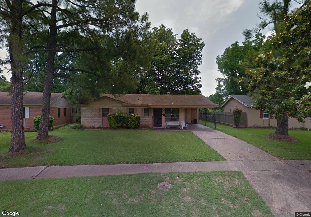
429 Brookbriar Dr Shreveport, LA 71107
Freestate-North Highlands NeighborhoodEstimated Value: $90,000 - $122,000
3
Beds
2
Baths
1,150
Sq Ft
$93/Sq Ft
Est. Value
About This Home
This home is located at 429 Brookbriar Dr, Shreveport, LA 71107 and is currently estimated at $106,424, approximately $92 per square foot. 429 Brookbriar Dr is a home with nearby schools including Cherokee Park Elementary School, Fairfield Magnet School, and Claiborne Fundamental Elementary School.
Ownership History
Date
Name
Owned For
Owner Type
Purchase Details
Closed on
May 30, 2013
Sold by
Starks David Harold and Starks Rebecca Joan Allison
Bought by
Dontia Llc
Current Estimated Value
Home Financials for this Owner
Home Financials are based on the most recent Mortgage that was taken out on this home.
Original Mortgage
$50,000,000
Outstanding Balance
$35,392,292
Interest Rate
3.38%
Mortgage Type
Unknown
Estimated Equity
-$35,285,868
Create a Home Valuation Report for This Property
The Home Valuation Report is an in-depth analysis detailing your home's value as well as a comparison with similar homes in the area
Home Values in the Area
Average Home Value in this Area
Purchase History
| Date | Buyer | Sale Price | Title Company |
|---|---|---|---|
| Dontia Llc | -- | Multiple |
Source: Public Records
Mortgage History
| Date | Status | Borrower | Loan Amount |
|---|---|---|---|
| Open | Dontia Llc | $50,000,000 |
Source: Public Records
Tax History Compared to Growth
Tax History
| Year | Tax Paid | Tax Assessment Tax Assessment Total Assessment is a certain percentage of the fair market value that is determined by local assessors to be the total taxable value of land and additions on the property. | Land | Improvement |
|---|---|---|---|---|
| 2024 | $774 | $6,138 | $700 | $5,438 |
| 2023 | $722 | $5,383 | $700 | $4,683 |
| 2022 | $718 | $5,383 | $700 | $4,683 |
| 2021 | $704 | $5,383 | $700 | $4,683 |
| 2020 | $561 | $5,383 | $700 | $4,683 |
| 2019 | $611 | $5,773 | $700 | $5,073 |
| 2018 | $611 | $5,773 | $700 | $5,073 |
| 2017 | $811 | $5,773 | $700 | $5,073 |
| 2016 | $811 | $5,773 | $700 | $5,073 |
| 2015 | $908 | $6,790 | $700 | $6,090 |
| 2014 | $928 | $6,790 | $700 | $6,090 |
Source: Public Records
Map
Nearby Homes
- 1113 Fenwick Dr
- 413 Seneca Trail
- 118 Mayfair Dr
- 726 Tecumseh Trail
- 0 Silver Point Dr Unit 3 20803133
- 0 Silver Point Dr Unit 11 20803059
- 0 Silver Point Dr Unit 7 20803008
- 0 Silver Point Dr Unit 5A 20802976
- 0 Silver Point Dr Unit 4 20796401
- 842 Navaho Trail
- 1805 Traffic St
- 202 Kelly St
- 0 Hwy 1 Unit 20326562
- 1205 W 2nd St
- 629 Yarborough St
- 608 Kelly St
- 614 Kelly St
- 105 Adair St
- 0 N Hearne Ave
- 521 Wyche St
- 1101 Arncliffe Dr
- 425 Brookbriar Dr
- 421 Brookbriar Dr
- 414 Brookbriar Dr
- 417 Brookbriar Dr
- 1109 Arncliff Dr
- 1105 Arncliff Dr
- 410 Brookbriar Dr
- 1106 Arncliff Dr
- 413 Brookbriar Dr
- 409 Brookbriar Dr
- 1113 Arncliff Dr
- 406 Brookbriar Dr
- 406 Brookbriar Dr
- 1106 Baythorne Dr
- 405 Brookbriar Dr
- 1105 Baythorne Dr
- 1117 Arncliff Dr
- 1114 Arncliff Dr
- 402 Brookbriar Dr