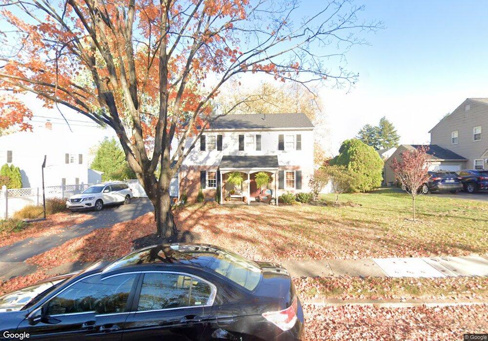
429 Covered Bridge Rd King of Prussia, PA 19406
Estimated Value: $563,840 - $676,000
4
Beds
3
Baths
2,464
Sq Ft
$250/Sq Ft
Est. Value
About This Home
This home is located at 429 Covered Bridge Rd, King of Prussia, PA 19406 and is currently estimated at $616,710, approximately $250 per square foot. 429 Covered Bridge Rd is a home located in Montgomery County with nearby schools including Caley Elementary School, Upper Merion Middle School, and Upper Merion High School.
Ownership History
Date
Name
Owned For
Owner Type
Purchase Details
Closed on
Jun 30, 2005
Sold by
Sodicoff Marvin and Sodicoff Maxine
Bought by
Menke James P and Menke Meghan L
Current Estimated Value
Home Financials for this Owner
Home Financials are based on the most recent Mortgage that was taken out on this home.
Original Mortgage
$285,000
Outstanding Balance
$148,870
Interest Rate
5.67%
Mortgage Type
New Conventional
Estimated Equity
$467,840
Create a Home Valuation Report for This Property
The Home Valuation Report is an in-depth analysis detailing your home's value as well as a comparison with similar homes in the area
Home Values in the Area
Average Home Value in this Area
Purchase History
| Date | Buyer | Sale Price | Title Company |
|---|---|---|---|
| Menke James P | $379,900 | -- |
Source: Public Records
Mortgage History
| Date | Status | Borrower | Loan Amount |
|---|---|---|---|
| Open | Menke James P | $285,000 |
Source: Public Records
Tax History Compared to Growth
Tax History
| Year | Tax Paid | Tax Assessment Tax Assessment Total Assessment is a certain percentage of the fair market value that is determined by local assessors to be the total taxable value of land and additions on the property. | Land | Improvement |
|---|---|---|---|---|
| 2025 | $5,273 | $171,110 | -- | -- |
| 2024 | $5,273 | $171,110 | -- | -- |
| 2023 | $4,962 | $166,920 | $53,650 | $113,270 |
| 2022 | $4,749 | $166,920 | $53,650 | $113,270 |
| 2021 | $4,602 | $166,920 | $53,650 | $113,270 |
| 2020 | $4,398 | $166,920 | $53,650 | $113,270 |
| 2019 | $4,323 | $166,920 | $53,650 | $113,270 |
| 2018 | $4,322 | $166,920 | $53,650 | $113,270 |
| 2017 | $4,168 | $166,920 | $53,650 | $113,270 |
| 2016 | $4,102 | $166,920 | $53,650 | $113,270 |
| 2015 | $3,951 | $166,920 | $53,650 | $113,270 |
| 2014 | $3,951 | $166,920 | $53,650 | $113,270 |
Source: Public Records
Map
Nearby Homes
- 735 Champlain Dr
- 345 W Signal Hill Rd
- 245 Chapel Ln Unit 80B
- 251 Chapel Ln Unit 83B
- 243 Chapel Ln Unit 79A
- 548 Susan Dr
- 394 Stonybrook Rd
- 156 Green Hill Rd
- 200 Prince Frederick St Unit J3
- 501 W Dekalb Pike
- 176 Riversedge Dr
- 143 Riversedge Dr Unit CONDO 143
- 121 Woodstream Dr Unit CONDO 121
- 603 Nantucket Cir
- 1914 Yorktown S
- 2012 Yorktown S
- 612 Brewster Aly Unit 74
- 608 Brewster Aly
- 237 E Valley Forge Rd
- 1905 Yorktown N
- 419 Covered Bridge Rd
- 433 Covered Bridge Rd
- 409 Covered Bridge Rd
- 428 W Valley Forge Rd
- 428 Covered Bridge Rd
- 405 Covered Bridge Rd
- 424 W Valley Forge Rd
- 436 W Valley Forge Rd
- 424 Covered Bridge Rd
- 617 Caley Rd
- 420 Covered Bridge Rd
- 440 W Valley Forge Rd
- 416 Covered Bridge Rd
- 412 Covered Bridge Rd
- 404 W Valley Forge Rd
- 408 Covered Bridge Rd
- 623 Caley Rd
- 404 Covered Bridge Rd
- 463 W Valley Forge Rd
- 469 W Valley Forge Rd