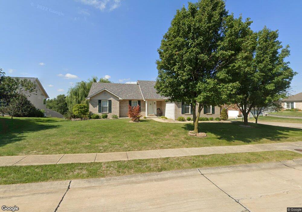
429 E Locust St Unit 1 Columbia, IL 62236
Estimated Value: $333,280 - $376,000
3
Beds
2
Baths
1,508
Sq Ft
$235/Sq Ft
Est. Value
About This Home
This home is located at 429 E Locust St Unit 1, Columbia, IL 62236 and is currently estimated at $354,570, approximately $235 per square foot. 429 E Locust St Unit 1 is a home located in Monroe County with nearby schools including Columbia Middle School and Columbia High School.
Ownership History
Date
Name
Owned For
Owner Type
Purchase Details
Closed on
Jun 8, 2025
Sold by
Shirley A Friesz Revocable Living Trust and Myres Pamela A
Bought by
Grossenheider Toni
Current Estimated Value
Home Financials for this Owner
Home Financials are based on the most recent Mortgage that was taken out on this home.
Original Mortgage
$344,350
Outstanding Balance
$342,335
Interest Rate
6.99%
Mortgage Type
New Conventional
Estimated Equity
$12,235
Create a Home Valuation Report for This Property
The Home Valuation Report is an in-depth analysis detailing your home's value as well as a comparison with similar homes in the area
Home Values in the Area
Average Home Value in this Area
Purchase History
| Date | Buyer | Sale Price | Title Company |
|---|---|---|---|
| Grossenheider Toni | $355,000 | Community Title | |
| Grossenheider Toni | $355,000 | Community Title |
Source: Public Records
Mortgage History
| Date | Status | Borrower | Loan Amount |
|---|---|---|---|
| Open | Grossenheider Toni | $344,350 |
Source: Public Records
Tax History
| Year | Tax Paid | Tax Assessment Tax Assessment Total Assessment is a certain percentage of the fair market value that is determined by local assessors to be the total taxable value of land and additions on the property. | Land | Improvement |
|---|---|---|---|---|
| 2024 | $4,777 | $94,584 | $19,749 | $74,835 |
| 2023 | $0 | $85,590 | $19,150 | $66,440 |
| 2022 | $4,208 | $78,640 | $15,160 | $63,480 |
| 2021 | $3,926 | $74,650 | $13,500 | $61,150 |
| 2020 | $3,454 | $72,670 | $13,500 | $59,170 |
| 2019 | $3,418 | $70,670 | $13,500 | $57,170 |
| 2018 | $3,485 | $69,720 | $13,500 | $56,220 |
| 2017 | $4,212 | $70,985 | $13,743 | $57,242 |
| 2016 | $0 | $70,390 | $12,770 | $57,620 |
| 2015 | $4,021 | $66,920 | $14,070 | $52,850 |
| 2014 | $3,831 | $65,050 | $14,070 | $50,980 |
| 2012 | -- | $62,720 | $13,300 | $49,420 |
Source: Public Records
Map
Nearby Homes
- 209 Heritage St
- 422 E Cherry St
- 1 Ogle Estates
- 3 Ogle Estates
- 203 S Metter Ave
- 807 N Metter Ave
- 407 Schneider St
- 811 N Main St
- 221 S Rapp Ave
- 103 N Rapp Ave
- 527 Fairfax Dr
- 000 Young Or Divers
- 147 Scott St
- 9700 Route 3
- XXX Centerville Rd
- 1504 Gedern Dr
- 1374 Walnut Ridge Dr
- 0 Timber Rock Lot 32 Unit MIS25078226
- 0 Timber Rock Lot 39 Unit MIS25078033
- 0 Timber Rock Lot 40 Unit MIS25078031
- 427 E Locust St
- 212 Heritage St
- 217 Heritage St
- 430 E Locust St
- 206 Heritage St
- 215 Heritage St
- 432 E Locust St
- 428 E Locust St
- 425 E Locust St
- 434 E Locust St
- 204 Heritage St
- 426 E Locust St
- 213 Heritage St
- 421 E Locust St
- 211 Heritage St
- 207 Heritage St
- 424 E Locust St
- 417 E Locust St
- 205 Heritage St
- 203 Heritage St
Your Personal Tour Guide
Ask me questions while you tour the home.