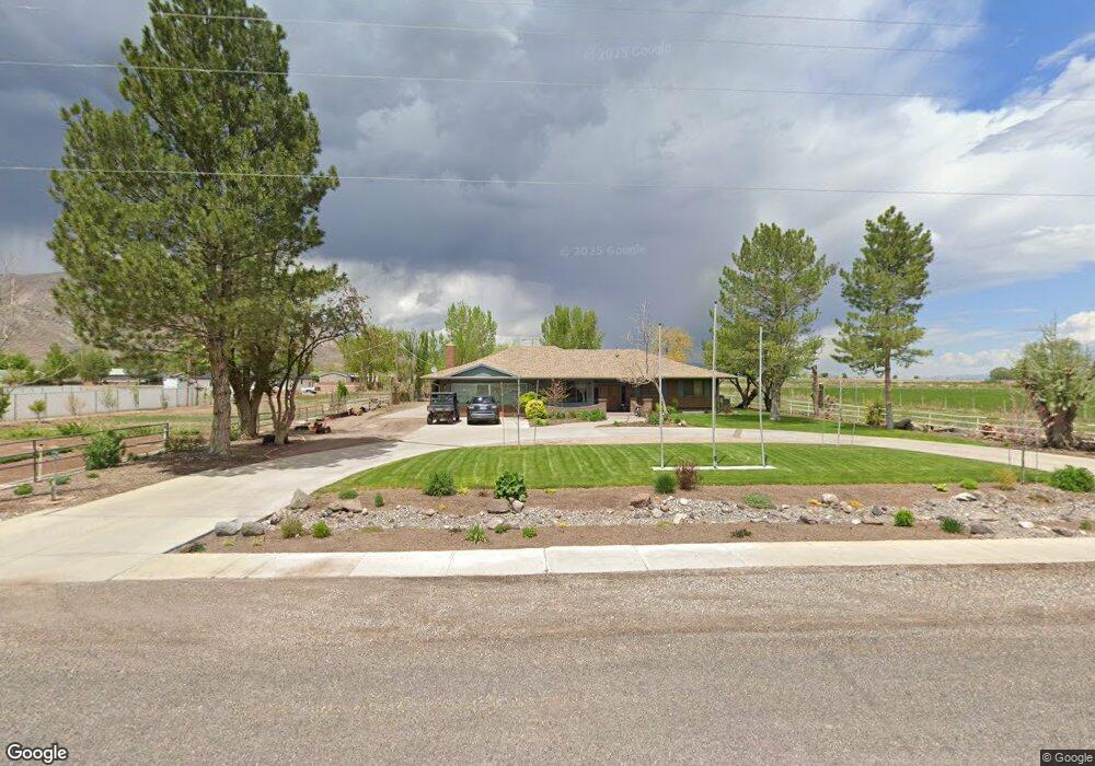
429 E Main St Elsinore, UT 84724
Estimated Value: $417,000 - $554,221
6
Beds
3
Baths
3,488
Sq Ft
$146/Sq Ft
Est. Value
About This Home
This home is located at 429 E Main St, Elsinore, UT 84724 and is currently estimated at $509,055, approximately $145 per square foot. 429 E Main St is a home located in Sevier County with nearby schools including Monroe School, South Sevier Middle School, and South Sevier High School.
Ownership History
Date
Name
Owned For
Owner Type
Purchase Details
Closed on
Dec 26, 2019
Sold by
Pierre David St and Pierre Amended
Bought by
Scott Brian E and Scott Jennica S
Current Estimated Value
Home Financials for this Owner
Home Financials are based on the most recent Mortgage that was taken out on this home.
Original Mortgage
$115,000
Outstanding Balance
$101,154
Interest Rate
3.7%
Mortgage Type
New Conventional
Estimated Equity
$407,901
Purchase Details
Closed on
May 7, 2019
Sold by
Likins Audrey B
Bought by
Likins Audrey B and Likins Trust
Create a Home Valuation Report for This Property
The Home Valuation Report is an in-depth analysis detailing your home's value as well as a comparison with similar homes in the area
Purchase History
| Date | Buyer | Sale Price | Title Company |
|---|---|---|---|
| Scott Brian E | -- | Professional Title Services | |
| Likins Audrey B | -- | None Available |
Source: Public Records
Mortgage History
| Date | Status | Borrower | Loan Amount |
|---|---|---|---|
| Open | Scott Brian E | $115,000 |
Source: Public Records
Tax History
| Year | Tax Paid | Tax Assessment Tax Assessment Total Assessment is a certain percentage of the fair market value that is determined by local assessors to be the total taxable value of land and additions on the property. | Land | Improvement |
|---|---|---|---|---|
| 2025 | $2,203 | $255,125 | $64,520 | $190,605 |
| 2024 | $2,203 | $272,964 | $56,793 | $216,171 |
| 2023 | $2,406 | $270,744 | $54,481 | $216,263 |
| 2022 | $2,966 | $292,743 | $50,540 | $242,203 |
| 2021 | $2,427 | $198,087 | $46,710 | $151,377 |
| 2020 | $2,047 | $156,458 | $29,194 | $127,264 |
| 2019 | $2,022 | $164,720 | $29,190 | $135,530 |
| 2018 | $1,989 | $144,050 | $29,190 | $114,860 |
| 2017 | $1,977 | $137,160 | $29,190 | $107,970 |
| 2016 | $1,496 | $131,400 | $0 | $0 |
| 2015 | $1,496 | $131,400 | $0 | $0 |
| 2014 | $1,496 | $131,400 | $0 | $0 |
Source: Public Records
Map
Nearby Homes
- 272 N 350 E
- 1075 S 800 E
- 125 S Center St
- 45 S 200 W
- 851 N 280 E
- 408 S Center St
- 1025 S 800 E
- 76 S Sr 118
- 50 E 1570 N Unit 3
- 1103 N Brooklyn Rd
- 986 E 2290 N
- 91 W 100 S
- 80 N 200 W
- 190 S Main St
- 1157 E 2350 N Unit 1
- 871 N Brooklyn Rd
- 2091 N 1200 E Unit 14
- 0 E Landslide Rd Unit 1
- 323 W 400 N
- 630 N Main St
Your Personal Tour Guide
Ask me questions while you tour the home.