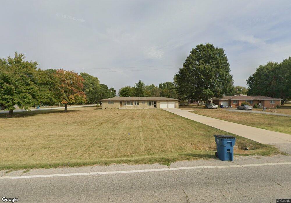
429 W Old Route 66 Strafford, MO 65757
Southeast Springfield NeighborhoodEstimated Value: $227,832 - $240,000
3
Beds
2
Baths
1,388
Sq Ft
$169/Sq Ft
Est. Value
About This Home
This home is located at 429 W Old Route 66, Strafford, MO 65757 and is currently estimated at $234,458, approximately $168 per square foot. 429 W Old Route 66 is a home located in Greene County with nearby schools including Strafford Elementary School, Strafford Middle School, and Strafford High School.
Ownership History
Date
Name
Owned For
Owner Type
Purchase Details
Closed on
May 22, 2024
Sold by
Strafford Sports Center Llc
Bought by
Revocable Trust Agreement Of Troy Matthew Mcs and Mcshane
Current Estimated Value
Purchase Details
Closed on
Aug 30, 2007
Sold by
Flatness Larry and Flatness Sheila
Bought by
Roach R
Purchase Details
Closed on
Jun 1, 2007
Sold by
Rhyne Beryl E and Rhyne Saundra S
Bought by
Flatness Larry and Flatness Sheila
Create a Home Valuation Report for This Property
The Home Valuation Report is an in-depth analysis detailing your home's value as well as a comparison with similar homes in the area
Home Values in the Area
Average Home Value in this Area
Purchase History
| Date | Buyer | Sale Price | Title Company |
|---|---|---|---|
| Revocable Trust Agreement Of Troy Matthew Mcs | -- | None Listed On Document | |
| Roach R | -- | Fidelity Title Agency | |
| Flatness Larry | -- | Lincoln Evans Land Title Co |
Source: Public Records
Tax History
| Year | Tax Paid | Tax Assessment Tax Assessment Total Assessment is a certain percentage of the fair market value that is determined by local assessors to be the total taxable value of land and additions on the property. | Land | Improvement |
|---|---|---|---|---|
| 2025 | $1,702 | $30,040 | $3,800 | $26,240 |
| 2024 | $1,629 | $28,100 | $3,420 | $24,680 |
| 2023 | $0 | $28,100 | $3,420 | $24,680 |
| 2022 | $1,394 | $24,970 | $3,420 | $21,550 |
| 2021 | $1,309 | $24,970 | $3,420 | $21,550 |
| 2020 | $973 | $18,280 | $3,420 | $14,860 |
| 2019 | $970 | $18,280 | $3,420 | $14,860 |
| 2018 | $850 | $15,880 | $3,420 | $12,460 |
| 2017 | $843 | $15,810 | $3,420 | $12,390 |
| 2016 | $836 | $15,810 | $3,420 | $12,390 |
| 2015 | $834 | $15,810 | $3,420 | $12,390 |
| 2014 | $794 | $14,900 | $3,420 | $11,480 |
Source: Public Records
Map
Nearby Homes
- 3246 Missouri 125
- Tbd E Farm Road 104
- 105 E Cherokee St
- 405 Dell St
- 105 E Rosalie
- 509 S Birchwood St
- 211 E Seminole St
- 208 E Seminole St
- 3246 N State Highway 125
- 7157 E Farm Road 84
- 704 N Ivy Ln
- 000 E Highway Oo
- 4885 N Crows Nest Ln
- Tract 8b N Farm Road 245
- Tract 1 N Farm Road 245
- Tract 8a N Farm Road 245
- Tract 2 N Farm Road 245
- 7990 E Farm Road 116
- 7291 Robin Ridge Ln
- 2332 N Farm Road 231
- 425 W Old Route 66
- 501 W Old Route 66
- 423 W Old Route 66
- 0 W Old Route 66 Unit 11012130
- 217 & 221 W Old Route 66
- 208 S Redwood Dr
- 421 W Old Route 66
- 422 W Hillcrest St
- 209 S Redwood Dr
- 505 W Old Route 66
- 420 W Hillcrest St
- 417 W Old Route 66
- 127 S Redwood Dr
- 412 W Hillcrest St
- 509 W Old Route 66
- 429 W Hillcrest St
- 425 W Hillcrest St
- 413 W Old Route 66
- 204 S Pinecrest Ave
- 421 W Hillcrest St
Your Personal Tour Guide
Ask me questions while you tour the home.