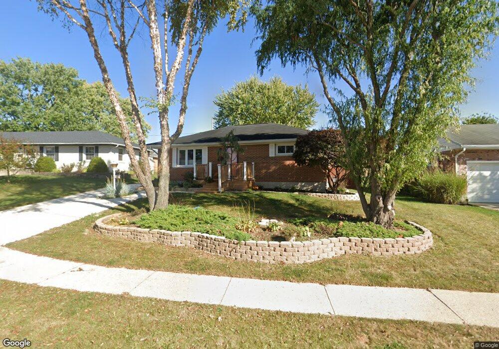
4290 Prince Cir Springfield, OH 45503
Estimated Value: $181,197 - $231,000
2
Beds
2
Baths
1,053
Sq Ft
$200/Sq Ft
Est. Value
About This Home
This home is located at 4290 Prince Cir, Springfield, OH 45503 and is currently estimated at $210,549, approximately $199 per square foot. 4290 Prince Cir is a home located in Clark County with nearby schools including Northridge Elementary School, Kenton Ridge Middle & High School, and Emmanuel Christian Academy.
Ownership History
Date
Name
Owned For
Owner Type
Purchase Details
Closed on
Jan 21, 2010
Sold by
Hoffman Teresa L
Bought by
Hoffman Teresa L and Teresa L Hoffman Family Revocable Living
Current Estimated Value
Purchase Details
Closed on
Dec 30, 2002
Sold by
Colvin Kenneth E and Colvin Latonda R
Bought by
Hoffman Teresa L
Home Financials for this Owner
Home Financials are based on the most recent Mortgage that was taken out on this home.
Original Mortgage
$81,500
Outstanding Balance
$33,793
Interest Rate
6.01%
Mortgage Type
Purchase Money Mortgage
Estimated Equity
$176,756
Purchase Details
Closed on
Aug 22, 1988
Create a Home Valuation Report for This Property
The Home Valuation Report is an in-depth analysis detailing your home's value as well as a comparison with similar homes in the area
Home Values in the Area
Average Home Value in this Area
Purchase History
| Date | Buyer | Sale Price | Title Company |
|---|---|---|---|
| Hoffman Teresa L | -- | Attorney | |
| Hoffman Teresa L | $102,000 | -- | |
| -- | $43,500 | -- |
Source: Public Records
Mortgage History
| Date | Status | Borrower | Loan Amount |
|---|---|---|---|
| Open | Hoffman Teresa L | $81,500 |
Source: Public Records
Tax History
| Year | Tax Paid | Tax Assessment Tax Assessment Total Assessment is a certain percentage of the fair market value that is determined by local assessors to be the total taxable value of land and additions on the property. | Land | Improvement |
|---|---|---|---|---|
| 2025 | $1,455 | $62,390 | $16,750 | $45,640 |
| 2024 | $1,434 | $43,080 | $9,750 | $33,330 |
| 2023 | $1,434 | $43,080 | $9,750 | $33,330 |
| 2022 | $1,457 | $43,080 | $9,750 | $33,330 |
| 2021 | $1,440 | $37,450 | $7,220 | $30,230 |
| 2020 | $1,441 | $37,450 | $7,220 | $30,230 |
| 2019 | $1,915 | $37,450 | $7,220 | $30,230 |
| 2018 | $1,897 | $35,550 | $9,210 | $26,340 |
| 2017 | $1,626 | $32,687 | $9,209 | $23,478 |
| 2016 | $1,615 | $32,687 | $9,209 | $23,478 |
| 2015 | $1,480 | $32,330 | $8,852 | $23,478 |
| 2014 | $1,480 | $32,330 | $8,852 | $23,478 |
| 2013 | $1,446 | $32,330 | $8,852 | $23,478 |
Source: Public Records
Map
Nearby Homes
- 4343 Burchill St
- 1341 Student Ave
- 4256 Midfield St Unit 9
- 4741 Cullen Ave
- 1162 Kingsgate Rd
- 4446 Ridgewood Rd E Unit 3
- 4802 Willowbrook Dr
- 593 Hiser Ave
- 1201 Kingsgate Rd
- 3942 Harris Ln
- 4577 Reno Ln Unit 2
- 4652 Reno Ln Unit 15
- 1500 Kingsgate Rd
- 1502 Kingsgate Rd
- 1500 Kingsgate Rd Unit 19430
- 1502 Kingsgate Rd Unit 19432
- 1509 Kingsgate Rd
- 3631 Kingsgate Ln
- 1503 Kingsgate Rd
- 1505 Kingsgate Rd
- 4278 Prince Cir
- 4310 Prince Cir
- 4287 Tritle Trail
- 4260 Prince Cir
- 4275 Tritle Trail
- 4303 Tritle Trail
- 4322 Prince Cir
- 4263 Tritle Trail
- 4311 Tritle Trail
- 4289 Prince Cir
- 1060 Montego Dr
- 4277 Prince Cir
- 4259 Prince Cir
- 1078 Montego Dr
- 4309 Prince Cir
- 4319 Tritle Trail
- 4321 Prince Cir
- 1020 Montego Dr
- 4342 Tudor Cir
- 4284 Tritle Trail
Your Personal Tour Guide
Ask me questions while you tour the home.