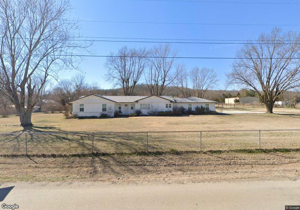
4294 Parsons Rd Springdale, AR 72764
Estimated Value: $360,252 - $406,000
3
Beds
2
Baths
1,332
Sq Ft
$292/Sq Ft
Est. Value
About This Home
This home is located at 4294 Parsons Rd, Springdale, AR 72764 and is currently estimated at $388,417, approximately $291 per square foot. 4294 Parsons Rd is a home located in Washington County with nearby schools including Sonora Elementary School, Lakeside Junior High School, and Sonora Middle School.
Ownership History
Date
Name
Owned For
Owner Type
Purchase Details
Closed on
Jan 17, 1997
Bought by
Gordon Muriel M
Current Estimated Value
Purchase Details
Closed on
Jan 3, 1997
Bought by
Walker David Herschel
Purchase Details
Closed on
Jul 31, 1989
Bought by
Walker David Herschel and Walker Cheryl
Purchase Details
Closed on
Nov 16, 1988
Bought by
Secretary Of Housing & Urban and Development
Purchase Details
Closed on
Sep 27, 1988
Bought by
Bancboston Mortgage Corporation
Purchase Details
Closed on
Apr 23, 1987
Bought by
Spigner Jesse J and Spigner Mae B
Create a Home Valuation Report for This Property
The Home Valuation Report is an in-depth analysis detailing your home's value as well as a comparison with similar homes in the area
Home Values in the Area
Average Home Value in this Area
Purchase History
| Date | Buyer | Sale Price | Title Company |
|---|---|---|---|
| Gordon Muriel M | $90,000 | -- | |
| Pederson Dwayne K | $90,000 | -- | |
| Walker David Herschel | -- | -- | |
| Walker David Herschel | -- | -- | |
| Secretary Of Housing & Urban | -- | -- | |
| Bancboston Mortgage Corporation | -- | -- | |
| Spigner Jesse J | $74,000 | -- |
Source: Public Records
Tax History Compared to Growth
Tax History
| Year | Tax Paid | Tax Assessment Tax Assessment Total Assessment is a certain percentage of the fair market value that is determined by local assessors to be the total taxable value of land and additions on the property. | Land | Improvement |
|---|---|---|---|---|
| 2025 | $827 | $51,490 | $11,160 | $40,330 |
| 2024 | $865 | $51,490 | $11,160 | $40,330 |
| 2023 | $904 | $51,490 | $11,160 | $40,330 |
| 2022 | $931 | $29,170 | $7,660 | $21,510 |
| 2021 | $877 | $29,170 | $7,660 | $21,510 |
| 2020 | $822 | $29,170 | $7,660 | $21,510 |
| 2019 | $767 | $23,440 | $5,160 | $18,280 |
| 2018 | $792 | $23,440 | $5,160 | $18,280 |
| 2017 | $409 | $16,320 | $5,160 | $11,160 |
| 2016 | $449 | $16,320 | $5,160 | $11,160 |
| 2015 | $449 | $16,320 | $5,160 | $11,160 |
| 2014 | $549 | $18,470 | $5,150 | $13,320 |
Source: Public Records
Map
Nearby Homes
- 0 Parsons Rd
- 4292 E Hewitt Springs Rd
- 4886-4856 Parsons Rd
- TBD Parsons Rd
- 3719 Sanday Ave
- 1744 Green Acres Cir
- 1380 Butterfield Coach Rd
- 2871 Commons Ave
- 768 Suffolk Cove
- 20700 E Highway 412
- 393 Cascade Cir
- 1779 Apple Butter St
- 2720 Granny Smith Ave
- 1533 Shannon St Unit A & B
- 2403 E Emma Ave
- 2377 E Emma Ave
- 912 N Monitor Rd
- 2443 Kasey Ave
- 2763 Grand Targhee St
- 2707 Grand Targhee St
- 4250 Parsons Rd
- 4358 Parsons Rd
- 4227 Parsons Rd
- 4357 Parsons Rd
- 4191 Parsons Rd
- 4352 Parsons Rd
- 4175 Parsons Rd
- 750 Dhein Ln
- 4159 Parsons Rd
- 4270 Whorton Ln
- 4418 Parsons Rd
- 4209 Parsons Rd
- 4216 Whorton Ln
- 4125 Parsons Rd
- 471 Carlock Rd
- 4436 Parsons Rd
- 625 Carlock Rd
- 4175 Whorton Ln
- 4080 Parsons Rd
- 519 Carlock Rd