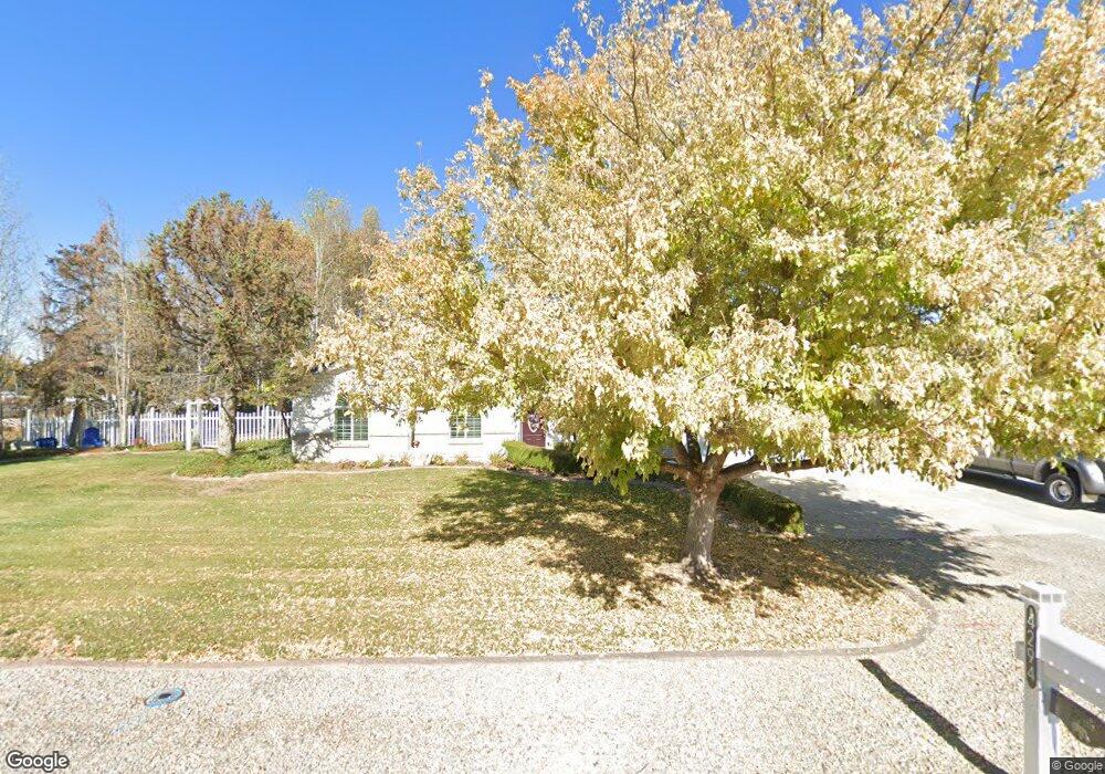
4294 W 1550 S Syracuse, UT 84075
Estimated Value: $546,000 - $640,817
3
Beds
2
Baths
1,627
Sq Ft
$362/Sq Ft
Est. Value
About This Home
This home is located at 4294 W 1550 S, Syracuse, UT 84075 and is currently estimated at $588,954, approximately $361 per square foot. 4294 W 1550 S is a home located in Davis County with nearby schools including Buffalo Point School, Syracuse Junior High School, and Syracuse High School.
Ownership History
Date
Name
Owned For
Owner Type
Purchase Details
Closed on
Mar 4, 1999
Sold by
Criddle Kelly James and Criddle Jerilyn
Bought by
Criddle Kelly J and Criddle Jerilyn C
Current Estimated Value
Home Financials for this Owner
Home Financials are based on the most recent Mortgage that was taken out on this home.
Original Mortgage
$147,600
Interest Rate
6.76%
Create a Home Valuation Report for This Property
The Home Valuation Report is an in-depth analysis detailing your home's value as well as a comparison with similar homes in the area
Home Values in the Area
Average Home Value in this Area
Purchase History
| Date | Buyer | Sale Price | Title Company |
|---|---|---|---|
| Criddle Kelly J | -- | Associated Title Company |
Source: Public Records
Mortgage History
| Date | Status | Borrower | Loan Amount |
|---|---|---|---|
| Closed | Criddle Kelly J | $147,600 |
Source: Public Records
Tax History Compared to Growth
Tax History
| Year | Tax Paid | Tax Assessment Tax Assessment Total Assessment is a certain percentage of the fair market value that is determined by local assessors to be the total taxable value of land and additions on the property. | Land | Improvement |
|---|---|---|---|---|
| 2025 | $3,099 | $298,940 | $152,233 | $146,707 |
| 2024 | $3,071 | $298,276 | $154,004 | $144,272 |
| 2023 | $2,846 | $496,000 | $190,303 | $305,697 |
| 2022 | $3,093 | $295,900 | $113,517 | $182,383 |
| 2021 | $2,451 | $363,000 | $162,038 | $200,962 |
| 2020 | $2,169 | $311,000 | $153,709 | $157,291 |
| 2019 | $2,037 | $288,000 | $144,367 | $143,633 |
| 2018 | $1,856 | $260,000 | $133,564 | $126,436 |
| 2016 | $1,545 | $115,451 | $50,044 | $65,407 |
| 2015 | $1,438 | $102,361 | $50,044 | $52,317 |
| 2014 | $1,560 | $113,123 | $48,128 | $64,995 |
| 2013 | -- | $102,549 | $49,862 | $52,687 |
Source: Public Records
Map
Nearby Homes
- 4191 W 1425 S
- 1238 S 4290 W
- 4580 W 1700 S
- 1157 S 4425 W
- 1155 S 4475 W
- 1139 S 4475 W
- 1125 S 4475 W
- 3951 Baltimore Cir
- 1068 S 4425 W
- 1084 S 4090 W
- 4578 W 1150 S
- 1039 S 4250 W
- Bradford Plan at Harvest Fields
- Avery Plan at Harvest Fields
- Sullivan Plan at Harvest Fields
- Presley Plan at Harvest Fields
- Ashmore Plan at Harvest Fields
- Bridgeport Plan at Harvest Fields
- Malan Plan at Harvest Fields
- Havenwood Plan at Harvest Fields
- 4260 W 1550 S
- 4330 W 1550 S
- 4303 W 1550 S
- 4277 W 1550 S
- 4327 W 1550 S
- 4255 W 1550 S
- 4358 W 1550 S
- 4343 W 1550 S
- 4303 W 1425 S Unit 405
- 4285 W 1425 S Unit 406
- 4319 W 1425 S Unit 404
- 4319 W 1425 S Unit 405
- 4375 W 1550 S
- 4263 W 1425 S Unit 407
- 4337 W 1425 S
- 4337 W 1425 S Unit 403
- 4380 W 1550 S
- 4245 W 1425 S Unit 501
- 4245 W 1425 S
- 4355 W 1425 S Unit 402