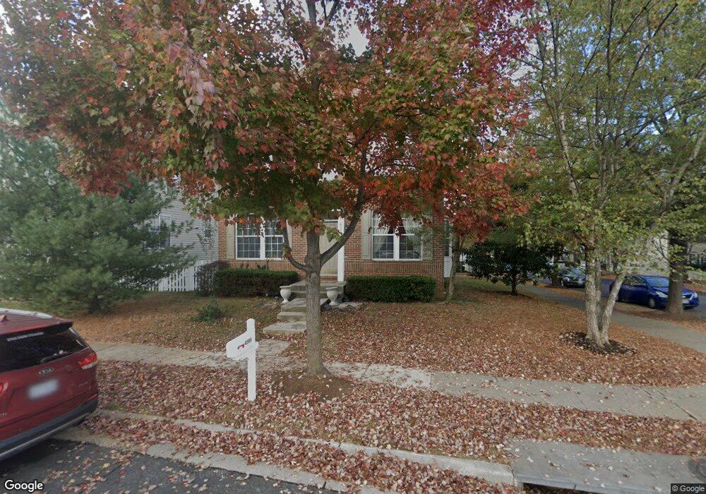
42956 Brookton Way Ashburn, VA 20147
Estimated Value: $858,000 - $920,000
4
Beds
4
Baths
2,116
Sq Ft
$420/Sq Ft
Est. Value
About This Home
This home is located at 42956 Brookton Way, Ashburn, VA 20147 and is currently estimated at $889,305, approximately $420 per square foot. 42956 Brookton Way is a home located in Loudoun County with nearby schools including Belmont Station Elementary School, Trailside Middle School, and Stone Bridge High.
Ownership History
Date
Name
Owned For
Owner Type
Purchase Details
Closed on
Apr 10, 2002
Sold by
Bch Prtnrs A Maryland
Bought by
Kennedy Mark
Current Estimated Value
Home Financials for this Owner
Home Financials are based on the most recent Mortgage that was taken out on this home.
Original Mortgage
$279,450
Outstanding Balance
$116,093
Interest Rate
6.84%
Mortgage Type
New Conventional
Estimated Equity
$773,212
Create a Home Valuation Report for This Property
The Home Valuation Report is an in-depth analysis detailing your home's value as well as a comparison with similar homes in the area
Home Values in the Area
Average Home Value in this Area
Purchase History
| Date | Buyer | Sale Price | Title Company |
|---|---|---|---|
| Kennedy Mark | $349,327 | -- |
Source: Public Records
Mortgage History
| Date | Status | Borrower | Loan Amount |
|---|---|---|---|
| Open | Kennedy Mark | $279,450 |
Source: Public Records
Tax History Compared to Growth
Tax History
| Year | Tax Paid | Tax Assessment Tax Assessment Total Assessment is a certain percentage of the fair market value that is determined by local assessors to be the total taxable value of land and additions on the property. | Land | Improvement |
|---|---|---|---|---|
| 2025 | $6,706 | $833,020 | $268,900 | $564,120 |
| 2024 | $6,724 | $777,380 | $268,900 | $508,480 |
| 2023 | $6,481 | $740,720 | $268,900 | $471,820 |
| 2022 | $6,040 | $678,700 | $248,900 | $429,800 |
| 2021 | $6,068 | $619,170 | $218,900 | $400,270 |
| 2020 | $6,059 | $585,420 | $199,400 | $386,020 |
| 2019 | $5,844 | $559,240 | $177,000 | $382,240 |
| 2018 | $5,701 | $525,420 | $177,000 | $348,420 |
| 2017 | $5,625 | $499,970 | $177,000 | $322,970 |
| 2016 | $5,638 | $492,430 | $0 | $0 |
| 2015 | $5,725 | $327,370 | $0 | $327,370 |
| 2014 | $5,491 | $298,420 | $0 | $298,420 |
Source: Public Records
Map
Nearby Homes
- 42948 Brookton Way
- 20333 Bowfonds St
- 20351 Bowfonds St
- 20393 Hartwell St
- 20419 Charter Oak Dr
- 20423 Bowfonds St
- 43169 Buttermere Terrace
- 20376 Mount Pleasant Terrace
- 20119 Old Line Terrace
- 20116 Old Line Terrace
- 20092 Old Line Terrace
- 20069 Forest Farm Ln
- 42764 Keiller Terrace
- 20395 Brightcrest Terrace
- 20616 Maitland Terrace
- 20144 Prairie Dunes Terrace
- 20530 Dillonvale Terrace
- 20121 Prairie Dunes Terrace
- 20658 Smollet Terrace
- 42686 Tunstall Terrace
- 42952 Brookton Way
- 20339 Charter Oak Dr
- 42944 Brookton Way
- 20342 Charter Oak Dr
- 20344 Charter Oak Dr
- 42957 Brookton Way
- 20340 Charter Oak Dr
- 42953 Brookton Way
- 20335 Charter Oak Dr
- 42940 Brookton Way
- 20338 Charter Oak Dr
- 42949 Brookton Way
- 20350 Charter Oak Dr
- 20336 Charter Oak Dr
- 20352 Charter Oak Dr
- 20333 Charter Oak Dr
- 42936 Brookton Way
- 42945 Brookton Way
- 20354 Charter Oak Dr
- 0 Beach Lot 24 Place Unit LO7081735