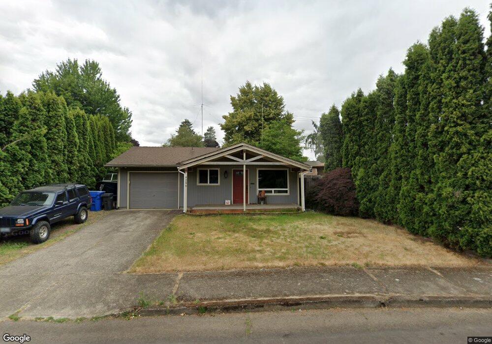
4299 Cedar Ave N Keizer, OR 97303
Estimated Value: $331,000 - $360,000
3
Beds
1
Bath
1,012
Sq Ft
$343/Sq Ft
Est. Value
About This Home
This home is located at 4299 Cedar Ave N, Keizer, OR 97303 and is currently estimated at $347,081, approximately $342 per square foot. 4299 Cedar Ave N is a home located in Marion County with nearby schools including Cummings Elementary School, Claggett Creek Middle School, and McNary High School.
Ownership History
Date
Name
Owned For
Owner Type
Purchase Details
Closed on
Aug 22, 2007
Sold by
Bays Michael and Bays Sandy
Bought by
Siddoway Robert Scott
Current Estimated Value
Home Financials for this Owner
Home Financials are based on the most recent Mortgage that was taken out on this home.
Original Mortgage
$170,317
Outstanding Balance
$106,223
Interest Rate
6.73%
Mortgage Type
FHA
Estimated Equity
$240,858
Purchase Details
Closed on
Dec 22, 2005
Sold by
Miller Denice Grace
Bought by
Bays Michael and Bays Sandy
Home Financials for this Owner
Home Financials are based on the most recent Mortgage that was taken out on this home.
Original Mortgage
$145,000
Interest Rate
6.35%
Mortgage Type
Fannie Mae Freddie Mac
Create a Home Valuation Report for This Property
The Home Valuation Report is an in-depth analysis detailing your home's value as well as a comparison with similar homes in the area
Home Values in the Area
Average Home Value in this Area
Purchase History
| Date | Buyer | Sale Price | Title Company |
|---|---|---|---|
| Siddoway Robert Scott | $173,000 | Fidelity Natl Title Co Of Or | |
| Bays Michael | $145,000 | Fidelity Natl Title Co Of Or |
Source: Public Records
Mortgage History
| Date | Status | Borrower | Loan Amount |
|---|---|---|---|
| Open | Siddoway Robert Scott | $170,317 | |
| Previous Owner | Bays Michael | $145,000 |
Source: Public Records
Tax History
| Year | Tax Paid | Tax Assessment Tax Assessment Total Assessment is a certain percentage of the fair market value that is determined by local assessors to be the total taxable value of land and additions on the property. | Land | Improvement |
|---|---|---|---|---|
| 2025 | $2,644 | $157,650 | -- | -- |
| 2024 | $2,644 | $153,060 | -- | -- |
| 2023 | $2,515 | $148,610 | $0 | $0 |
| 2022 | $2,370 | $144,290 | $0 | $0 |
| 2021 | $2,295 | $140,090 | $0 | $0 |
| 2020 | $2,236 | $136,010 | $0 | $0 |
| 2019 | $2,150 | $132,050 | $0 | $0 |
| 2018 | $2,187 | $0 | $0 | $0 |
| 2017 | $1,966 | $0 | $0 | $0 |
| 2016 | $1,885 | $0 | $0 | $0 |
| 2015 | $1,885 | $0 | $0 | $0 |
| 2014 | $1,824 | $0 | $0 | $0 |
Source: Public Records
Map
Nearby Homes
- 4407 Toni Ave N
- 211 Sunset Ave N
- 591 Wayne Dr N
- 132 Sunset Ave N Unit 168
- 651 Wayne Dr N
- 641 Dietz Ave NE
- 820 Ivy Way NE
- 4495 Cummings Place N
- 1202 Leo St NE
- 4025 Filbert Ave NE
- 4575 Clark Ave NE
- 3925 Rivercrest Dr N
- 3775 3rd Ave N
- 4030 Hennessy Ln NE
- 1031 Ring St NE Unit 1037
- 1061 Ring St NE Unit 1067
- 862 Cummings Ln N
- 4072 Brooks Ave NE
- 3705 Cherry Ave NE
- 500 Bever Dr NE
- 4339 Cedar Ave N
- 4289 Cedar Ave N
- 4320 Toni Ave N
- 4330 Toni Ave N
- 323 Manbrin Dr N
- 342 Marino Dr N
- 0 Manbrin Dr NE Unit 15238812
- 383 Manbrin Dr N
- 383 Manbrin Dr N
- 4340 Toni Ave N
- 4298 Cedar Ave N
- 4288 Cedar Ave N
- 4338 Cedar Ave N
- 223 Manbrin Dr N
- 4358 Cedar Ave N
- 4305 Toni Ave N
- 341 Marino Dr N
- 406 Marino Dr N
- 4360 Toni Ave N
- 4297 Birch Ave N
Your Personal Tour Guide
Ask me questions while you tour the home.