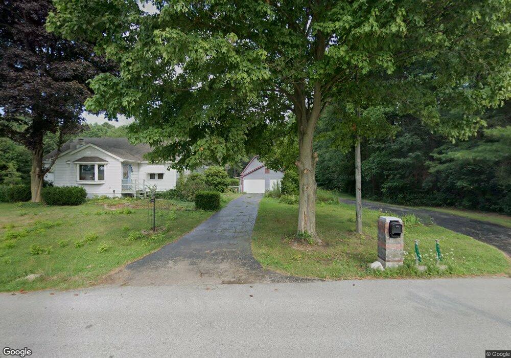
4299 N 350 E Rolling Prairie, IN 46371
Estimated Value: $294,926 - $354,000
3
Beds
2
Baths
1,422
Sq Ft
$229/Sq Ft
Est. Value
About This Home
This home is located at 4299 N 350 E, Rolling Prairie, IN 46371 and is currently estimated at $325,309, approximately $228 per square foot. 4299 N 350 E is a home located in LaPorte County with nearby schools including New Prairie High School and Sacred Heart Apostolic School.
Ownership History
Date
Name
Owned For
Owner Type
Purchase Details
Closed on
Oct 14, 2022
Sold by
Alberding Gregory M
Bought by
Alberding Amanda L and Alberding Gregory M
Current Estimated Value
Purchase Details
Closed on
Dec 30, 2010
Sold by
Burkus Doris H and Burkus Doris
Bought by
Alberding Gregory M
Home Financials for this Owner
Home Financials are based on the most recent Mortgage that was taken out on this home.
Original Mortgage
$120,000
Interest Rate
4.53%
Mortgage Type
Unknown
Purchase Details
Closed on
Feb 24, 2010
Sold by
Burkus Alex George and Frazier Karen L
Bought by
Burkus Doris H and Burkus Doris
Create a Home Valuation Report for This Property
The Home Valuation Report is an in-depth analysis detailing your home's value as well as a comparison with similar homes in the area
Purchase History
| Date | Buyer | Sale Price | Title Company |
|---|---|---|---|
| Alberding Amanda L | -- | -- | |
| Alberding Gregory M | -- | None Available | |
| Burkus Doris H | -- | None Available |
Source: Public Records
Mortgage History
| Date | Status | Borrower | Loan Amount |
|---|---|---|---|
| Previous Owner | Alberding Gregory M | $120,000 |
Source: Public Records
Tax History
| Year | Tax Paid | Tax Assessment Tax Assessment Total Assessment is a certain percentage of the fair market value that is determined by local assessors to be the total taxable value of land and additions on the property. | Land | Improvement |
|---|---|---|---|---|
| 2025 | $2,120 | $154,800 | $57,800 | $97,000 |
| 2024 | $2,147 | $190,600 | $57,800 | $132,800 |
| 2023 | $2,068 | $189,600 | $57,800 | $131,800 |
| 2022 | $2,357 | $193,200 | $57,800 | $135,400 |
| 2021 | $2,520 | $189,300 | $57,800 | $131,500 |
| 2020 | $2,920 | $189,300 | $57,800 | $131,500 |
| 2019 | $2,803 | $201,400 | $59,000 | $142,400 |
| 2018 | $2,631 | $201,300 | $59,000 | $142,300 |
| 2017 | $2,394 | $186,800 | $49,200 | $137,600 |
| 2016 | $2,154 | $169,600 | $29,600 | $140,000 |
| 2014 | $1,798 | $162,000 | $23,700 | $138,300 |
Source: Public Records
Map
Nearby Homes
- 4404 N 350 E
- 306 W Michigan St
- 3099 N 350 E
- 3429 E Sand Ridge Rd
- 3202 N 300 E
- 2897 N Morning Glory Ave
- 2945 N Morning Glory Ave Unit 73
- 2983 N Morning Glory Ave Unit 72
- 2979 N Morning Glory Ave
- 2893 N Morning Glory Ave
- 2898 N 350 E
- 6798 E 350 N
- 3812 N 600 E
- 67 Acres E 300 N
- 2248 E State Road 2
- 842 E Sportsman Ln
- 6361 E State Road 2
- 6844 N Modern Way
- 2027 N Coachlight Dr
- Lots 41-44 Campbell
- 4255 N 350 E
- 4306 N 350 E
- 4223 N 350 E
- 4352 N 350 E
- 4201 N 350 E
- 4475 N 350 E
- 3628 E Us Highway 20
- 3508 E Us Highway 20
- 4155 N 350 E
- 4416 N 350 E
- 3702 E Us Highway 20
- 3702 E Us Highway 20
- 3702 E Us Highway 20
- 3574 E Us Highway 20
- 3606 E Us Highway 20
- 3606 E Us Highway 20
- 4103 N 350 E
- 3046 E Us Highway 20
- 3698 E Us Highway 20
Your Personal Tour Guide
Ask me questions while you tour the home.