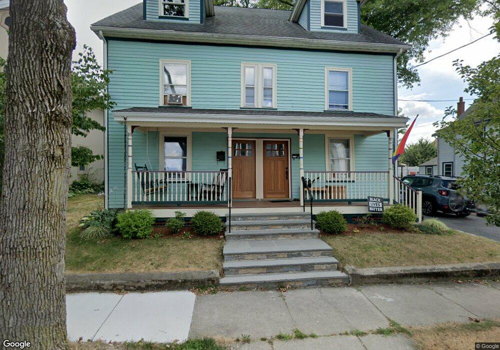
43-45 Cook St Newton, MA 02458
Nonantum NeighborhoodEstimated Value: $1,227,000 - $1,383,000
6
Beds
2
Baths
2,741
Sq Ft
$476/Sq Ft
Est. Value
About This Home
This home is located at 43-45 Cook St, Newton, MA 02458 and is currently estimated at $1,306,070, approximately $476 per square foot. 43-45 Cook St is a home located in Middlesex County with nearby schools including Lincoln-Eliot Elementary School, Bigelow Middle School, and Newton North High School.
Ownership History
Date
Name
Owned For
Owner Type
Purchase Details
Closed on
Jul 5, 2019
Sold by
Gilpin Robert M and Gilpin Jan K
Bought by
43-45 Cook Street Rt
Current Estimated Value
Purchase Details
Closed on
Sep 17, 1999
Sold by
Mcgrath Donnie S
Bought by
Gilpin Robert M and Gilpin Jan K
Purchase Details
Closed on
Jun 2, 1995
Sold by
Hicks Grant E and Hicks Lucia R
Bought by
Mcgrath Donnie S
Purchase Details
Closed on
Jul 24, 1987
Sold by
Rogers John A
Bought by
Hicks Grant E
Create a Home Valuation Report for This Property
The Home Valuation Report is an in-depth analysis detailing your home's value as well as a comparison with similar homes in the area
Home Values in the Area
Average Home Value in this Area
Purchase History
| Date | Buyer | Sale Price | Title Company |
|---|---|---|---|
| 43-45 Cook Street Rt | -- | -- | |
| Gilpin Robert M | $338,000 | -- | |
| Mcgrath Donnie S | $209,000 | -- | |
| Hicks Grant E | $200,000 | -- |
Source: Public Records
Mortgage History
| Date | Status | Borrower | Loan Amount |
|---|---|---|---|
| Previous Owner | Hicks Grant E | $345,000 | |
| Previous Owner | Hicks Grant E | $358,000 |
Source: Public Records
Tax History Compared to Growth
Tax History
| Year | Tax Paid | Tax Assessment Tax Assessment Total Assessment is a certain percentage of the fair market value that is determined by local assessors to be the total taxable value of land and additions on the property. | Land | Improvement |
|---|---|---|---|---|
| 2025 | $10,364 | $1,057,600 | $646,200 | $411,400 |
| 2024 | $9,967 | $1,021,200 | $627,400 | $393,800 |
| 2023 | $9,547 | $937,800 | $498,300 | $439,500 |
| 2022 | $9,135 | $868,300 | $461,400 | $406,900 |
| 2021 | $8,571 | $796,600 | $423,300 | $373,300 |
| 2020 | $8,307 | $795,700 | $423,300 | $372,400 |
| 2019 | $7,771 | $743,600 | $395,600 | $348,000 |
| 2018 | $7,754 | $716,600 | $371,800 | $344,800 |
| 2017 | $7,310 | $657,400 | $341,100 | $316,300 |
| 2016 | $6,863 | $603,100 | $312,900 | $290,200 |
| 2015 | $6,543 | $563,600 | $292,400 | $271,200 |
Source: Public Records
Map
Nearby Homes
- 290 Watertown St Unit 3
- 290 Watertown St Unit 4
- 34 West St Unit A
- 53 West St
- 86 West St
- 188-190 Adams St
- 158 Adams St
- 12-14 Middle St
- 11 Murphy Ct
- 77 Pond Ave Unit 1103
- 3 Ashmont Ave
- 49 Hawthorn St
- 90 Waban Park Unit 2
- 68 Los Angeles St Unit PH5
- 22-24 Emerald St
- 141 Morse St
- 324 Adams St Unit 2
- 336 Nevada St Unit 338
- 15-17 Jewett Place Unit 2
- 42-44 Judkins St
- 43 Cook St Unit 45
- 49 Cook St
- 47 Cook St
- 47 Cook St Unit 47
- 37 Cook St
- 186 Chapel St
- 180 Chapel St
- 180-182 Chapel St Unit 182
- 46 Cook St Unit 1
- 46 Cook St Unit 3
- 53 Cook St
- 33 Cook St
- 33 Cook St Unit m
- 33 Cook St Unit 2
- 33 Cook St Unit 3
- 50 Cook St Unit 1
- 190 Chapel St Unit 192
- 36 Cook St Unit 40
- 38 Cook St Unit 38
- 40 Cook St