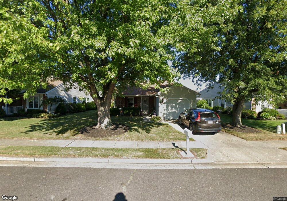
43 Adner Dr Mount Laurel, NJ 08054
Estimated Value: $325,679 - $400,000
Studio
--
Bath
1,278
Sq Ft
$294/Sq Ft
Est. Value
About This Home
This home is located at 43 Adner Dr, Mount Laurel, NJ 08054 and is currently estimated at $375,420, approximately $293 per square foot. 43 Adner Dr is a home located in Burlington County with nearby schools including Hillside Elementary School, T.E. Harrington Middle School, and Mount Laurel Hartford School.
Ownership History
Date
Name
Owned For
Owner Type
Purchase Details
Closed on
Apr 19, 2017
Sold by
Williams Dianne C
Bought by
Zimmerman Paula
Current Estimated Value
Home Financials for this Owner
Home Financials are based on the most recent Mortgage that was taken out on this home.
Original Mortgage
$169,413
Interest Rate
3.87%
Mortgage Type
FHA
Purchase Details
Closed on
Mar 16, 2017
Sold by
Tidwell Anna M
Bought by
Williams Dianne C and The Anna M Tidwell Speical House Trust
Home Financials for this Owner
Home Financials are based on the most recent Mortgage that was taken out on this home.
Original Mortgage
$169,413
Interest Rate
3.87%
Mortgage Type
FHA
Purchase Details
Closed on
Mar 13, 1986
Bought by
Tidwell Anna M and %Diane Williams
Create a Home Valuation Report for This Property
The Home Valuation Report is an in-depth analysis detailing your home's value as well as a comparison with similar homes in the area
Home Values in the Area
Average Home Value in this Area
Purchase History
| Date | Buyer | Sale Price | Title Company |
|---|---|---|---|
| Zimmerman Paula | $185,000 | Group 21 Title Agency | |
| Williams Dianne C | -- | None Available | |
| Tidwell Anna M | $74,300 | -- |
Source: Public Records
Mortgage History
| Date | Status | Borrower | Loan Amount |
|---|---|---|---|
| Previous Owner | Zimmerman Paula | $169,413 |
Source: Public Records
Tax History
| Year | Tax Paid | Tax Assessment Tax Assessment Total Assessment is a certain percentage of the fair market value that is determined by local assessors to be the total taxable value of land and additions on the property. | Land | Improvement |
|---|---|---|---|---|
| 2025 | $5,279 | $167,200 | $53,500 | $113,700 |
| 2024 | $5,080 | $167,200 | $53,500 | $113,700 |
| 2023 | $5,080 | $167,200 | $53,500 | $113,700 |
| 2022 | $5,063 | $167,200 | $53,500 | $113,700 |
| 2021 | $4,968 | $167,200 | $53,500 | $113,700 |
| 2020 | $4,871 | $167,200 | $53,500 | $113,700 |
| 2019 | $4,820 | $167,200 | $53,500 | $113,700 |
| 2018 | $4,784 | $167,200 | $53,500 | $113,700 |
| 2017 | $4,660 | $167,200 | $53,500 | $113,700 |
| 2016 | $4,590 | $167,200 | $53,500 | $113,700 |
| 2015 | $4,536 | $167,200 | $53,500 | $113,700 |
| 2014 | $4,491 | $167,200 | $53,500 | $113,700 |
Source: Public Records
Map
Nearby Homes
- 8 Raven Ct
- 12 Taconia Ct
- 23 Emory Ln
- 17 White Stone Ct
- 3 Avandale Ct
- 9 Avandale Ct
- 23 E Oleander Dr
- 112 Village Ln Unit 112
- 2103A Ferndale Ct Unit A
- 420 Elderberry Ct
- 104B Sumac Ct Unit 104B
- 1604B Steeplebush Terrace Unit 2604B
- 679 Cascade Dr S
- 266 Saint David Dr
- 2702B Bluegrass Dr Unit B
- 840 Lafayette Dr
- 130B Birchfield Ct Unit B
- 130B Birchfield Ct Unit 130B
- 404 Aster Place
- 78 Watson Dr
Your Personal Tour Guide
Ask me questions while you tour the home.