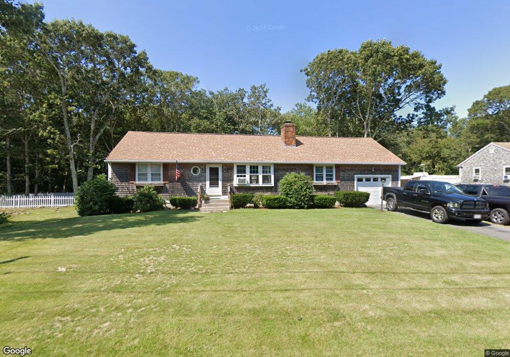
43 Arrowhead Dr Yarmouth Port, MA 02675
Yarmouth Port NeighborhoodEstimated Value: $558,000 - $674,000
3
Beds
2
Baths
1,201
Sq Ft
$506/Sq Ft
Est. Value
About This Home
This home is located at 43 Arrowhead Dr, Yarmouth Port, MA 02675 and is currently estimated at $607,414, approximately $505 per square foot. 43 Arrowhead Dr is a home located in Barnstable County with nearby schools including Dennis-Yarmouth Regional High School, St. Pius X. School, and Trinity Christian Academy of Cape Cod.
Ownership History
Date
Name
Owned For
Owner Type
Purchase Details
Closed on
Jul 1, 1999
Sold by
Zellars Sherri L
Bought by
Buckel Richard C
Current Estimated Value
Home Financials for this Owner
Home Financials are based on the most recent Mortgage that was taken out on this home.
Original Mortgage
$101,000
Outstanding Balance
$27,465
Interest Rate
7.19%
Mortgage Type
Purchase Money Mortgage
Estimated Equity
$579,949
Purchase Details
Closed on
Nov 20, 1997
Sold by
Cincotta Robert and Cincotta Sandy
Bought by
Zellars John R
Home Financials for this Owner
Home Financials are based on the most recent Mortgage that was taken out on this home.
Original Mortgage
$95,000
Interest Rate
7.17%
Mortgage Type
Purchase Money Mortgage
Create a Home Valuation Report for This Property
The Home Valuation Report is an in-depth analysis detailing your home's value as well as a comparison with similar homes in the area
Home Values in the Area
Average Home Value in this Area
Purchase History
| Date | Buyer | Sale Price | Title Company |
|---|---|---|---|
| Buckel Richard C | $135,000 | -- | |
| Zellars John R | $125,000 | -- |
Source: Public Records
Mortgage History
| Date | Status | Borrower | Loan Amount |
|---|---|---|---|
| Open | Zellars John R | $101,000 | |
| Previous Owner | Zellars John R | $95,000 |
Source: Public Records
Tax History Compared to Growth
Tax History
| Year | Tax Paid | Tax Assessment Tax Assessment Total Assessment is a certain percentage of the fair market value that is determined by local assessors to be the total taxable value of land and additions on the property. | Land | Improvement |
|---|---|---|---|---|
| 2025 | $3,901 | $551,000 | $179,300 | $371,700 |
| 2024 | $3,638 | $492,900 | $151,600 | $341,300 |
| 2023 | $3,501 | $431,700 | $131,200 | $300,500 |
| 2022 | $3,288 | $358,200 | $119,300 | $238,900 |
| 2021 | $3,074 | $321,600 | $119,300 | $202,300 |
| 2020 | $2,996 | $299,600 | $119,300 | $180,300 |
| 2019 | $2,759 | $273,200 | $119,300 | $153,900 |
| 2018 | $2,629 | $255,500 | $101,600 | $153,900 |
| 2017 | $2,516 | $251,100 | $97,200 | $153,900 |
| 2016 | $2,417 | $242,200 | $88,300 | $153,900 |
| 2015 | $2,287 | $227,800 | $88,300 | $139,500 |
Source: Public Records
Map
Nearby Homes
- 68 Seminole Dr
- 209 Union St
- 882 W Yarmouth Rd
- 32 Deveau Ln
- 1 Hamblin Hill
- 8 Rowley Ln
- 32 Deveau Ln
- 24 Minnetuxet Way
- 1016 W West Yarmouth Rd
- 40 Deveau Ln
- 463 Route 6a
- 170 Pine St
- 404 Route 6a
- 14 Many Oaks Cir
- 50 Cottonwood St
- 16 Warren Rd Unit 16
- 16 Warren Rd
- 23 Dauphine Dr
- 21 Boxwood Cir
- 25 Oak Glen
- 37 Arrowhead Dr
- 47 Arrowhead Dr
- 42 Arrowhead Dr
- 48 Arrowhead Dr
- 33 Arrowhead Dr
- 34 Arrowhead Dr
- 51 Arrowhead Dr
- 52 Arrowhead Dr
- 35 Harpoon Ln
- 39 Harpoon Ln
- 28 Arrowhead Dr
- 27 Arrowhead Dr
- 29 Harpoon Ln
- 57 Arrowhead Dr
- 58 Arrowhead Dr
- 23 Harpoon Ln
- 24 Arrowhead Dr
- 43 Harpoon Ln
- 23 Arrowhead Dr
- 36 Harpoon Ln