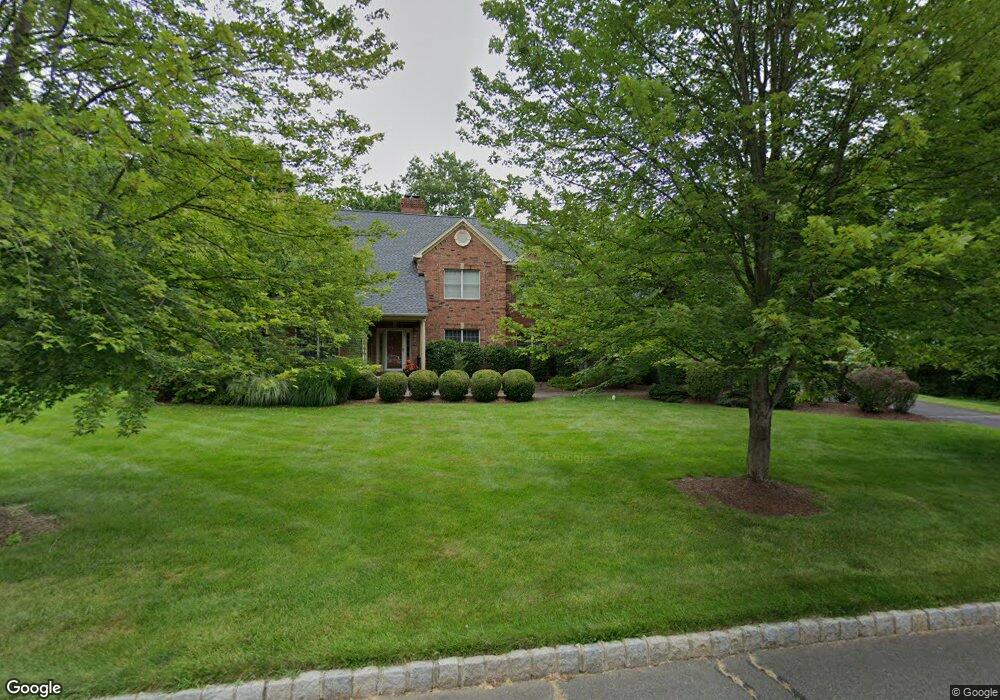
43 Bernard Dr Basking Ridge, NJ 07920
Estimated Value: $1,679,000 - $1,721,000
Studio
--
Bath
3,670
Sq Ft
$463/Sq Ft
Est. Value
About This Home
This home is located at 43 Bernard Dr, Basking Ridge, NJ 07920 and is currently estimated at $1,700,754, approximately $463 per square foot. 43 Bernard Dr is a home located in Somerset County with nearby schools including Cedar Hill Elementary School, William Annin Middle School, and Ridge High School.
Ownership History
Date
Name
Owned For
Owner Type
Purchase Details
Closed on
Sep 30, 2009
Sold by
Laffey David R and Laffey Georgiene Ruocco
Bought by
Yang Xiaodong and Kuang Tao
Current Estimated Value
Home Financials for this Owner
Home Financials are based on the most recent Mortgage that was taken out on this home.
Original Mortgage
$500,000
Outstanding Balance
$320,812
Interest Rate
5.14%
Mortgage Type
New Conventional
Estimated Equity
$1,379,942
Purchase Details
Closed on
Jun 22, 1994
Sold by
Sherbrooke Development Inc
Bought by
Laffey Dave and Ruocco Georgiene
Home Financials for this Owner
Home Financials are based on the most recent Mortgage that was taken out on this home.
Original Mortgage
$401,000
Interest Rate
8.74%
Create a Home Valuation Report for This Property
The Home Valuation Report is an in-depth analysis detailing your home's value as well as a comparison with similar homes in the area
Home Values in the Area
Average Home Value in this Area
Purchase History
| Date | Buyer | Sale Price | Title Company |
|---|---|---|---|
| Yang Xiaodong | $990,500 | None Available | |
| Laffey Dave | $445,008 | -- |
Source: Public Records
Mortgage History
| Date | Status | Borrower | Loan Amount |
|---|---|---|---|
| Open | Yang Xiaodong | $500,000 | |
| Previous Owner | Laffey Dave | $401,000 |
Source: Public Records
Tax History
| Year | Tax Paid | Tax Assessment Tax Assessment Total Assessment is a certain percentage of the fair market value that is determined by local assessors to be the total taxable value of land and additions on the property. | Land | Improvement |
|---|---|---|---|---|
| 2025 | $24,029 | $1,482,700 | $458,300 | $1,024,400 |
| 2024 | $24,029 | $1,350,700 | $385,200 | $965,500 |
| 2023 | $22,943 | $1,216,500 | $385,200 | $831,300 |
| 2022 | $23,215 | $1,154,400 | $380,500 | $773,900 |
| 2021 | $21,305 | $1,009,700 | $375,700 | $634,000 |
| 2020 | $20,974 | $1,001,600 | $370,300 | $631,300 |
| 2019 | $21,166 | $1,040,600 | $372,200 | $668,400 |
| 2018 | $22,350 | $1,114,700 | $372,200 | $742,500 |
| 2017 | $22,199 | $1,116,100 | $407,100 | $709,000 |
| 2016 | $22,634 | $1,160,100 | $407,100 | $753,000 |
| 2015 | $22,036 | $1,150,100 | $387,100 | $763,000 |
| 2014 | $22,278 | $1,151,900 | $372,100 | $779,800 |
Source: Public Records
Map
Nearby Homes
- 49 Alexandria Way Ondo
- 20 Alexandria Way
- 7 Valley View Dr
- 22 Alexandria Way
- 195 Alexandria Way Ondo
- 46 Smithfield Ct
- 206 Potomac Dr
- 40 Chestnut Ct
- 62 Smithfield Ct
- 7 Potomac Dr Unit 7
- 168 Potomac Dr Condo Unit 168
- 138 Potomac Dr Condo
- 85 Sycamore Ct Ondo
- 192 Potomac Dr Condo Unit 192
- 272 Potomac Dr
- 171 Jamestown Rd Ondo Unit 171
- 227 Arrowood Way
- 247 Lyons Rd
- 279 English Place
- 26 Woodward Ln
Your Personal Tour Guide
Ask me questions while you tour the home.