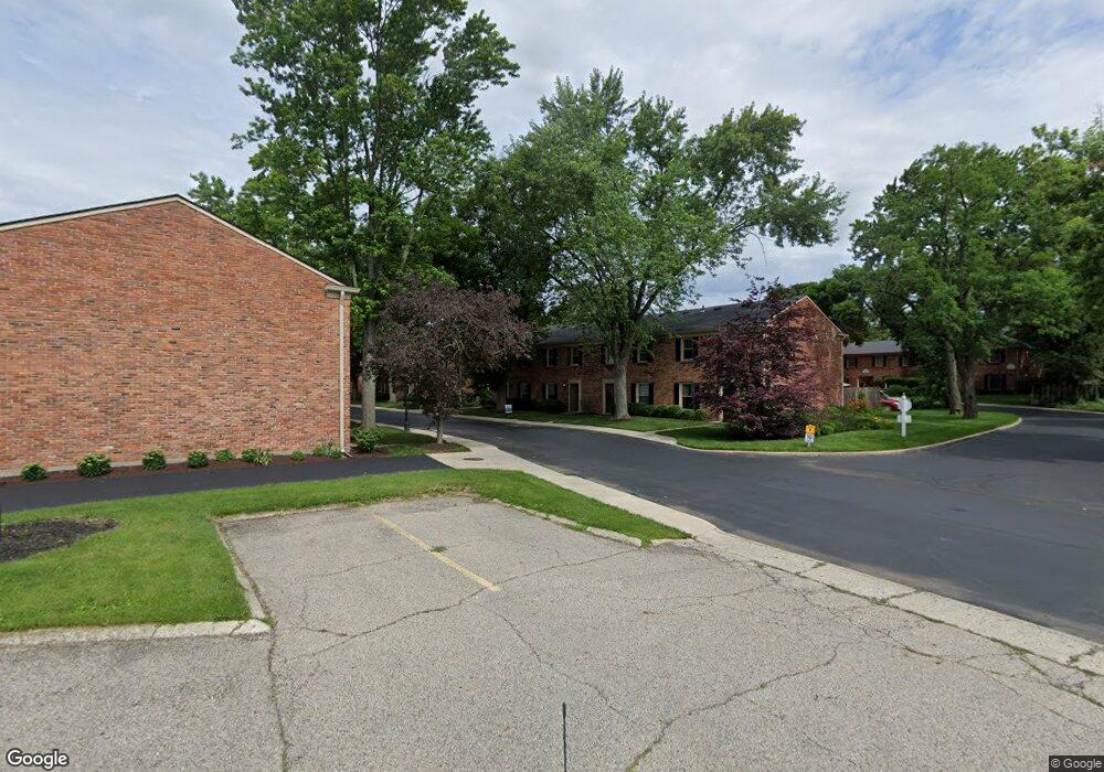
43 Cranston Ct Unit 18 Dayton, OH 45458
Estimated Value: $159,000 - $182,000
3
Beds
2
Baths
1,200
Sq Ft
$144/Sq Ft
Est. Value
About This Home
This home is located at 43 Cranston Ct Unit 18, Dayton, OH 45458 and is currently estimated at $173,362, approximately $144 per square foot. 43 Cranston Ct Unit 18 is a home located in Montgomery County with nearby schools including Primary Village South, Cline Elementary, and Magsig Middle School.
Ownership History
Date
Name
Owned For
Owner Type
Purchase Details
Closed on
May 7, 2018
Sold by
Black Penny and Good Penny L
Bought by
Fraker Julia
Current Estimated Value
Home Financials for this Owner
Home Financials are based on the most recent Mortgage that was taken out on this home.
Original Mortgage
$76,400
Outstanding Balance
$65,843
Interest Rate
4.44%
Mortgage Type
New Conventional
Estimated Equity
$107,519
Purchase Details
Closed on
May 20, 2003
Sold by
Dinneen Sara A
Bought by
Gifford Laura J
Home Financials for this Owner
Home Financials are based on the most recent Mortgage that was taken out on this home.
Original Mortgage
$79,650
Interest Rate
5.95%
Mortgage Type
FHA
Purchase Details
Closed on
Feb 7, 2002
Sold by
Baker James C and Baker Margaret I
Bought by
Baker James C and The James C Baker Trust
Purchase Details
Closed on
Dec 10, 1993
Sold by
Brock Cynthia L
Bought by
Baker James C and Baker Margaret I
Create a Home Valuation Report for This Property
The Home Valuation Report is an in-depth analysis detailing your home's value as well as a comparison with similar homes in the area
Home Values in the Area
Average Home Value in this Area
Purchase History
| Date | Buyer | Sale Price | Title Company |
|---|---|---|---|
| Fraker Julia | $89,900 | First Ohio Title Agency | |
| Gifford Laura J | $81,500 | Sterling Land Title Agency I | |
| Baker James C | -- | -- | |
| Baker James C | -- | -- |
Source: Public Records
Mortgage History
| Date | Status | Borrower | Loan Amount |
|---|---|---|---|
| Open | Fraker Julia | $76,400 | |
| Previous Owner | Gifford Laura J | $79,650 |
Source: Public Records
Tax History Compared to Growth
Tax History
| Year | Tax Paid | Tax Assessment Tax Assessment Total Assessment is a certain percentage of the fair market value that is determined by local assessors to be the total taxable value of land and additions on the property. | Land | Improvement |
|---|---|---|---|---|
| 2024 | $2,612 | $44,780 | $9,640 | $35,140 |
| 2023 | $2,612 | $44,780 | $9,640 | $35,140 |
| 2022 | $2,156 | $29,270 | $6,300 | $22,970 |
| 2021 | $2,162 | $29,270 | $6,300 | $22,970 |
| 2020 | $2,159 | $29,270 | $6,300 | $22,970 |
| 2019 | $1,854 | $22,390 | $6,300 | $16,090 |
| 2018 | $1,645 | $22,390 | $6,300 | $16,090 |
| 2017 | $1,626 | $22,390 | $6,300 | $16,090 |
| 2016 | $1,903 | $24,790 | $6,300 | $18,490 |
| 2015 | $1,884 | $24,790 | $6,300 | $18,490 |
| 2014 | $1,884 | $24,790 | $6,300 | $18,490 |
| 2012 | -- | $25,930 | $6,300 | $19,630 |
Source: Public Records
Map
Nearby Homes
- 170 S Main St Unit C
- 92 E Ridgeway Dr
- 61 Lynn Rae Cir
- 20 Gershwin Dr
- 40 Cemetery Dr
- 155 Bristol Dr
- 156 Mallard Glen Dr Unit 4
- 306 Monarch Rd
- 325 Annette Dr
- 284 Tauber Dr
- 121 Woodfield Place
- 140 Mallard Glen Dr Unit 3
- 296 Tauber Dr
- 352 Sentinel Oak Dr
- 311 E Franklin St
- 7687 Normandy Ln
- 694 Spring Ridge Place
- 435 Clareridge Ln
- 35 Bywood Ct
- 129 Bradstreet Rd
- 41 Cranston Ct Unit 17
- 45 Cranston Ct Unit 19
- 42 Cranston Ct Unit 2
- 40 Cranston Ct Unit 1
- 44 Cranston Ct Unit 3
- 53 Cranston Ct Unit 22
- 46 Cranston Ct Unit 4
- 55 Cranston Ct Unit 23
- 57 Cranston Ct Unit 24
- 51 Cranston Ct Unit 21
- 50 Cranston Ct Unit 5
- 79 S Main St
- 54 Cranston Ct Unit 7
- 41 Winchester Place Unit 42
- 41 Winchester Place Unit 41
- 41 Winchester Place Unit 40
- 41 Winchester Place Unit 39
- 41 Winchester Place Unit 38
- 41 Winchester Place Unit 37
- 41 Winchester Place Unit 36