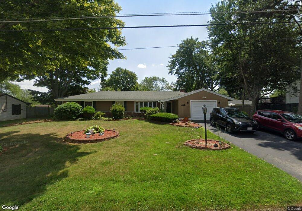
43 Delmar Rd Brockton, MA 02302
Montello NeighborhoodEstimated Value: $486,000 - $520,414
3
Beds
3
Baths
1,428
Sq Ft
$355/Sq Ft
Est. Value
About This Home
This home is located at 43 Delmar Rd, Brockton, MA 02302 and is currently estimated at $506,604, approximately $354 per square foot. 43 Delmar Rd is a home located in Plymouth County with nearby schools including Brookfield Elementary School, Downey Elementary School, and Ashfield Middle School.
Ownership History
Date
Name
Owned For
Owner Type
Purchase Details
Closed on
Dec 23, 2019
Sold by
Hinkle Donald G
Bought by
Hinkle Richard A
Current Estimated Value
Purchase Details
Closed on
Aug 30, 1996
Sold by
Regan Robert W and Regan Helen M
Bought by
Hinkle Donald G and Hinkle Carol A
Purchase Details
Closed on
May 27, 1993
Sold by
Citicorp Mtg Inc
Bought by
Fegan Robert W and Regan Helen M
Purchase Details
Closed on
Mar 2, 1993
Sold by
May Danny L and Citicorp Mtg Inc
Bought by
Citicorp Mtg Inc
Purchase Details
Closed on
Nov 13, 1989
Sold by
Duffy Robert T
Bought by
May Danny L
Create a Home Valuation Report for This Property
The Home Valuation Report is an in-depth analysis detailing your home's value as well as a comparison with similar homes in the area
Home Values in the Area
Average Home Value in this Area
Purchase History
| Date | Buyer | Sale Price | Title Company |
|---|---|---|---|
| Hinkle Richard A | -- | None Available | |
| Hinkle Donald G | $100,000 | -- | |
| Fegan Robert W | $88,750 | -- | |
| Citicorp Mtg Inc | $68,600 | -- | |
| May Danny L | $138,000 | -- |
Source: Public Records
Mortgage History
| Date | Status | Borrower | Loan Amount |
|---|---|---|---|
| Previous Owner | May Danny L | $125,000 | |
| Previous Owner | May Danny L | $104,000 |
Source: Public Records
Tax History Compared to Growth
Tax History
| Year | Tax Paid | Tax Assessment Tax Assessment Total Assessment is a certain percentage of the fair market value that is determined by local assessors to be the total taxable value of land and additions on the property. | Land | Improvement |
|---|---|---|---|---|
| 2025 | $5,503 | $454,400 | $145,000 | $309,400 |
| 2024 | $5,183 | $431,200 | $145,000 | $286,200 |
| 2023 | $5,048 | $388,900 | $110,000 | $278,900 |
| 2022 | $4,681 | $335,100 | $100,000 | $235,100 |
| 2021 | $4,409 | $304,100 | $95,000 | $209,100 |
| 2020 | $4,571 | $301,700 | $91,000 | $210,700 |
| 2019 | $4,188 | $269,500 | $85,500 | $184,000 |
| 2018 | $4,251 | $264,700 | $85,500 | $179,200 |
| 2017 | $3,940 | $244,700 | $85,500 | $159,200 |
| 2016 | $3,305 | $190,400 | $81,500 | $108,900 |
| 2015 | $3,258 | $179,500 | $81,500 | $98,000 |
| 2014 | $3,407 | $187,900 | $81,500 | $106,400 |
Source: Public Records
Map
Nearby Homes