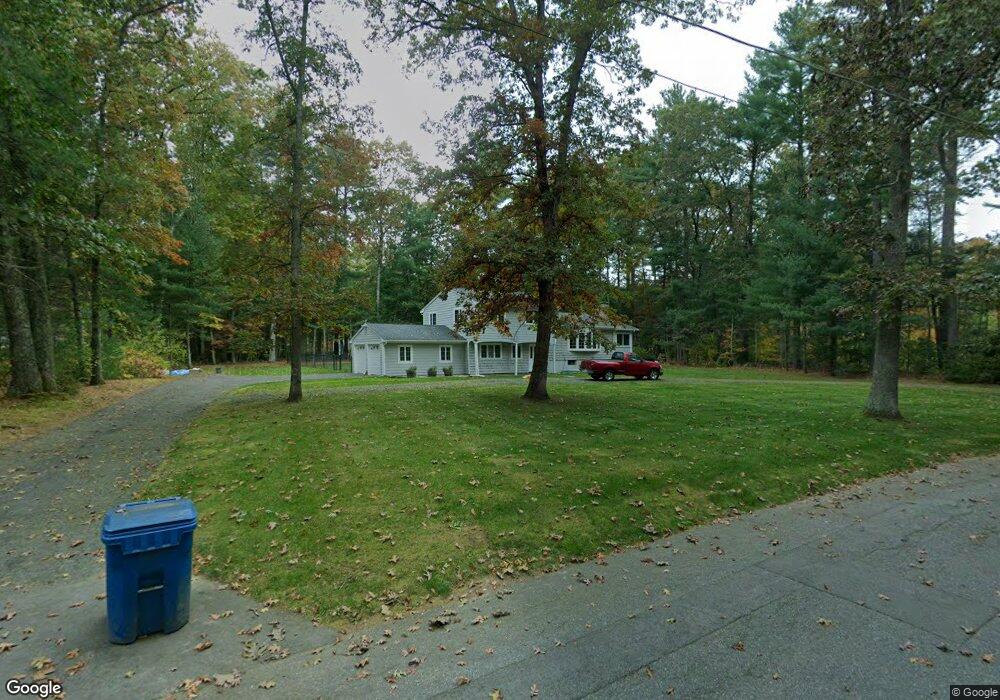
43 Drum Ln Sudbury, MA 01776
Estimated Value: $809,000 - $1,066,000
3
Beds
3
Baths
2,002
Sq Ft
$470/Sq Ft
Est. Value
About This Home
This home is located at 43 Drum Ln, Sudbury, MA 01776 and is currently estimated at $940,421, approximately $469 per square foot. 43 Drum Ln is a home located in Middlesex County with nearby schools including Peter Noyes Elementary School, Ephraim Curtis Middle School, and Lincoln-Sudbury Regional High School.
Ownership History
Date
Name
Owned For
Owner Type
Purchase Details
Closed on
Nov 21, 1997
Sold by
Morely Geraldine R
Bought by
Kane Michael T and Kane Patricia C
Current Estimated Value
Home Financials for this Owner
Home Financials are based on the most recent Mortgage that was taken out on this home.
Original Mortgage
$150,000
Interest Rate
7.17%
Mortgage Type
Purchase Money Mortgage
Create a Home Valuation Report for This Property
The Home Valuation Report is an in-depth analysis detailing your home's value as well as a comparison with similar homes in the area
Home Values in the Area
Average Home Value in this Area
Purchase History
| Date | Buyer | Sale Price | Title Company |
|---|---|---|---|
| Kane Michael T | $291,500 | -- |
Source: Public Records
Mortgage History
| Date | Status | Borrower | Loan Amount |
|---|---|---|---|
| Open | Kane Michael T | $257,000 | |
| Closed | Kane Michael T | $150,000 |
Source: Public Records
Tax History
| Year | Tax Paid | Tax Assessment Tax Assessment Total Assessment is a certain percentage of the fair market value that is determined by local assessors to be the total taxable value of land and additions on the property. | Land | Improvement |
|---|---|---|---|---|
| 2025 | $12,169 | $831,200 | $469,400 | $361,800 |
| 2024 | $11,755 | $804,600 | $455,800 | $348,800 |
| 2023 | $11,701 | $742,000 | $422,600 | $319,400 |
| 2022 | $11,039 | $611,600 | $388,200 | $223,400 |
| 2021 | $10,722 | $569,400 | $388,200 | $181,200 |
| 2020 | $10,505 | $569,400 | $388,200 | $181,200 |
| 2019 | $10,198 | $569,400 | $388,200 | $181,200 |
| 2018 | $10,071 | $561,700 | $408,200 | $153,500 |
| 2017 | $9,707 | $547,200 | $403,400 | $143,800 |
| 2016 | $9,439 | $530,300 | $388,200 | $142,100 |
| 2015 | $8,902 | $505,800 | $373,400 | $132,400 |
| 2014 | $8,865 | $491,700 | $362,600 | $129,100 |
Source: Public Records
Map
Nearby Homes
- 62 Churchill St
- 46 Brewster Rd
- 427 Concord Rd
- 11 October Rd
- 111 Willis Rd
- 26 Clark Rd
- 45 Webster Cir
- 30 Kendall Rd
- 557 Dutton Rd Unit 2
- 55 Widow Rites Ln
- 45 Widow Rites Ln
- 11 Farmstead Ln Unit 11
- 30 Rolling Ln
- 30 Harness Ln
- 15 Harness Ln
- 1011 Boston Post Rd
- 0 Robbins Rd
- 53 Pine St
- 24 Woodland Rd
- 11 Great Lake Dr
- 400 Old Lancaster Rd
- 19 Demarco Rd
- 35 Drum Ln
- 42 Drum Ln
- 15 Demarco Rd
- 27 Demarco Rd
- 390 Old Lancaster Rd
- 406 Old Lancaster Rd
- 16 Demarco Rd
- 0 Confidential Unit 72742735
- 26 Demarco Rd
- 414 Old Lancaster Rd
- 12 Demarco Rd
- 22 Demarco Rd
- 34 Drum Ln
- 31 Demarco Rd
- 384 Old Lancaster Rd
- 29 Drum Ln
- 4 Demarco Rd
- 32 Demarco Rd
Your Personal Tour Guide
Ask me questions while you tour the home.