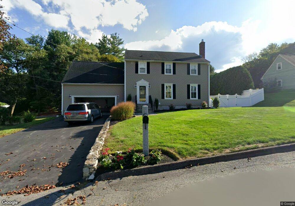
43 Forsythia Rd Leominster, MA 01453
Estimated Value: $572,000 - $625,000
3
Beds
3
Baths
2,168
Sq Ft
$278/Sq Ft
Est. Value
About This Home
This home is located at 43 Forsythia Rd, Leominster, MA 01453 and is currently estimated at $602,840, approximately $278 per square foot. 43 Forsythia Rd is a home located in Worcester County with nearby schools including Leominster High School, St Bernards Elementary School, and St. Leo School.
Ownership History
Date
Name
Owned For
Owner Type
Purchase Details
Closed on
May 15, 2019
Sold by
Gasbarro Karen
Bought by
Karen Gasbarro Lt
Current Estimated Value
Purchase Details
Closed on
Oct 23, 2017
Sold by
Gasbarro Mark A and Gasbarro Karen
Bought by
Gasbarro Karen
Purchase Details
Closed on
Aug 26, 2005
Sold by
Gasbarro Karen and Gasbarro Mark A
Bought by
Phillips Debra J and Phillips Peter
Purchase Details
Closed on
May 26, 2000
Sold by
Leblanc Constr
Bought by
Gasbarro Mark A and Gasbarro Karen
Purchase Details
Closed on
Sep 4, 1991
Sold by
Regan Construction
Bought by
Gasbarro Mark A and Karen Gasbarro
Home Financials for this Owner
Home Financials are based on the most recent Mortgage that was taken out on this home.
Original Mortgage
$127,000
Interest Rate
8.9%
Create a Home Valuation Report for This Property
The Home Valuation Report is an in-depth analysis detailing your home's value as well as a comparison with similar homes in the area
Home Values in the Area
Average Home Value in this Area
Purchase History
| Date | Buyer | Sale Price | Title Company |
|---|---|---|---|
| Karen Gasbarro Lt | -- | -- | |
| Gasbarro Karen | -- | -- | |
| Phillips Debra J | $45,000 | -- | |
| Gasbarro Mark A | $8,333 | -- | |
| Gasbarro Mark A | $140,000 | -- |
Source: Public Records
Mortgage History
| Date | Status | Borrower | Loan Amount |
|---|---|---|---|
| Previous Owner | Gasbarro Mark A | $111,000 | |
| Previous Owner | Gasbarro Mark A | $129,000 | |
| Previous Owner | Gasbarro Mark A | $129,350 | |
| Previous Owner | Gasbarro Mark A | $127,000 |
Source: Public Records
Tax History Compared to Growth
Tax History
| Year | Tax Paid | Tax Assessment Tax Assessment Total Assessment is a certain percentage of the fair market value that is determined by local assessors to be the total taxable value of land and additions on the property. | Land | Improvement |
|---|---|---|---|---|
| 2025 | $7,211 | $514,000 | $162,800 | $351,200 |
| 2024 | $7,088 | $488,500 | $154,900 | $333,600 |
| 2023 | $6,716 | $432,200 | $134,800 | $297,400 |
| 2022 | $6,407 | $386,900 | $117,200 | $269,700 |
| 2021 | $6,157 | $339,600 | $91,400 | $248,200 |
| 2020 | $5,446 | $302,900 | $91,400 | $211,500 |
| 2019 | $5,297 | $285,700 | $87,000 | $198,700 |
| 2018 | $5,269 | $272,600 | $84,500 | $188,100 |
| 2017 | $5,100 | $258,500 | $78,900 | $179,600 |
| 2016 | $5,063 | $258,600 | $78,900 | $179,700 |
| 2015 | $4,687 | $241,100 | $78,900 | $162,200 |
| 2014 | $4,549 | $240,800 | $84,000 | $156,800 |
Source: Public Records
Map
Nearby Homes
- 1084 Main St
- 121 Morningside St Unit 121
- 67 Bernice Ave
- 51 Claflin St
- 1479 Main St
- 31 Park Ave
- 40 Flaggler Rd
- 3 Chase Ave
- 14 Stetson St
- 29 Lakeview Ave
- 291 Joslin St
- 471 North St
- 17 Fernwood Dr Unit D
- 17 Fernwood Dr Unit G
- 51 Fox Meadow Rd Unit C
- 14 Fernwood Dr Unit D
- 11 Dale Ave
- 26 Otis St
- 44 Hamlin St
- 452 Hollis Rd
- 49 Forsythia Rd
- 37 Forsythia Rd
- 42 Forsythia Rd
- 48 Forsythia Rd
- 36 Wisteria Dr
- 31 Forsythia Rd
- 55 Forsythia Rd
- 56 Forsythia Rd
- 29 Wisteria Dr
- 45 Mary Ave
- 60 Forsythia Rd
- 23 Forsythia Rd
- 24 Wisteria Dr
- 42 Mary Ave
- 24 Forsythia Rd
- 39 Mary Ave
- 23 Wisteria Dr
- 17 Forsythia Rd
- 18 Forsythia Rd
- 16 Wisteria Dr