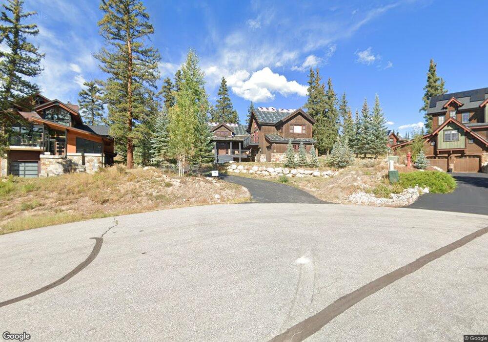
43 Grays Peak Trail Dillon, CO 80435
Keystone NeighborhoodEstimated Value: $2,175,399 - $2,451,000
5
Beds
5
Baths
2,949
Sq Ft
$786/Sq Ft
Est. Value
About This Home
This home is located at 43 Grays Peak Trail, Dillon, CO 80435 and is currently estimated at $2,317,350, approximately $785 per square foot. 43 Grays Peak Trail is a home located in Summit County with nearby schools including Summit Cove Elementary School, Summit Middle School, and Summit High School.
Ownership History
Date
Name
Owned For
Owner Type
Purchase Details
Closed on
Jun 25, 2011
Sold by
Kool Brad and Kool Christopher G
Bought by
Pgcb Llc
Current Estimated Value
Purchase Details
Closed on
Jun 24, 2011
Sold by
Lunney Stephen J and Lunney Rachel E
Bought by
Kool Brad and Kool Christopher G
Purchase Details
Closed on
Mar 22, 2007
Sold by
Lunney Stephen J and Lunney Rachel E
Bought by
Trego Wakeeney State Bank
Purchase Details
Closed on
Feb 3, 2005
Sold by
Adams Patrick and Adams Sharon
Bought by
Lunney Stephen J and Lunney Rachel E
Home Financials for this Owner
Home Financials are based on the most recent Mortgage that was taken out on this home.
Original Mortgage
$143,600
Interest Rate
6.25%
Mortgage Type
Unknown
Create a Home Valuation Report for This Property
The Home Valuation Report is an in-depth analysis detailing your home's value as well as a comparison with similar homes in the area
Home Values in the Area
Average Home Value in this Area
Purchase History
| Date | Buyer | Sale Price | Title Company |
|---|---|---|---|
| Pgcb Llc | -- | None Available | |
| Kool Brad | $900,000 | Stewart Title | |
| Trego Wakeeney State Bank | $710,000 | -- | |
| Lunney Stephen J | $179,500 | Highland Title Company |
Source: Public Records
Mortgage History
| Date | Status | Borrower | Loan Amount |
|---|---|---|---|
| Previous Owner | Lunney Stephen J | $143,600 |
Source: Public Records
Tax History Compared to Growth
Tax History
| Year | Tax Paid | Tax Assessment Tax Assessment Total Assessment is a certain percentage of the fair market value that is determined by local assessors to be the total taxable value of land and additions on the property. | Land | Improvement |
|---|---|---|---|---|
| 2024 | $8,010 | $147,400 | -- | -- |
| 2023 | $8,010 | $143,715 | $0 | $0 |
| 2022 | $5,683 | $95,298 | $0 | $0 |
| 2021 | $5,733 | $98,041 | $0 | $0 |
| 2020 | $4,731 | $85,752 | $0 | $0 |
| 2019 | $4,670 | $85,752 | $0 | $0 |
| 2018 | $3,775 | $66,703 | $0 | $0 |
| 2017 | $3,473 | $66,703 | $0 | $0 |
| 2016 | $3,827 | $72,297 | $0 | $0 |
| 2015 | $3,715 | $72,297 | $0 | $0 |
| 2014 | $3,428 | $65,531 | $0 | $0 |
| 2013 | -- | $65,531 | $0 | $0 |
Source: Public Records
Map
Nearby Homes
- 56 Canyon View Ct
- 27 Habitat Ct
- 120 Pikes Peak Place
- 152 Pikes Peak Place
- 0120 Pikes Peak Place
- 105 Red Cloud Peak Dr
- 34 Snow Peak Ct
- 101 Mule Deer Ct
- 12 Raindance Trail
- 70 Lone Wolf Ct
- 20 Gingerquill Ct
- 216 Climax Dr
- 7 Golden Rod Cir
- 396 Cove Blvd Unit 30
- 396 Cove Blvd Unit 11
- 840 Penstemon Rd
- 113 Cooper Dr
- 862 Penstemon Rd
- 815 Summit Dr
- 182 Idlewild Dr
- 37 Gray's Peak Trail
- 49 Grays Peak Trail
- 35 Grays Peak Trail
- 65 Canyon View Ct
- 71 Canyon View Ct
- 48 Grays Peak Trail
- 55 Canyon View Ct
- 33 Grays Peak Trail
- 40 Grays Peak Trail
- 36 Grays Peak Trail
- 49 Canyon View Ct
- 79 Canyon View Ct
- 34 Grays Peak Trail
- 29 Grays Peak Trail
- 45 Canyon View Ct
- 26 Grays Peak Trail
- 85 Canyon View Ct
- 80 Canyon View Ct
- 25 Grays Peak Trail
- 86 Canyon View Ct