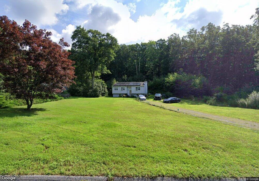
43 Grouse Cir East Lyme, CT 06333
Estimated Value: $340,000 - $451,000
3
Beds
1
Bath
948
Sq Ft
$403/Sq Ft
Est. Value
About This Home
This home is located at 43 Grouse Cir, East Lyme, CT 06333 and is currently estimated at $382,491, approximately $403 per square foot. 43 Grouse Cir is a home located in New London County with nearby schools including East Lyme Middle School, East Lyme High School, and Carelot Children's Center - East Lyme.
Ownership History
Date
Name
Owned For
Owner Type
Purchase Details
Closed on
Aug 31, 2010
Sold by
Ingham Robert and Iovene Mary
Bought by
Castonguay Dennis Paul
Current Estimated Value
Purchase Details
Closed on
Nov 4, 1997
Sold by
Solomon Eskin Morris
Bought by
Iovene Scott W and Ingham Mary
Home Financials for this Owner
Home Financials are based on the most recent Mortgage that was taken out on this home.
Original Mortgage
$60,000
Interest Rate
7.37%
Mortgage Type
Unknown
Create a Home Valuation Report for This Property
The Home Valuation Report is an in-depth analysis detailing your home's value as well as a comparison with similar homes in the area
Home Values in the Area
Average Home Value in this Area
Purchase History
| Date | Buyer | Sale Price | Title Company |
|---|---|---|---|
| Castonguay Dennis Paul | $188,000 | -- | |
| Iovene Scott W | $105,000 | -- |
Source: Public Records
Mortgage History
| Date | Status | Borrower | Loan Amount |
|---|---|---|---|
| Previous Owner | Iovene Scott W | $160,000 | |
| Previous Owner | Iovene Scott W | $101,500 | |
| Previous Owner | Iovene Scott W | $16,900 | |
| Previous Owner | Iovene Scott W | $60,000 |
Source: Public Records
Tax History Compared to Growth
Tax History
| Year | Tax Paid | Tax Assessment Tax Assessment Total Assessment is a certain percentage of the fair market value that is determined by local assessors to be the total taxable value of land and additions on the property. | Land | Improvement |
|---|---|---|---|---|
| 2025 | $4,974 | $177,590 | $104,090 | $73,500 |
| 2024 | $4,679 | $177,590 | $104,090 | $73,500 |
| 2023 | $4,418 | $177,590 | $104,090 | $73,500 |
| 2022 | $4,234 | $177,590 | $104,090 | $73,500 |
| 2021 | $4,361 | $152,950 | $98,840 | $54,110 |
| 2020 | $4,338 | $152,950 | $98,840 | $54,110 |
| 2019 | $4,312 | $152,950 | $98,840 | $54,110 |
| 2018 | $4,183 | $152,950 | $98,840 | $54,110 |
| 2017 | $4,001 | $152,950 | $98,840 | $54,110 |
| 2016 | $3,785 | $149,240 | $93,660 | $55,580 |
| 2015 | $3,688 | $149,240 | $93,660 | $55,580 |
| 2014 | $3,586 | $149,240 | $93,660 | $55,580 |
Source: Public Records
Map
Nearby Homes
- 8 Alscot Dr
- 2 Brookfield Dr
- 0 Cedarbrook Ln Unit 24110327
- 15 Rocco Dr
- 18 Sandpiper Ln
- 32 Village Dr
- 29 Rocco Dr
- 50 Gurley Rd
- 32 Upper Pattagansett Rd Unit 8
- 36 Church Ln
- 1 Hathaway Rd
- 30 Pattagansett Dr
- 267 Waterford Pkwy N
- 13 Charter Oak Dr
- 181 Oil Mill Rd
- 205 Butlertown Rd
- 12 Josan Dr
- 0 Silver Falls Rd
- 33 Arbor Crossing
- 57 Walnut Hill Rd