43 High Point Rd Conway, NH 03818
Estimated Value: $1,021,000 - $1,146,864
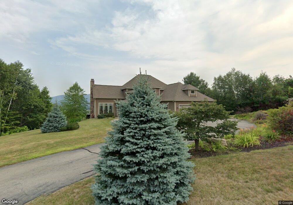
About This Home
This home is located at 43 High Point Rd, Conway, NH 03818 and is currently estimated at $1,100,466, approximately $278 per square foot. 43 High Point Rd is a home located in Carroll County with nearby schools including A. Crosby Kennett Middle School, Kennett High School, and Robert Frost Charter School.
Ownership History
We collect this data history from publicly available records. To have your information removed, we recommend requesting removal directly through your county’s website.
Purchase Details
Home Financials for this Owner
Home Financials are based on the most recent Mortgage that was taken out on this home.Purchase Details
Home Values in the Area
Average Home Value in this Area
Purchase History
We collect this data history from publicly available records. To have your information removed, we recommend requesting removal directly through your county’s website.
| Date | Buyer | Sale Price | Title Company |
|---|---|---|---|
| $875,000 | None Available | ||
| $875,000 | None Available | ||
| $577,500 | -- |
Mortgage History
We collect this data history from publicly available records. To have your information removed, we recommend requesting removal directly through your county’s website.
| Date | Status | Borrower | Loan Amount |
|---|---|---|---|
| Open | $625,000 | ||
| Closed | $625,000 |
Tax History
We collect this data history from publicly available records. To have your information removed, we recommend requesting removal directly through your county’s website.
| Year | Tax Paid | Tax Assessment Tax Assessment Total Assessment is a certain percentage of the fair market value that is determined by local assessors to be the total taxable value of land and additions on the property. | Land | Improvement |
|---|---|---|---|---|
| 2025 | $12,315 | $1,067,200 | $210,700 | $856,500 |
| 2024 | $12,913 | $1,067,200 | $210,700 | $856,500 |
| 2023 | $11,643 | $1,067,200 | $210,700 | $856,500 |
| 2022 | $10,330 | $572,000 | $146,800 | $425,200 |
| 2021 | $9,346 | $572,000 | $146,800 | $425,200 |
| 2020 | $9,918 | $572,000 | $146,800 | $425,200 |
| 2019 | $9,907 | $572,000 | $146,800 | $425,200 |
| 2018 | $10,552 | $505,600 | $161,800 | $343,800 |
| 2017 | $10,102 | $505,600 | $161,800 | $343,800 |
| 2016 | $9,763 | $505,600 | $161,800 | $343,800 |
| 2015 | $9,663 | $506,200 | $161,800 | $344,400 |
| 2014 | $9,547 | $506,200 | $161,800 | $344,400 |
| 2013 | $9,366 | $524,400 | $161,800 | $362,600 |
Map
- 1014 W Side Rd Unit 5
- 00 Grandview Rd
- 00 Grandview Rd Unit 4
- 511 Grandview Rd
- 00 Madeline Way Unit 45
- 140 Sidetrack Rd
- 77 Northbrook Cir Unit 39
- 30 Moat Brook Dr
- 123 Oxbow Ln
- Map 264 Lot 65 Oxbow Ln
- 47 Oxbow Ln
- 113 Oxbow Ln
- 211 High St
- 74 Lamplighter's Dr
- 26 Firelite Rd
- 51 Tent Ave
- 37 Oconnor Ln
- 20 Lighthouse Ln
- 357 Lamplighters Dr
- 17 Okeefes Cir
- 43 High Point Rd
- 67 High Point Rd
- 40 High Point Rd
- 40 High Point Rd
- 33 High Point Rd
- 33 High Point Rd
- 9 High Point Rd
- 112 Holly Ridge Ln
- 10 High Point Rd
- 10 High Point Rd
- 10 High Point Rd
- 10 Highpoint Rd
- 200 Heather Hill Rd
- 94 Holly Ridge Ln
- 81 High Point Rd
- 100 Highpoint Rd
- 94 High Point Rd
- 220 Heather Hill Rd
- 84 Holly Ridge Ln
- 99 High Point Rd
Ask me questions while you tour the home.