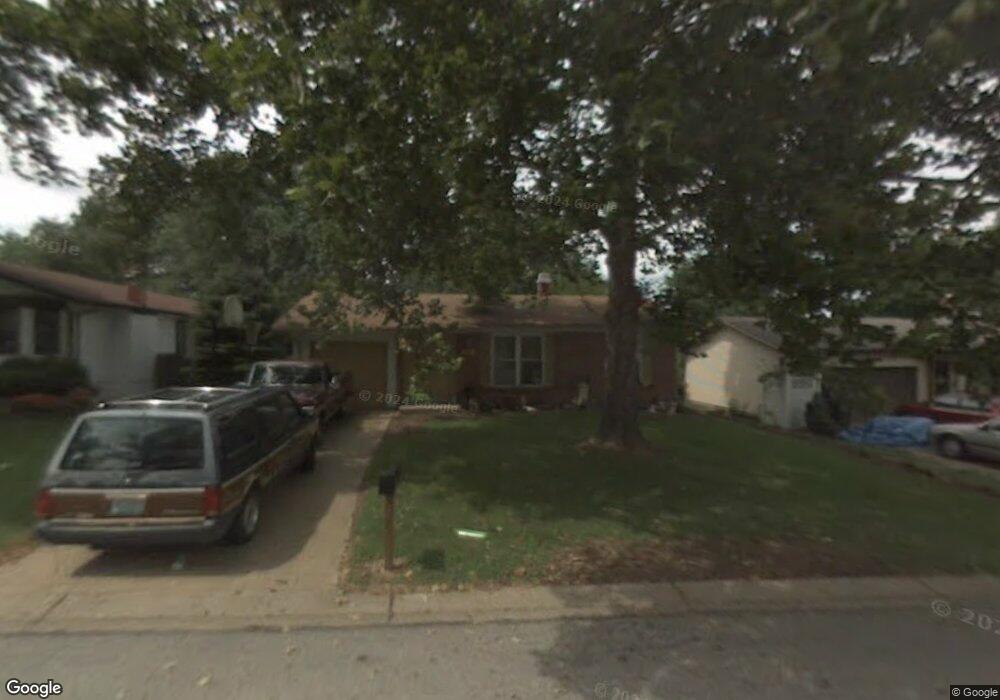
43 Julie Ln Saint Peters, MO 63376
Estimated Value: $287,000 - $306,000
3
Beds
2
Baths
1,322
Sq Ft
$223/Sq Ft
Est. Value
About This Home
This home is located at 43 Julie Ln, Saint Peters, MO 63376 and is currently estimated at $294,762, approximately $222 per square foot. 43 Julie Ln is a home located in St. Charles County with nearby schools including Lewis & Clark Elementary School, Dr. Bernard J. Dubray Middle School, and Fort Zumwalt East High School.
Ownership History
Date
Name
Owned For
Owner Type
Purchase Details
Closed on
Jan 28, 2022
Sold by
43 Julie Trust
Bought by
Griffon Donald and Griffon Jessica
Current Estimated Value
Purchase Details
Closed on
Feb 10, 2004
Sold by
Mcelroy Mary M
Bought by
43 Julie Trust
Home Financials for this Owner
Home Financials are based on the most recent Mortgage that was taken out on this home.
Original Mortgage
$102,850
Interest Rate
5.86%
Mortgage Type
Purchase Money Mortgage
Create a Home Valuation Report for This Property
The Home Valuation Report is an in-depth analysis detailing your home's value as well as a comparison with similar homes in the area
Home Values in the Area
Average Home Value in this Area
Purchase History
| Date | Buyer | Sale Price | Title Company |
|---|---|---|---|
| Griffon Donald | -- | None Listed On Document | |
| 43 Julie Trust | $124,000 | Archway Title Agency Inc |
Source: Public Records
Mortgage History
| Date | Status | Borrower | Loan Amount |
|---|---|---|---|
| Previous Owner | 43 Julie Trust | $102,850 | |
| Closed | 43 Julie Trust | $21,780 |
Source: Public Records
Tax History Compared to Growth
Tax History
| Year | Tax Paid | Tax Assessment Tax Assessment Total Assessment is a certain percentage of the fair market value that is determined by local assessors to be the total taxable value of land and additions on the property. | Land | Improvement |
|---|---|---|---|---|
| 2025 | $3,158 | $49,115 | -- | -- |
| 2023 | $3,156 | $44,192 | $0 | $0 |
| 2022 | $2,644 | $34,636 | $0 | $0 |
| 2021 | $2,640 | $34,636 | $0 | $0 |
| 2020 | $2,402 | $30,504 | $0 | $0 |
| 2019 | $2,396 | $30,504 | $0 | $0 |
| 2018 | $2,176 | $26,587 | $0 | $0 |
| 2017 | $2,166 | $26,587 | $0 | $0 |
| 2016 | $1,982 | $24,248 | $0 | $0 |
| 2015 | $1,856 | $24,248 | $0 | $0 |
| 2014 | $1,983 | $25,434 | $0 | $0 |
Source: Public Records
Map
Nearby Homes
- 31 Carriage Way W
- 537 Ryehill Dr
- 528 Selene St
- 833 Harding St
- 1196 Colby Ct
- 1 Marianne Dr
- Brookmont Plan at Ryehill Manor
- Parker Plan at Ryehill Manor
- Whitehall Plan at Ryehill Manor
- Lansford Plan at Ryehill Manor
- Stratton Plan at Ryehill Manor
- Winslow Plan at Ryehill Manor
- Carver Plan at Ryehill Manor
- Waverly Plan at Ryehill Manor
- 99 Long And Winding Rd
- 404 Kaliedoscope Ln
- 16 Oxbow Rd
- 114 Long And Winding Rd
- 50 Oak Hill Ln
- 8 Cross Trail Ln