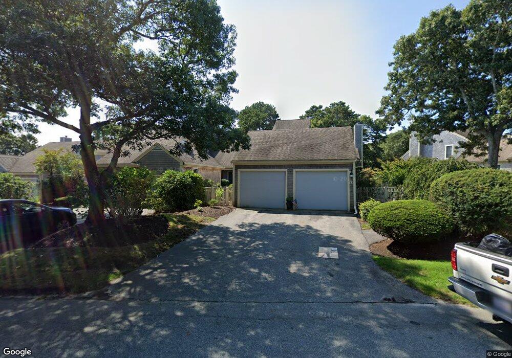
43 Kates Path Yarmouth Port, MA 02675
Yarmouth Port NeighborhoodEstimated Value: $700,000 - $777,000
2
Beds
4
Baths
1,829
Sq Ft
$397/Sq Ft
Est. Value
About This Home
This home is located at 43 Kates Path, Yarmouth Port, MA 02675 and is currently estimated at $725,892, approximately $396 per square foot. 43 Kates Path is a home located in Barnstable County with nearby schools including Dennis-Yarmouth Regional High School.
Ownership History
Date
Name
Owned For
Owner Type
Purchase Details
Closed on
Jul 21, 2021
Sold by
Brennan Eleanor
Bought by
Ellie Brennan Irt
Current Estimated Value
Purchase Details
Closed on
Jul 13, 2017
Sold by
Forbes Claire J
Bought by
Brennan Eleanor
Purchase Details
Closed on
Jan 20, 2006
Sold by
Widmer Ralph G and Widmer Suzanne C
Bought by
Forbes Claire J
Home Financials for this Owner
Home Financials are based on the most recent Mortgage that was taken out on this home.
Original Mortgage
$250,000
Interest Rate
6.33%
Purchase Details
Closed on
Sep 25, 2003
Sold by
Majorie Nichols Ret
Bought by
Widmer Ralph G
Purchase Details
Closed on
May 16, 1988
Sold by
The Green Co Inc
Bought by
Nichols Marjorie
Create a Home Valuation Report for This Property
The Home Valuation Report is an in-depth analysis detailing your home's value as well as a comparison with similar homes in the area
Home Values in the Area
Average Home Value in this Area
Purchase History
| Date | Buyer | Sale Price | Title Company |
|---|---|---|---|
| Ellie Brennan Irt | -- | None Available | |
| Brennan Eleanor | $400,000 | -- | |
| Forbes Claire J | $530,000 | -- | |
| Widmer Ralph G | $444,000 | -- | |
| Nichols Marjorie | $261,000 | -- |
Source: Public Records
Mortgage History
| Date | Status | Borrower | Loan Amount |
|---|---|---|---|
| Previous Owner | Nichols Marjorie | $248,000 | |
| Previous Owner | Nichols Marjorie | $250,000 |
Source: Public Records
Tax History Compared to Growth
Tax History
| Year | Tax Paid | Tax Assessment Tax Assessment Total Assessment is a certain percentage of the fair market value that is determined by local assessors to be the total taxable value of land and additions on the property. | Land | Improvement |
|---|---|---|---|---|
| 2025 | $4,600 | $649,700 | $0 | $649,700 |
| 2024 | $5,141 | $696,600 | $0 | $696,600 |
| 2023 | $4,392 | $541,500 | $0 | $541,500 |
| 2022 | $4,749 | $517,300 | $0 | $517,300 |
| 2021 | $4,619 | $483,200 | $0 | $483,200 |
| 2020 | $4,661 | $466,100 | $0 | $466,100 |
| 2019 | $4,370 | $432,700 | $0 | $432,700 |
| 2018 | $4,108 | $399,200 | $0 | $399,200 |
| 2017 | $3,833 | $382,500 | $0 | $382,500 |
| 2016 | $3,651 | $365,800 | $0 | $365,800 |
| 2015 | -- | $380,900 | $0 | $380,900 |
Source: Public Records
Map
Nearby Homes
- 228 Kates Path
- 158 Kates Path
- 17 Kates Path Unit A
- 19 John Hall Cartway Unit E
- 19 John Halls Cartpath Village Unit E
- 64 Kates Path
- 50 John Hall Cartway
- 50 John Hall Cartway Unit 50
- 42 John Hall Cartway Unit 42
- 17 Nottingham Dr
- 30 W Woods
- 30 W Woods Cir Unit 30
- 28 Oak Glen
- 43 Canterbury Rd
- 25 Oak Glen Village Unit 25
- 25 Oak Glen
- 2 Pine Grove
- 44 Stratford Ln
- 800 Route 6a
- 800 Route 6a
- 53 Kates Path
- 51 Kates Path
- 49 Kates Path
- 47 Kates Path
- 45 Kates Path
- 47 Kates Path Unit 47-B
- 45 Kates Path Unit C45
- 53 Kate's Path
- 53 Kate's Point Unit 53
- 43 Kates Path Unit 43
- 51 Kates Path Unit A
- 43 Kates Path Unit H
- 53 Kates Path Unit D
- 61 Kates Path
- 59 Kates Path
- 57 Kates Path
- 55 Kates Path
- 61 Kates Path Unit A
- 59 Kate's Path Unit 59
- 57 Kates Path Unit 57