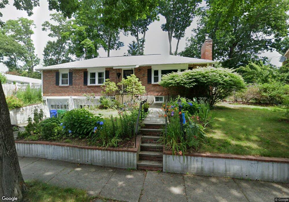
43 Kendall Rd Newton Center, MA 02459
Newton Highlands NeighborhoodEstimated Value: $1,468,000 - $1,685,000
4
Beds
3
Baths
2,280
Sq Ft
$675/Sq Ft
Est. Value
About This Home
This home is located at 43 Kendall Rd, Newton Center, MA 02459 and is currently estimated at $1,539,794, approximately $675 per square foot. 43 Kendall Rd is a home located in Middlesex County with nearby schools including Countryside Elementary School, Bowen School, and Charles E Brown Middle School.
Ownership History
Date
Name
Owned For
Owner Type
Purchase Details
Closed on
Oct 5, 2017
Sold by
Yang Xiaohui and Deng Dong
Bought by
Liu Jie and Zuo Tao
Current Estimated Value
Home Financials for this Owner
Home Financials are based on the most recent Mortgage that was taken out on this home.
Original Mortgage
$768,000
Outstanding Balance
$631,442
Interest Rate
3.25%
Mortgage Type
Unknown
Estimated Equity
$908,352
Purchase Details
Closed on
Aug 26, 2005
Sold by
Lowenthal Frank and Lowenthal Jeanne D
Bought by
Deng Dong and Yang Xiaohui
Home Financials for this Owner
Home Financials are based on the most recent Mortgage that was taken out on this home.
Original Mortgage
$540,000
Interest Rate
5.68%
Mortgage Type
Purchase Money Mortgage
Purchase Details
Closed on
Oct 29, 1987
Sold by
Abrams Shirley A
Bought by
Lowenthal Frank
Home Financials for this Owner
Home Financials are based on the most recent Mortgage that was taken out on this home.
Original Mortgage
$198,000
Interest Rate
10.97%
Mortgage Type
Purchase Money Mortgage
Create a Home Valuation Report for This Property
The Home Valuation Report is an in-depth analysis detailing your home's value as well as a comparison with similar homes in the area
Home Values in the Area
Average Home Value in this Area
Purchase History
| Date | Buyer | Sale Price | Title Company |
|---|---|---|---|
| Liu Jie | $960,000 | -- | |
| Deng Dong | $675,000 | -- | |
| Lowenthal Frank | $264,000 | -- |
Source: Public Records
Mortgage History
| Date | Status | Borrower | Loan Amount |
|---|---|---|---|
| Open | Liu Jie | $768,000 | |
| Previous Owner | Deng Dong | $540,000 | |
| Previous Owner | Lowenthal Frank | $191,000 | |
| Previous Owner | Lowenthal Frank | $198,000 | |
| Previous Owner | Lowenthal Frank | $18,000 |
Source: Public Records
Tax History Compared to Growth
Tax History
| Year | Tax Paid | Tax Assessment Tax Assessment Total Assessment is a certain percentage of the fair market value that is determined by local assessors to be the total taxable value of land and additions on the property. | Land | Improvement |
|---|---|---|---|---|
| 2025 | $11,792 | $1,203,300 | $940,700 | $262,600 |
| 2024 | $11,403 | $1,168,300 | $913,300 | $255,000 |
| 2023 | $10,749 | $1,055,900 | $700,400 | $355,500 |
| 2022 | $10,285 | $977,700 | $648,500 | $329,200 |
| 2021 | $9,925 | $922,400 | $611,800 | $310,600 |
| 2020 | $9,630 | $922,400 | $611,800 | $310,600 |
| 2019 | $9,358 | $895,500 | $594,000 | $301,500 |
| 2018 | $8,885 | $821,200 | $538,900 | $282,300 |
| 2017 | $8,615 | $774,700 | $508,400 | $266,300 |
| 2016 | $8,239 | $724,000 | $475,100 | $248,900 |
| 2015 | $7,855 | $676,600 | $444,000 | $232,600 |
Source: Public Records
Map
Nearby Homes
- 19 Selwyn Rd
- 628 Boylston St
- 671 Boylston St
- 21 Philbrick Rd
- 625 Boylston St
- 125 Oakdale Rd
- 42 Sunhill Ln
- 35 Haynes Rd
- 1308 Walnut St
- 250 Woodcliff Rd
- 1292 Walnut St
- 45 Brandeis Rd
- 5 Halcyon Rd
- 36 Cannon St
- 1597 Centre St Unit 1597
- 1597 Centre St
- 1623-1625 Centre St
- 1629 Centre St
- 42 Bow Rd
- 85 Dudley Rd
- 43 Kendall Rd
- 55 Kendall Rd
- 54 Walnut Hill Rd
- 44 Parker Ave
- 50 Parker Ave
- 36 Parker Ave
- 36 Parker Ave
- 36 Parker Ave Unit 36
- 36 Parker Ave
- 44 Kendall Rd
- 50 Kendall Rd
- 29 Kendall Rd
- 38 Kendall Rd
- 30 Parker Ave
- 51 Walnut Hill Rd
- 32 Kendall Rd
- 47 Parker Ave
- 61 Walnut Hill Rd
- 39 Parker Ave
- 39 Parker Ave Unit 37