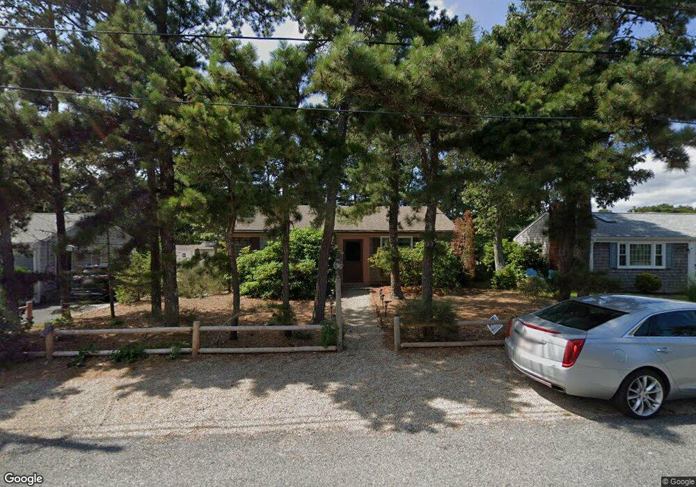
43 Lawrence Rd Dennis Port, MA 02639
Dennis Port NeighborhoodEstimated Value: $439,000 - $567,277
2
Beds
1
Bath
864
Sq Ft
$582/Sq Ft
Est. Value
About This Home
This home is located at 43 Lawrence Rd, Dennis Port, MA 02639 and is currently estimated at $502,569, approximately $581 per square foot. 43 Lawrence Rd is a home located in Barnstable County with nearby schools including Dennis-Yarmouth Regional High School and St. Pius X. School.
Ownership History
Date
Name
Owned For
Owner Type
Purchase Details
Closed on
Jul 15, 2016
Sold by
Sharp Susan M
Bought by
Sharp Susan M and Sharp Amanda M
Current Estimated Value
Purchase Details
Closed on
Dec 21, 1998
Sold by
Wilkinson Ft
Bought by
Dunkley Dennisport T
Home Financials for this Owner
Home Financials are based on the most recent Mortgage that was taken out on this home.
Original Mortgage
$47,000
Interest Rate
6.85%
Mortgage Type
Purchase Money Mortgage
Create a Home Valuation Report for This Property
The Home Valuation Report is an in-depth analysis detailing your home's value as well as a comparison with similar homes in the area
Home Values in the Area
Average Home Value in this Area
Purchase History
| Date | Buyer | Sale Price | Title Company |
|---|---|---|---|
| Sharp Susan M | -- | -- | |
| Dunkley Dennisport T | $87,000 | -- |
Source: Public Records
Mortgage History
| Date | Status | Borrower | Loan Amount |
|---|---|---|---|
| Previous Owner | Dunkley Dennisport T | $47,000 |
Source: Public Records
Tax History Compared to Growth
Tax History
| Year | Tax Paid | Tax Assessment Tax Assessment Total Assessment is a certain percentage of the fair market value that is determined by local assessors to be the total taxable value of land and additions on the property. | Land | Improvement |
|---|---|---|---|---|
| 2025 | $2,016 | $465,700 | $193,500 | $272,200 |
| 2024 | $1,871 | $426,200 | $186,100 | $240,100 |
| 2023 | $1,810 | $387,600 | $169,200 | $218,400 |
| 2022 | $1,753 | $313,000 | $152,400 | $160,600 |
| 2021 | $1,824 | $302,500 | $170,800 | $131,700 |
| 2020 | $1,637 | $268,400 | $149,400 | $119,000 |
| 2019 | $1,567 | $253,900 | $146,500 | $107,400 |
| 2018 | $1,505 | $237,400 | $139,500 | $97,900 |
| 2017 | $1,379 | $224,300 | $129,500 | $94,800 |
| 2016 | $1,429 | $218,800 | $139,500 | $79,300 |
| 2015 | $1,400 | $218,800 | $139,500 | $79,300 |
| 2014 | $1,235 | $194,500 | $119,500 | $75,000 |
Source: Public Records
Map
Nearby Homes
- 80 Michaels Ave
- 37 Ocean Dr Unit 2
- 64 Beaten Rd
- 31 Easy St
- 112 Old Wharf Rd Unit E4
- 112 Old Wharf Rd Unit E1
- 19 Standish Way
- 120 Old Wharf Rd Unit 11
- 154 Old Wharf Rd Unit 26
- 154 Old Wharf Rd Unit 14
- 22 Wixon Rd
- 61 Trotters Ln
- 12 Spoonbill Rd
- 4 Coffey Ln
- 217 Old Wharf Rd Unit 64
- 71 Main St
- 15 Woodside Park Rd
- 262 Old Wharf Rd Unit 67
- 262 Old Wharf Rd Unit 5
- 262 Old Wharf Rd Unit 5
- 39 Lawrence Rd
- 45 Lawrence Rd
- 19 Nipigon Way E
- 37 Lawrence Rd
- 49 Lawrence Rd
- 21 Nipigon Way E
- 40 Lawrence Rd
- 42 Lawrence Rd
- 118 Michaels Ave
- 13 Nipigon Way E
- 51 Lawrence Rd
- 36 Lawrence Rd
- 46 Lawrence Rd
- 34 Lawrence Rd
- 48 Lawrence Rd
- 22 Nipigon Way E
- 114 Michaels Ave
- 9 Nipigon Way E
- 55 Lawrence Rd
- 12 Nipigon Way E